
| Memorials | : | 1 |
| Location | : | Saronville, Clay County, USA |
| Coordinate | : | 40.5824700, -97.9199400 |
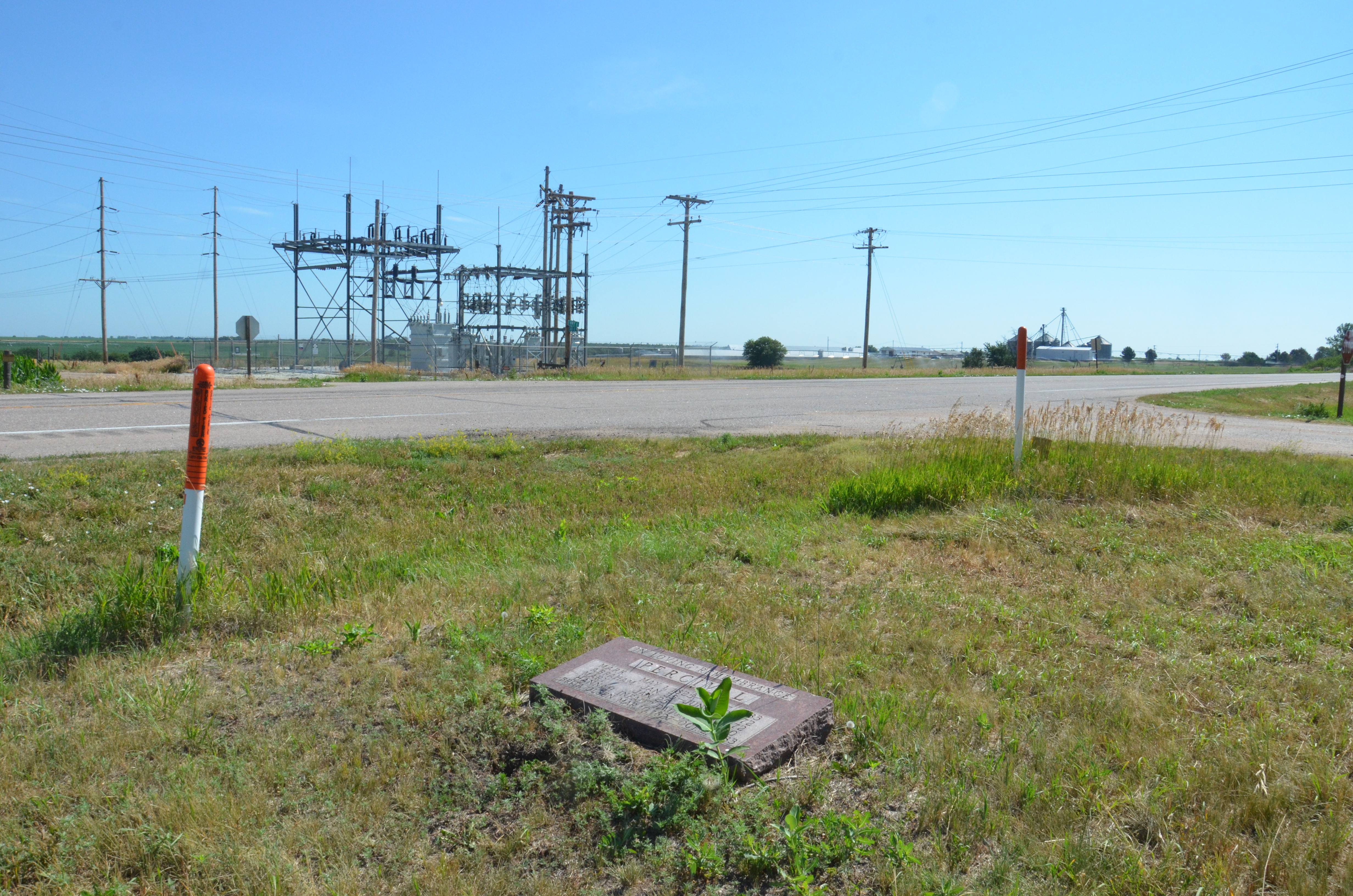
| Description | : | The Percival Family Lot is in the extreme Northeast corner of Section 18, Township 7, Range 5 (Sutton Township, Clay County, Nebraska) at the intersection of U. S. Highway 6 and County Road U. Prior to the organization of the Saron Lutheran Cemetery in 1884, some deceased members of the Swedish Evangelical Lutheran Church were buried at their family homesteads. The Percival Family Lot is documented in the Saron Lutheran Cemetery directory published in 1988 on page 35. The single common gravestone for the five persons (two adults, three children) buried here is only several feet off the south shoulder of Highway... Read More |
frequently asked questions (FAQ):
-
Where is Percival Family Lot?
Percival Family Lot is located at Saronville, Clay County ,Nebraska ,USA.
-
Percival Family Lot cemetery's updated grave count on graveviews.com?
1 memorials
-
Where are the coordinates of the Percival Family Lot?
Latitude: 40.5824700
Longitude: -97.9199400
Nearby Cemetories:
1. Saron Lutheran Church Cemetery
Saronville, Clay County, USA
Coordinate: 40.6110992, -97.9297028
2. Saronville United Methodist Cemetery
Saronville, Clay County, USA
Coordinate: 40.6147100, -97.9188500
3. Calvary Cemetery
Sutton, Clay County, USA
Coordinate: 40.5746994, -97.8636017
4. Verona Danish Cemetery
Clay County, USA
Coordinate: 40.5685997, -97.9756012
5. Verona Swedish Cemetery
Clay County, USA
Coordinate: 40.5677986, -97.9764023
6. Sutton Cemetery
Sutton, Clay County, USA
Coordinate: 40.6189003, -97.8644028
7. Marshall Union Evergreen Cemetery
Clay Center, Clay County, USA
Coordinate: 40.4880300, -97.9573000
8. Emmanuel Reformed Church Cemetery
School Creek Township, Clay County, USA
Coordinate: 40.6847220, -97.8811110
9. Clay Center Cemetery
Clay Center, Clay County, USA
Coordinate: 40.5325012, -98.0500031
10. Eller Cemetery
Clay Center, Clay County, USA
Coordinate: 40.4956700, -98.0145700
11. Free German Reformed Salem Church Cemetery
Fillmore County, USA
Coordinate: 40.6697220, -97.8227780
12. Chapel Grove Cemetery
Clay County, USA
Coordinate: 40.4660988, -97.8816986
13. Fairview Cemetery
Fillmore County, USA
Coordinate: 40.4817009, -97.8133011
14. Stockham Cemetery
Stockham, Hamilton County, USA
Coordinate: 40.7111015, -97.9408035
15. Harvard Cemetery
Harvard, Clay County, USA
Coordinate: 40.6123047, -98.0920258
16. Farmers Valley Cemetery
Hamilton County, USA
Coordinate: 40.7216988, -97.8533020
17. Prairieview Cemetery
Ong, Clay County, USA
Coordinate: 40.4235100, -97.9093400
18. Holy Cross Cemetery
Grafton, Fillmore County, USA
Coordinate: 40.6150017, -97.7108002
19. Grafton Cemetery
Grafton, Fillmore County, USA
Coordinate: 40.6157990, -97.7106018
20. Saint Marys Cemetery
Shickley, Fillmore County, USA
Coordinate: 40.4816700, -97.7295400
21. Ong Cemetery
Ong, Clay County, USA
Coordinate: 40.4077988, -97.8367004
22. First Evangelical Cemetery
Harvard, Clay County, USA
Coordinate: 40.6702995, -98.1374969
23. Norwegian Cemetery
Hamilton County, USA
Coordinate: 40.7125015, -98.1022034
24. Zion Cemetery
Clay County, USA
Coordinate: 40.5382996, -98.1643982