
| Memorials | : | 0 |
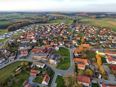
| Location | : | Vilsheim, Landkreis Landshut, Germany |
| Coordinate | : | 48.4500000, 12.1166670 |
| Description | : | Parish Church of St. Castulus. The late-Gothic building was built around the mid-15th century. In 1862, the Western nave received an extension. |
frequently asked questions (FAQ):
-
Where is Pfarrkirche St. Kastulus?
Pfarrkirche St. Kastulus is located at Vilsheim, Landkreis Landshut ,Bavaria (Bayern) ,Germany.
-
Pfarrkirche St. Kastulus cemetery's updated grave count on graveviews.com?
0 memorials
-
Where are the coordinates of the Pfarrkirche St. Kastulus?
Latitude: 48.4500000
Longitude: 12.1166670
Nearby Cemetories:
1. Kirchhof Heilig Blut
Landshut, Stadtkreis Landshut, Germany
Coordinate: 48.5288713, 12.1651627
2. Martinskirche
Landshut, Stadtkreis Landshut, Germany
Coordinate: 48.5341700, 12.1518620
3. Friedhof Geislbach
Geislbach, Landkreis Erding, Germany
Coordinate: 48.3646030, 12.1647824
4. Kloster Seligenthal
Landshut, Stadtkreis Landshut, Germany
Coordinate: 48.5423430, 12.1476170
5. Hauptfriedhof Landshut
Landshut, Stadtkreis Landshut, Germany
Coordinate: 48.5410240, 12.1590690
6. Friedhof Waratenberg
Wartenberg, Landkreis Erding, Germany
Coordinate: 48.4037790, 11.9896890
7. St. Georg Church Cemetery
Eugenbach, Landkreis Landshut, Germany
Coordinate: 48.5488428, 12.0837432
8. Kirchhof St. Stephanus
Inning am Holz, Landkreis Erding, Germany
Coordinate: 48.3500155, 12.0773569
9. Friedhof Altdorf
Altdorf, Landkreis Landshut, Germany
Coordinate: 48.5589392, 12.1192489
10. Nordfriedhof St.Michael
Landshut, Stadtkreis Landshut, Germany
Coordinate: 48.5630100, 12.1301100
11. Gemeindefriedhof Taufkirchen
Taufkirchen, Landkreis Erding, Germany
Coordinate: 48.3364731, 12.1294812
12. Kirchhof St. Georg
Ottering, Landkreis Erding, Germany
Coordinate: 48.3367926, 12.0627382
13. Kirchhof St. Stephanus
Rappoltskirchen, Landkreis Erding, Germany
Coordinate: 48.3415630, 12.0336010
14. Friedhof Arth
Arth, Landkreis Landshut, Germany
Coordinate: 48.5865301, 12.0575029
15. Kirchhof St. Valentin
Thonstetten, Landkreis Freising, Germany
Coordinate: 48.4501506, 11.9020653
16. Friedhof Lohkirchen
Lohkirchen, Landkreis Erding, Germany
Coordinate: 48.3595680, 11.9502340
17. Friedhof Hecken
Hecken, Landkreis Erding, Germany
Coordinate: 48.3260560, 11.9898930
18. Hörgersdorf
Hörgersdorf, Landkreis Erding, Germany
Coordinate: 48.3004700, 12.0570000
19. Kirchhof St. Andreas
Niederhummel, Landkreis Freising, Germany
Coordinate: 48.4346994, 11.8813534
20. Neuer Friedhof Bockhorn
Bockhorn, Landkreis Erding, Germany
Coordinate: 48.3158977, 11.9876884
21. Kirchhof Mariae Heimsuchung
Bockhorn, Landkreis Erding, Germany
Coordinate: 48.3149364, 11.9878800
22. Kirchhof St. Georg
Oberhummel, Landkreis Freising, Germany
Coordinate: 48.4272979, 11.8736425
23. Friedhof Essenbach
Essenbach, Landkreis Dachau, Germany
Coordinate: 48.6092065, 12.2161064
24. Friedhof Dorfen
Dorfen, Landkreis Erding, Germany
Coordinate: 48.2774300, 12.1465400