
| Memorials | : | 0 |
| Location | : | Peachland, Anson County, USA |
| Coordinate | : | 34.9668010, -80.2831610 |
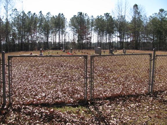
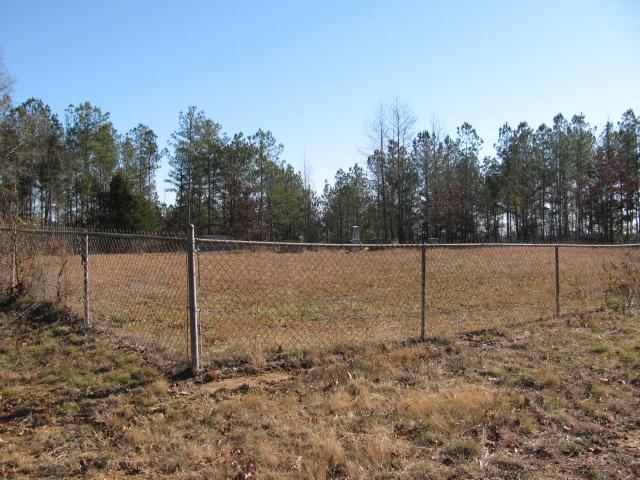
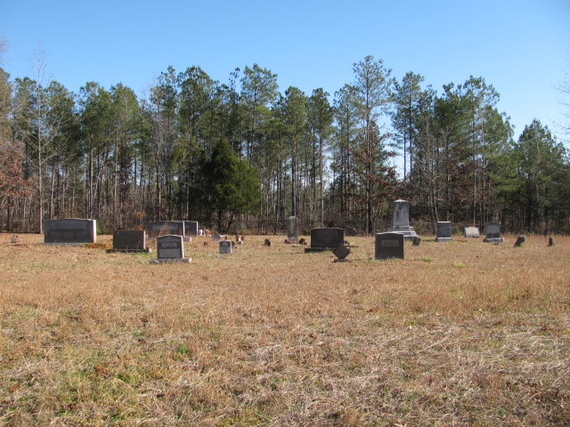
| Description | : | From Peachland, N.C. Take Clinton Avenue. Cross the bridge over Highway 74. Turn right on Upper Whites Store Road. Travel about two miles. Right before you get to Saint James Church there will be a dirt drive to the left with a locked gate. Cemetery will be inside the gate up the hill. It is enclosed in a chain link fence. PRIVATE PROPERTY. Please get permission from the residence beside Saint James Church. Nine graves marked with iron rocks. Family members say they are all Horne children. |
frequently asked questions (FAQ):
-
Where is Phillips Cemetery?
Phillips Cemetery is located at Upper Whites Store Road Peachland, Anson County ,North Carolina ,USA.
-
Phillips Cemetery cemetery's updated grave count on graveviews.com?
0 memorials
-
Where are the coordinates of the Phillips Cemetery?
Latitude: 34.9668010
Longitude: -80.2831610
Nearby Cemetories:
1. Mount Carmel Baptist Church Cemetery
Peachland, Anson County, USA
Coordinate: 34.9646380, -80.2930800
2. Edwards Memorial Marker
Peachland, Anson County, USA
Coordinate: 34.9819790, -80.2732210
3. Horne Family Cemetery
Peachland, Anson County, USA
Coordinate: 34.9515150, -80.2928600
4. Sturdivant-Bennett-Dargan Cemetery
Peachland, Anson County, USA
Coordinate: 34.9506000, -80.2701150
5. Gray Cemetery
Peachland, Anson County, USA
Coordinate: 34.9873410, -80.2685380
6. Col. Joseph White Cemetery
White Store Township, Anson County, USA
Coordinate: 34.9440760, -80.2709150
7. Peachland Cemetery
Peachland, Anson County, USA
Coordinate: 34.9854730, -80.2620790
8. Edwards Cemetery
Peachland, Anson County, USA
Coordinate: 34.9362300, -80.2953280
9. German Hill Cemetery
Peachland, Anson County, USA
Coordinate: 35.0043520, -80.2840360
10. Beeman Cemetery
Peachland, Anson County, USA
Coordinate: 34.9981610, -80.2533140
11. Covington Cemetery
Peachland, Anson County, USA
Coordinate: 34.9942320, -80.2457020
12. Mineral Springs Baptist Church Cemetery
Peachland, Anson County, USA
Coordinate: 34.9440660, -80.2407720
13. Green Cemetery
Marshville Township, Union County, USA
Coordinate: 34.9561100, -80.3369400
14. Flint Ridge Baptist Church Cemetery
Marshville, Union County, USA
Coordinate: 34.9427290, -80.3301860
15. Harmony Community Church Cemetery
Peachland, Anson County, USA
Coordinate: 35.0185270, -80.2974950
16. Gilboa United Methodist Church Cemetery
Marshville, Union County, USA
Coordinate: 34.9464569, -80.3468475
17. Barrett Cemetery
White Store Township, Anson County, USA
Coordinate: 34.9109192, -80.2752991
18. W Edmund Horne Family Cemetery
Polkton, Anson County, USA
Coordinate: 34.9924040, -80.2159670
19. Bethel Baptist Church Cemetery
Marshville, Union County, USA
Coordinate: 34.9296280, -80.3418430
20. Phifer Cemetery
Union County, USA
Coordinate: 35.0233612, -80.3114624
21. Deep Springs Baptist Church Cemetery
Peachland, Anson County, USA
Coordinate: 35.0308160, -80.2759470
22. Union Grove Baptist Church Cemetery
Marshville, Union County, USA
Coordinate: 35.0118790, -80.3397141
23. Caudle-Phifer Cemetery
Peachland, Anson County, USA
Coordinate: 35.0319410, -80.2881170
24. High Ridge Primitive Baptist Church Cemetery
Marshville, Union County, USA
Coordinate: 34.9098570, -80.3228740