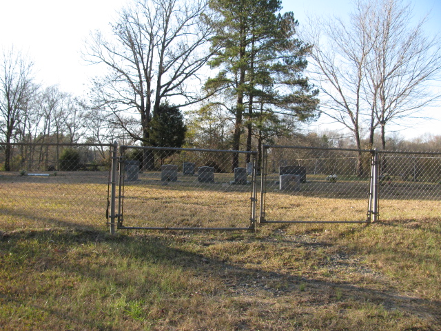
| Memorials | : | 0 |
| Location | : | Peachland, Anson County, USA |
| Coordinate | : | 34.9506000, -80.2701150 |
| Description | : | From downtown Peachland, N.C. take Clinton Avenue (State Road 1240). Cross the bridge over Highway 74. This turns into Mineral Springs Church Road. Turn right on Lower White Store Road (State Road 1252). After you pass Hasty Road on the right the cemetery will be on the right. |
frequently asked questions (FAQ):
-
Where is Sturdivant-Bennett-Dargan Cemetery?
Sturdivant-Bennett-Dargan Cemetery is located at Lower White Store Road Peachland, Anson County ,North Carolina ,USA.
-
Sturdivant-Bennett-Dargan Cemetery cemetery's updated grave count on graveviews.com?
0 memorials
-
Where are the coordinates of the Sturdivant-Bennett-Dargan Cemetery?
Latitude: 34.9506000
Longitude: -80.2701150
Nearby Cemetories:
1. Col. Joseph White Cemetery
White Store Township, Anson County, USA
Coordinate: 34.9440760, -80.2709150
2. Horne Family Cemetery
Peachland, Anson County, USA
Coordinate: 34.9515150, -80.2928600
3. Phillips Cemetery
Peachland, Anson County, USA
Coordinate: 34.9668010, -80.2831610
4. Mount Carmel Baptist Church Cemetery
Peachland, Anson County, USA
Coordinate: 34.9646380, -80.2930800
5. Mineral Springs Baptist Church Cemetery
Peachland, Anson County, USA
Coordinate: 34.9440660, -80.2407720
6. Edwards Cemetery
Peachland, Anson County, USA
Coordinate: 34.9362300, -80.2953280
7. Edwards Memorial Marker
Peachland, Anson County, USA
Coordinate: 34.9819790, -80.2732210
8. Peachland Cemetery
Peachland, Anson County, USA
Coordinate: 34.9854730, -80.2620790
9. Gray Cemetery
Peachland, Anson County, USA
Coordinate: 34.9873410, -80.2685380
10. Barrett Cemetery
White Store Township, Anson County, USA
Coordinate: 34.9109192, -80.2752991
11. Covington Cemetery
Peachland, Anson County, USA
Coordinate: 34.9942320, -80.2457020
12. Beeman Cemetery
Peachland, Anson County, USA
Coordinate: 34.9981610, -80.2533140
13. Flint Ridge Baptist Church Cemetery
Marshville, Union County, USA
Coordinate: 34.9427290, -80.3301860
14. Poplar Hill Missionary Baptist Church Cemetery
Polkton, Anson County, USA
Coordinate: 34.9182590, -80.2223500
15. German Hill Cemetery
Peachland, Anson County, USA
Coordinate: 35.0043520, -80.2840360
16. Green Cemetery
Marshville Township, Union County, USA
Coordinate: 34.9561100, -80.3369400
17. Poplar Hill United Methodist Church Cemetery
Polkton, Anson County, USA
Coordinate: 34.9383230, -80.2031990
18. High Ridge Primitive Baptist Church Cemetery
Marshville, Union County, USA
Coordinate: 34.9098570, -80.3228740
19. W Edmund Horne Family Cemetery
Polkton, Anson County, USA
Coordinate: 34.9924040, -80.2159670
20. Bethel Baptist Church Cemetery
Marshville, Union County, USA
Coordinate: 34.9296280, -80.3418430
21. Gilboa United Methodist Church Cemetery
Marshville, Union County, USA
Coordinate: 34.9464569, -80.3468475
22. Gordon Mountain Cemetery
Wadesboro Township, Anson County, USA
Coordinate: 34.9162604, -80.2001372
23. Gulledge Cemetery
White Store Township, Anson County, USA
Coordinate: 34.8834496, -80.2495880
24. Williams Cemetery
Polkton, Anson County, USA
Coordinate: 35.0026910, -80.2119000

