
| Memorials | : | 206 |
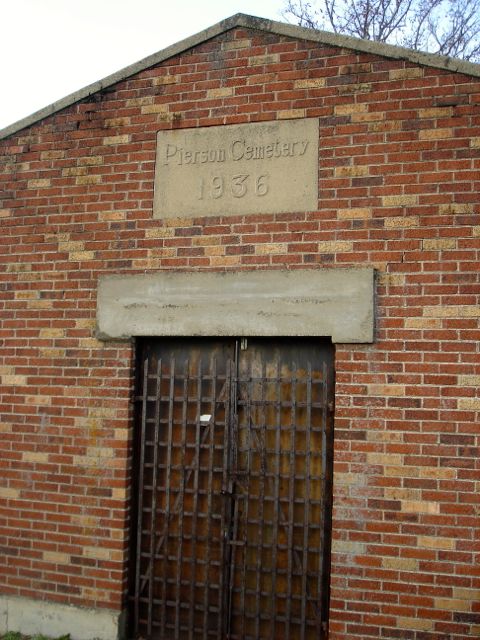
| Location | : | Pierson, Montcalm County, USA |
| Coordinate | : | 43.3381004, -85.5006027 |
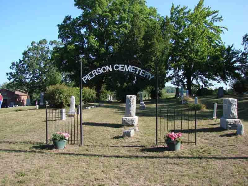
| Description | : | The cemetery is located on the north side of Cannonsville Road at its intersection with Amy School Road. The U.S. Geological Survey (USGS) Geographic Names Information System (GNIS) feature ID for the cemetery is 634842 (Pierson Cemetery). |
frequently asked questions (FAQ):
-
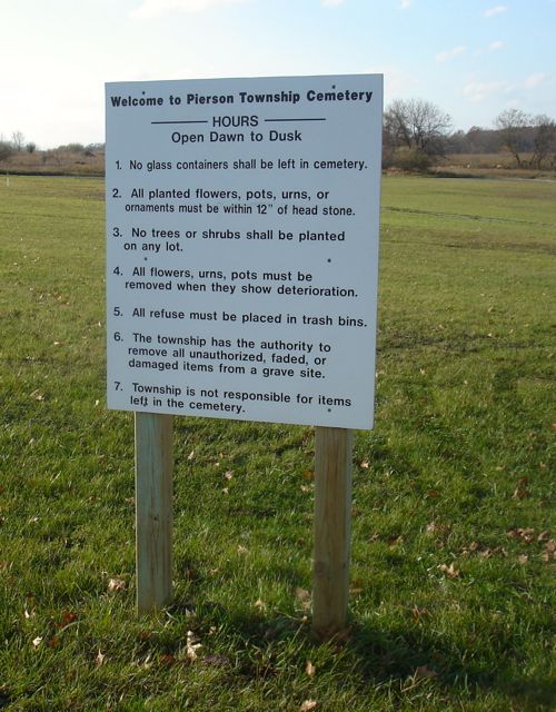
Where is Pierson Township Cemetery?
Pierson Township Cemetery is located at Cannonsville Road Pierson, Montcalm County ,Michigan , 49339USA.
-
Pierson Township Cemetery cemetery's updated grave count on graveviews.com?
180 memorials
-
Where are the coordinates of the Pierson Township Cemetery?
Latitude: 43.3381004
Longitude: -85.5006027
Nearby Cemetories:
1. Sand Lake Cemetery
Sand Lake, Kent County, USA
Coordinate: 43.2861480, -85.5313380
2. Saint Mary's Cemetery
Sand Lake, Kent County, USA
Coordinate: 43.2717018, -85.4969025
3. North Ensley Cemetery
Ensley Center, Newaygo County, USA
Coordinate: 43.3671989, -85.5935974
4. Reynolds Township Cemetery
Howard City, Montcalm County, USA
Coordinate: 43.4101300, -85.4767100
5. Coral Cemetery
Coral, Montcalm County, USA
Coordinate: 43.3671989, -85.4060974
6. Saint Johns Catholic Cemetery
Ensley Center, Newaygo County, USA
Coordinate: 43.3664017, -85.5969009
7. Crandall Cemetery
Ensley Center, Newaygo County, USA
Coordinate: 43.2938995, -85.5939026
8. Coady Cemetery
Maple Valley Township, Montcalm County, USA
Coordinate: 43.3540520, -85.3825890
9. Maple Valley Cemetery
Maple Valley Township, Montcalm County, USA
Coordinate: 43.3358002, -85.3724976
10. Punches Cemetery
Cedar Springs, Kent County, USA
Coordinate: 43.2467003, -85.5317001
11. Bouton Family Farm Burial Site
Reynolds Township, Montcalm County, USA
Coordinate: 43.4294960, -85.5555570
12. Trufant Cemetery
Maple Valley Township, Montcalm County, USA
Coordinate: 43.3083000, -85.3653030
13. Christian Plains Cemetery
Croton Township, Newaygo County, USA
Coordinate: 43.4100200, -85.6028200
14. East Nelson Cemetery
Cedar Springs, Kent County, USA
Coordinate: 43.2355995, -85.4561005
15. Amble Cemetery
Amble, Montcalm County, USA
Coordinate: 43.4352989, -85.4024963
16. Oak Grove Cemetery
Croton Township, Newaygo County, USA
Coordinate: 43.4061012, -85.6430969
17. Solon Township Cemetery
Cedar Springs, Kent County, USA
Coordinate: 43.2344589, -85.6100235
18. Elmwood Cemetery
Cedar Springs, Kent County, USA
Coordinate: 43.2118988, -85.5532990
19. West Pine Cemetery
Coral, Montcalm County, USA
Coordinate: 43.3669014, -85.3227997
20. Stearns Prairie Cemetery
Croton Township, Newaygo County, USA
Coordinate: 43.4543991, -85.5980988
21. Culp Cemetery
Croton Township, Newaygo County, USA
Coordinate: 43.4537900, -85.6078400
22. DeGraw Family Cemetery
Cedar Springs, Kent County, USA
Coordinate: 43.2066585, -85.4283281
23. Saint Margarets Catholic Cemetery
Spencer Township, Kent County, USA
Coordinate: 43.2063890, -85.4169440
24. Aetna Township Cemetery
Morley, Mecosta County, USA
Coordinate: 43.4906006, -85.4597015