
| Memorials | : | 0 |
| Location | : | Lyttonsville, Montgomery County, USA |
| Coordinate | : | 39.0023740, -77.0536160 |
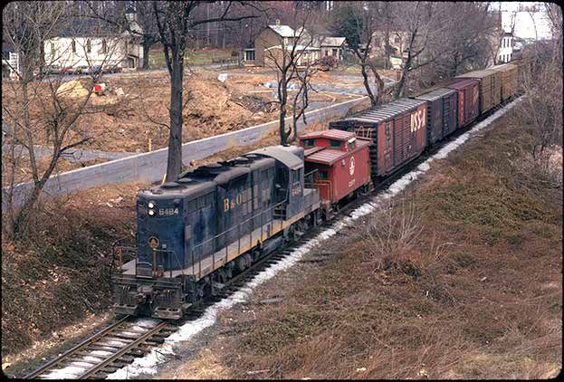
| Description | : | By 1930, Lyttonsville had about 60 black households and 300 people. Shops and residences lined Brookville Road and Garfield Avenue. The Pilgrim Baptist Church and its cemetery sat at the junction of the two streets facing Brookville Road. The two-room segregated Linden School for grades 1-7 was on the north side of Garfield in the middle of the block. Ike’s Blue Moon, a beer hall on Brookville Road, provided refreshment. Rail lines cut through the neighborhood. |
frequently asked questions (FAQ):
-
Where is Pilgrim Baptist Cemetery?
Pilgrim Baptist Cemetery is located at 8890 Brookville Rd, Silver Spring, MD Lyttonsville, Montgomery County ,Maryland , 20910USA.
-
Pilgrim Baptist Cemetery cemetery's updated grave count on graveviews.com?
0 memorials
-
Where are the coordinates of the Pilgrim Baptist Cemetery?
Latitude: 39.0023740
Longitude: -77.0536160
Nearby Cemetories:
1. Grace Episcopal Church Cemetery
Silver Spring, Montgomery County, USA
Coordinate: 39.0052986, -77.0381012
2. Saint John the Evangelist Catholic Church Cemetery
Forest Glen, Montgomery County, USA
Coordinate: 39.0152300, -77.0509500
3. North Chevy Chase Christian Church Memorial Garden
Chevy Chase, Montgomery County, USA
Coordinate: 39.0019900, -77.0757800
4. Dunlop Family Cemetery
Chevy Chase, Montgomery County, USA
Coordinate: 38.9975600, -77.0805500
5. Columbia Country Club
Chevy Chase, Montgomery County, USA
Coordinate: 38.9891100, -77.0781500
6. Chevy Chase United Methodist Church Cemetery
Chevy Chase, Montgomery County, USA
Coordinate: 38.9801870, -77.0709590
7. Saint Pauls United Methodist Church Memorial Garde
Kensington, Montgomery County, USA
Coordinate: 39.0268500, -77.0744600
8. National Museum of Health and Medicine
Washington, District of Columbia, USA
Coordinate: 38.9760170, -77.0325060
9. Episcopal Church of the Ascension Columbarium
Silver Spring, Montgomery County, USA
Coordinate: 38.9914293, -77.0157511
10. Allen Chapel A. M. E. Church Cemetery
Wheaton, Montgomery County, USA
Coordinate: 39.0367500, -77.0433300
11. Bethesda Meeting House Cemetery
Bethesda, Montgomery County, USA
Coordinate: 39.0097220, -77.0983330
12. Good Shepherd Episcopal Church Columbarium
Montgomery County, USA
Coordinate: 39.0322020, -77.0236240
13. Battleground National Cemetery
Washington, District of Columbia, USA
Coordinate: 38.9707298, -77.0266800
14. Chevy Chase Presbyterian Church Columbarium
Chevy Chase Heights, District of Columbia, USA
Coordinate: 38.9672380, -77.0757640
15. Cecil-Davis Cemetery
Takoma Park, Montgomery County, USA
Coordinate: 38.9890800, -76.9999100
16. Christ Lutheran Church Memorial Garden
Petworth, District of Columbia, USA
Coordinate: 38.9519560, -77.0360790
17. Wood Family Cemetery
Bethesda, Montgomery County, USA
Coordinate: 38.9639600, -77.1006010
18. Solyom Family Cemetery
Bethesda, Montgomery County, USA
Coordinate: 38.9622420, -77.0985030
19. Isaac Shoemaker Family Cemetery
Chevy Chase, Montgomery County, USA
Coordinate: 38.9585350, -77.0924920
20. Lee Family Cemetery
Wheaton, Montgomery County, USA
Coordinate: 39.0516600, -77.0227800
21. River Road Moses Cemetery
Bethesda, Montgomery County, USA
Coordinate: 38.9645800, -77.1063100
22. Reflection Terrace Memorial
Wheaton, Montgomery County, USA
Coordinate: 39.0571500, -77.0369600
23. Peirce Family Cemetery
Cleveland Park, District of Columbia, USA
Coordinate: 38.9456040, -77.0563070
24. Posey - Busey Family Cemetery
Bethesda, Montgomery County, USA
Coordinate: 38.9682370, -77.1123530