
| Memorials | : | 14 |
| Location | : | Cottonwood, Shasta County, USA |
| Coordinate | : | 40.3997002, -122.5180969 |
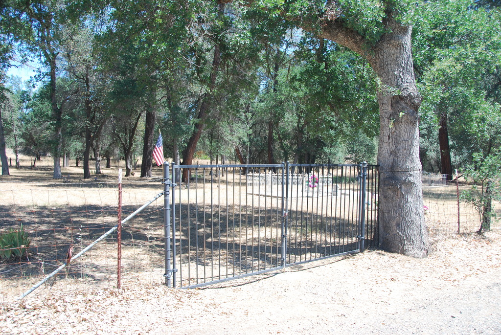
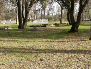
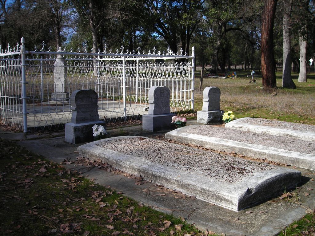
| Description | : | On Gas Point Road Cottonwood, Shasta, CA (very close to Tehama Co,) You go to what appears to be the end of the road, but the road turns and goes to Igo, CA. The cemetery is right on the corner. Very old and uncared for. Many unmarked or unreadable graves. |
frequently asked questions (FAQ):
-
Where is Pinckney Cemetery?
Pinckney Cemetery is located at Cottonwood, Shasta County ,California ,USA.
-
Pinckney Cemetery cemetery's updated grave count on graveviews.com?
14 memorials
-
Where are the coordinates of the Pinckney Cemetery?
Latitude: 40.3997002
Longitude: -122.5180969
Nearby Cemetories:
1. Northern California Veterans Cemetery
Igo, Shasta County, USA
Coordinate: 40.4785400, -122.5422500
2. Happy Valley Cemetery
Redding, Shasta County, USA
Coordinate: 40.4668999, -122.4535980
3. Ono Cemetery
Ono, Shasta County, USA
Coordinate: 40.4692497, -122.6131821
4. Barbara Glass Gravesite
Shasta County, USA
Coordinate: 40.5067600, -122.5049700
5. Philpott Cemetery
Ono, Shasta County, USA
Coordinate: 40.4770012, -122.6194992
6. Fann-Slaughter Cemetery
Shasta County, USA
Coordinate: 40.4720500, -122.6280400
7. Igo Cemetery
Igo, Shasta County, USA
Coordinate: 40.5130501, -122.5375977
8. Texas Springs Cemetery
Redding, Shasta County, USA
Coordinate: 40.5116844, -122.4516144
9. Rosewood Cemetery
Rosewood, Tehama County, USA
Coordinate: 40.2685360, -122.5575190
10. Middletown Cemetery
Redding, Shasta County, USA
Coordinate: 40.5392800, -122.4748700
11. Cottonwood Cemetery
Cottonwood, Shasta County, USA
Coordinate: 40.3856100, -122.2936500
12. Anderson District Cemetery
Anderson, Shasta County, USA
Coordinate: 40.4419518, -122.2967300
13. Sleepy Hollow Pet Cemetery
Anderson, Shasta County, USA
Coordinate: 40.4199430, -122.2858410
14. Oddfellows Cemetery
Anderson, Shasta County, USA
Coordinate: 40.4431590, -122.2907070
15. Anderson Pioneer Cemetery
Anderson, Shasta County, USA
Coordinate: 40.4439011, -122.2904968
16. Shasta General Hospital Cemetery
Redding, Shasta County, USA
Coordinate: 40.5516000, -122.3894000
17. Shasta General Hospital Cemetery
Redding, Shasta County, USA
Coordinate: 40.5509200, -122.3841800
18. Whiskeytown Cemetery
Whiskeytown, Shasta County, USA
Coordinate: 40.5858002, -122.5381012
19. Shasta Masonic Cemetery
Shasta, Shasta County, USA
Coordinate: 40.5910492, -122.4859695
20. Saint Joseph Cemetery
Redding, Shasta County, USA
Coordinate: 40.5824509, -122.4310989
21. Cottonwood Creek Ranch Cemetery
Cottonwood, Shasta County, USA
Coordinate: 40.3663100, -122.2598800
22. Shasta Union Cemetery
Shasta, Shasta County, USA
Coordinate: 40.6008682, -122.4906845
23. Shasta Catholic Cemetery
Shasta, Shasta County, USA
Coordinate: 40.6014950, -122.4917190
24. Old Saint Joseph Cemetery
Redding, Shasta County, USA
Coordinate: 40.5781326, -122.3912811