
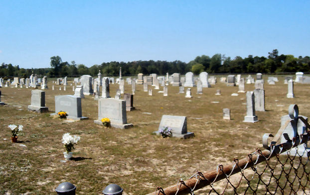
| Memorials | : | 1 |
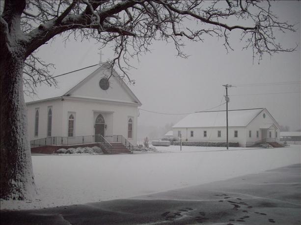
| Location | : | Lone Star, Calhoun County, USA |
| Coordinate | : | 33.6349610, -80.6016470 |
frequently asked questions (FAQ):
-
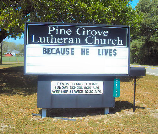
Where is Pine Grove Lutheran Church Cemetery?
Pine Grove Lutheran Church Cemetery is located at 3688 McCord's Ferry Rd. Lone Star, Calhoun County ,South Carolina , 29030USA.
-
Pine Grove Lutheran Church Cemetery cemetery's updated grave count on graveviews.com?
1 memorials
-
Where are the coordinates of the Pine Grove Lutheran Church Cemetery?
Latitude: 33.6349610
Longitude: -80.6016470
Nearby Cemetories:
1. Irick Cemetery
Lone Star, Calhoun County, USA
Coordinate: 33.6283580, -80.5924100
2. Cedar Grove Baptist Church Cemetery
Lone Star, Calhoun County, USA
Coordinate: 33.6259320, -80.5947950
3. Bodrick Cemetery
Lone Star, Calhoun County, USA
Coordinate: 33.6245880, -80.5891440
4. Saint Mark Baptist Church Cemetery
Lone Star, Calhoun County, USA
Coordinate: 33.6545810, -80.6008700
5. Saint Luke A.M.E. Church Cemetery
Lone Star, Calhoun County, USA
Coordinate: 33.6415340, -80.6286180
6. East Bethel United Methodist Church Cemetery
Saint Matthews, Calhoun County, USA
Coordinate: 33.6350770, -80.6353840
7. Haynes Chapel AME Church Cemetery
Cameron, Calhoun County, USA
Coordinate: 33.6130110, -80.5751970
8. Saint Paul AME Church Cemetery
Creston, Calhoun County, USA
Coordinate: 33.6137640, -80.6624160
9. Rast Cemetery
Calhoun County, USA
Coordinate: 33.6121000, -80.6631660
10. Mizpah Baptist Church Cemetery
Fort Motte, Calhoun County, USA
Coordinate: 33.6826400, -80.6410970
11. New Bethany Baptist Church Cemetery
Fort Motte, Calhoun County, USA
Coordinate: 33.6826040, -80.6412690
12. Saint Matthews Lutheran Church
Saint Matthews, Calhoun County, USA
Coordinate: 33.6175190, -80.6719850
13. Union AME Church Cemetery
Calhoun County, USA
Coordinate: 33.5840910, -80.5575110
14. Mount Zion AME Church Cemetery
Creston, Calhoun County, USA
Coordinate: 33.5689940, -80.6151050
15. Mount Pleasant Baptist Church Cemetery
Fort Motte, Calhoun County, USA
Coordinate: 33.6947670, -80.6497860
16. Elloree Hillcrest Cemetery
Elloree, Orangeburg County, USA
Coordinate: 33.5608720, -80.6099720
17. Bethlehem Baptist Church Cemetery
Fort Motte, Calhoun County, USA
Coordinate: 33.6632980, -80.6851910
18. Shady Grove Methodist Church Cemetery
Cameron, Calhoun County, USA
Coordinate: 33.5896560, -80.6767060
19. Santee First Baptist Cemetery
Elloree, Orangeburg County, USA
Coordinate: 33.5553700, -80.6018080
20. Trinity Lutheran Church Cemetery
Elloree, Orangeburg County, USA
Coordinate: 33.5603720, -80.5659850
21. Gates Family Cemetery
Saint Matthews, Calhoun County, USA
Coordinate: 33.6590790, -80.6943780
22. Bookhart Cemetery
Elloree, Orangeburg County, USA
Coordinate: 33.5485992, -80.5924988
23. Bouzard Family Cemetery
Fort Motte, Calhoun County, USA
Coordinate: 33.6962800, -80.6776210
24. Antioch UME Church Cemetery
Rimini, Clarendon County, USA
Coordinate: 33.6592170, -80.4962380