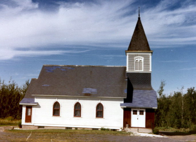
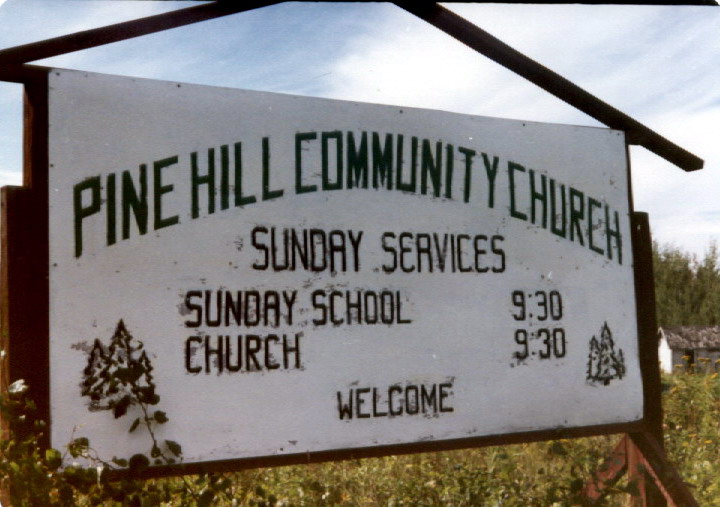
| Memorials | : | 0 |
| Location | : | Eldes Corner, St. Louis County, USA |
| Coordinate | : | 46.7083120, -92.2812560 |
frequently asked questions (FAQ):
-
Where is Pine Hill Lutheran Church Cemetery?
Pine Hill Lutheran Church Cemetery is located at 5702 Old Highway 61 Eldes Corner, St. Louis County ,Minnesota , 55810USA.
-
Pine Hill Lutheran Church Cemetery cemetery's updated grave count on graveviews.com?
0 memorials
-
Where are the coordinates of the Pine Hill Lutheran Church Cemetery?
Latitude: 46.7083120
Longitude: -92.2812560
Nearby Cemetories:
1. Roussain Cemetery
Fond du Lac, St. Louis County, USA
Coordinate: 46.6752600, -92.2966200
2. Augustana Lutheran Church Cemetery
Midway, St. Louis County, USA
Coordinate: 46.7461190, -92.2818950
3. Apostolic Lutheran Cemetery
Esko, Carlton County, USA
Coordinate: 46.7093201, -92.3451691
4. Mission Creek Native American Cemetery
Duluth, St. Louis County, USA
Coordinate: 46.6610510, -92.2775800
5. Saint Matthews Lutheran Cemetery
Esko, Carlton County, USA
Coordinate: 46.7366300, -92.3822100
6. Hermantown Cemetery
Hermantown, St. Louis County, USA
Coordinate: 46.7793999, -92.2435989
7. Oneota Cemetery
Duluth, St. Louis County, USA
Coordinate: 46.7503014, -92.1828003
8. Thomson Pioneer Cemetery
Thomson, Carlton County, USA
Coordinate: 46.6574000, -92.3935000
9. Union Cemetery
Hermantown, St. Louis County, USA
Coordinate: 46.7868996, -92.2069016
10. Bethany Cemetery
Duluth, St. Louis County, USA
Coordinate: 46.7872009, -92.1988983
11. Independent Apostolic Lutheran cemetery
Munger, St. Louis County, USA
Coordinate: 46.8027182, -92.3378130
12. Solway Cemetery
St. Louis County, USA
Coordinate: 46.8083000, -92.3544006
13. Hillside Cemetery
Carlton, Carlton County, USA
Coordinate: 46.6506004, -92.4225006
14. Saint Francis Cemetery
Carlton, Carlton County, USA
Coordinate: 46.6486161, -92.4228822
15. Calvary Cemetery
Superior, Douglas County, USA
Coordinate: 46.6631012, -92.1256027
16. Saint Johns Lutheran Cemetery
Wrenshall, Carlton County, USA
Coordinate: 46.6200610, -92.3912040
17. Zion Lutheran Church Columbarium
Cloquet, Carlton County, USA
Coordinate: 46.7068200, -92.4531300
18. Riverside Cemetery
Superior, Douglas County, USA
Coordinate: 46.6617012, -92.1213989
19. Graceland Cemetery
Superior Village, Douglas County, USA
Coordinate: 46.6601720, -92.1209400
20. Hebrew Cemetery
Superior, Douglas County, USA
Coordinate: 46.6575012, -92.1216965
21. Silver Brook Township Cemetery
Wrenshall, Carlton County, USA
Coordinate: 46.6058006, -92.3752975
22. Shaara Tzedek Cemetery
Hermantown, St. Louis County, USA
Coordinate: 46.8157700, -92.1956700
23. Enger Tower
Duluth, St. Louis County, USA
Coordinate: 46.7760500, -92.1247900
24. Hillcrest East Cemetery
Cloquet, Carlton County, USA
Coordinate: 46.7168800, -92.4659100


