
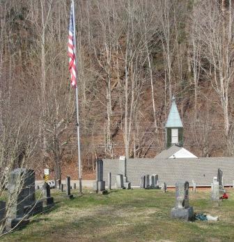
| Memorials | : | 20 |
| Location | : | Greeneville, Greene County, USA |
| Coordinate | : | 35.9782380, -82.8700750 |
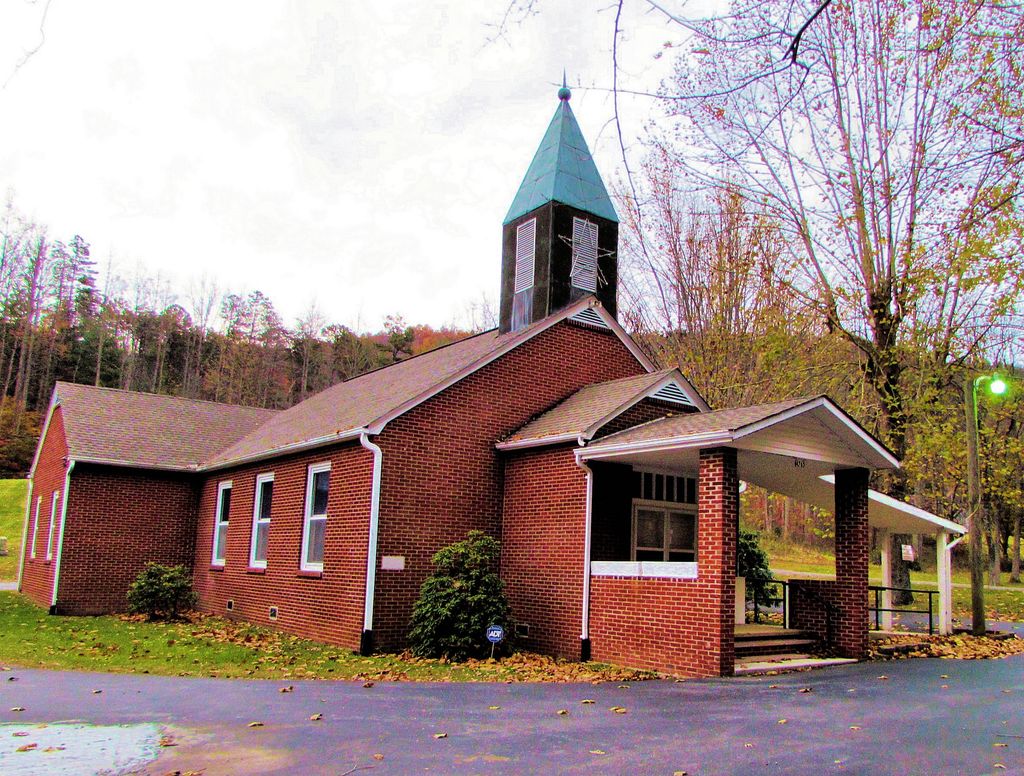
| Description | : | A North Carolina grant of 200 acres on Richland Creek north of the Nolichucky River was entered for James Houston in Greene County under date of 1 November 1786. The early Greeneville settlement grew up around the Big Spring which forms the headwaters of this Richland Creek. We are told that Houston was located here as early as 1778, and that he later sold this land to buy 640 acres south of the river at the head of Brush Creek. He built a two-story log house, part of which was still standing in 1953, and a log church. This was... Read More |
frequently asked questions (FAQ):
-
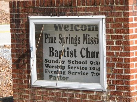
Where is Pine Springs Missionary Baptist Church Cemetery?
Pine Springs Missionary Baptist Church Cemetery is located at 4765 Houston Valley Road Greeneville, Greene County ,Tennessee ,USA.
-
Pine Springs Missionary Baptist Church Cemetery cemetery's updated grave count on graveviews.com?
20 memorials
-
Where are the coordinates of the Pine Springs Missionary Baptist Church Cemetery?
Latitude: 35.9782380
Longitude: -82.8700750
Nearby Cemetories:
1. Haire Family Cemetery
Greene County, USA
Coordinate: 35.9888992, -82.8432999
2. Lawson, Wills, & Arrington Cemetery
Greene County, USA
Coordinate: 35.9734660, -82.9083070
3. Lamb Family Cemetery at Sherills Cove
Greene County, USA
Coordinate: 35.9959800, -82.8374200
4. Beersheba Cemetery
Limestone Springs, Greene County, USA
Coordinate: 36.0153008, -82.8566971
5. Rehobeth United Methodist Church Cemetery
Greene County, USA
Coordinate: 36.0158005, -82.8518982
6. Hale Cemetery
Houston Valley, Greene County, USA
Coordinate: 35.9692210, -82.9200490
7. Paint Rock Cemetery
Paint Rock, Madison County, USA
Coordinate: 35.9287500, -82.8851800
8. Houston Memorial Cemetery
Camp Creek, Greene County, USA
Coordinate: 36.0211170, -82.8302780
9. Cedar Creek Cemetery
Cedar Creek, Greene County, USA
Coordinate: 36.0263770, -82.8995460
10. Click Cemetery
Hot Springs, Madison County, USA
Coordinate: 35.9221700, -82.8646900
11. Solomon Lutheran Church Cemetery
Greeneville, Greene County, USA
Coordinate: 36.0411797, -82.8680573
12. Furnace Cemetery
Greene County, USA
Coordinate: 36.0259960, -82.8185780
13. Mount Olivet Church Cemetery
Greene County, USA
Coordinate: 36.0006000, -82.9439000
14. William Norton Family Cemetery
Hot Springs, Madison County, USA
Coordinate: 35.9120000, -82.8924800
15. Maynard Cemetery
Hot Springs, Madison County, USA
Coordinate: 35.9168800, -82.9116700
16. Ottinger Chapel Cemetery
Shaleville, Madison County, USA
Coordinate: 35.9090800, -82.8513300
17. Swaney Family Cemetery
Hot Springs, Madison County, USA
Coordinate: 35.9070600, -82.8839300
18. Antioch Cemetery
Hot Springs, Madison County, USA
Coordinate: 35.9051700, -82.8834400
19. Upper Paint Creek Cemetery
Greeneville, Greene County, USA
Coordinate: 36.0012610, -82.7821590
20. Walker Cemetery
Camp Creek, Greene County, USA
Coordinate: 35.9943500, -82.7790400
21. Fairview Methodist Church Graveyard
Hot Springs, Madison County, USA
Coordinate: 35.9014300, -82.8563400
22. Sexton Cemetery
Camp Creek, Greene County, USA
Coordinate: 36.0127460, -82.7835140
23. Burnetts Chapel Baptist Cemetery
Greeneville, Greene County, USA
Coordinate: 36.0491470, -82.8271250
24. Cutshall Cemetery
Camp Creek, Greene County, USA
Coordinate: 36.0003700, -82.7751300