| Memorials | : | 2 |
| Location | : | Rock Run Township, Stephenson County, USA |
| Coordinate | : | 42.4014015, -89.4953003 |
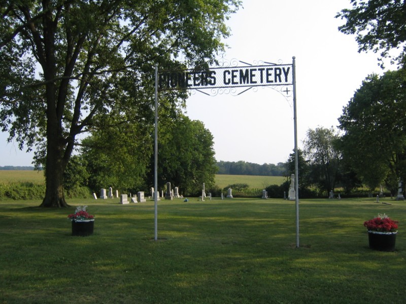
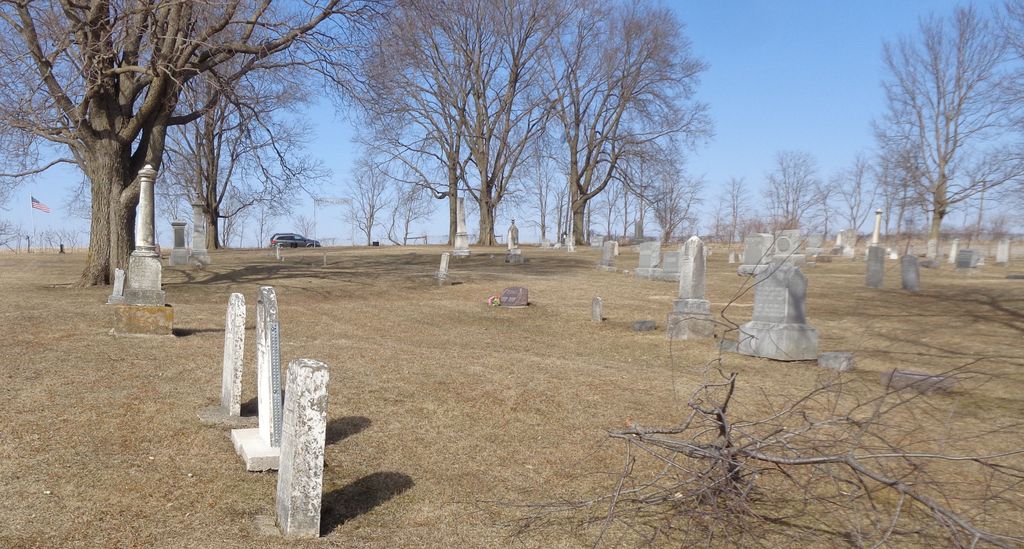
| Description | : | Rock Run Township - Section 29 On the east side of Brown Road, just south of where it ends at Farm School Road, a Presbyterian church was built in 1857 and continued until about 1890. The building was torn down about 1909, but the cemetery remains. This was on Vehmeier land and was originally called the Vehmeier Cemetery, but was renamed in 1937 the Pioneer Cemetery. |
frequently asked questions (FAQ):
-
Where is Pioneers Cemetery?
Pioneers Cemetery is located at Rock Run Township, Stephenson County ,Illinois ,USA.
-
Pioneers Cemetery cemetery's updated grave count on graveviews.com?
2 memorials
-
Where are the coordinates of the Pioneers Cemetery?
Latitude: 42.4014015
Longitude: -89.4953003
Nearby Cemetories:
1. Rock City Cemetery
Rock City, Stephenson County, USA
Coordinate: 42.4025002, -89.4728012
2. Dakota Cemetery
Dakota, Stephenson County, USA
Coordinate: 42.3899994, -89.5338974
3. Saint Pauls Epleyanna Cemetery
Davis, Stephenson County, USA
Coordinate: 42.4300000, -89.4420000
4. Brubaker Cemetery
Rock Run Township, Stephenson County, USA
Coordinate: 42.3526306, -89.4791183
5. Lancaster Cemetery
Dakota, Stephenson County, USA
Coordinate: 42.3600006, -89.5342026
6. Bethlehem Cemetery
Stephenson County, USA
Coordinate: 42.4481010, -89.4574966
7. Freeport Mennonite Church Cemetery
Freeport, Stephenson County, USA
Coordinate: 42.3601600, -89.5450400
8. Afolkey Cemetery
Afolkey, Stephenson County, USA
Coordinate: 42.4289017, -89.5759506
9. Davis Cemetery
Davis, Stephenson County, USA
Coordinate: 42.4255790, -89.4091840
10. Irish Grove Catholic Cemetery
Stephenson County, USA
Coordinate: 42.3797226, -89.4069443
11. Rock Grove Cemetery
Rock Grove, Stephenson County, USA
Coordinate: 42.4688988, -89.5294037
12. Silver Spring Cemetery
Stephenson County, USA
Coordinate: 42.3306007, -89.5532990
13. Felts Cemetery
Stephenson County, USA
Coordinate: 42.4692001, -89.4308014
14. Frankeburger Cemetery
Rock Grove, Stephenson County, USA
Coordinate: 42.4892006, -89.4925003
15. Zion Cemetery
Buckeye Township, Stephenson County, USA
Coordinate: 42.4210400, -89.6379800
16. Ridott Township Cemetery
Ridott, Stephenson County, USA
Coordinate: 42.2946120, -89.4808530
17. Cedarville Cemetery
Cedarville, Stephenson County, USA
Coordinate: 42.3838997, -89.6410980
18. Grandview Cemetery
Freeport, Stephenson County, USA
Coordinate: 42.3480988, -89.6318970
19. Wagner Cemetery
Ridott, Stephenson County, USA
Coordinate: 42.2971992, -89.4257965
20. Bellview Cemetery
Stephenson County, USA
Coordinate: 42.4166985, -89.6524963
21. State Line Cemetery
Rock Grove, Stephenson County, USA
Coordinate: 42.5001370, -89.4071250
22. Johnson Cemetery
Twin Grove, Green County, USA
Coordinate: 42.5031013, -89.5783005
23. Eldorado Cemetery
Orangeville, Stephenson County, USA
Coordinate: 42.4831009, -89.6136017
24. Gund Cemetery
Freeport, Stephenson County, USA
Coordinate: 42.2797012, -89.5194016


