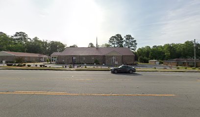
| Memorials | : | 0 |
| Location | : | Hinesville, Liberty County, USA |
| Coordinate | : | 31.7941000, -81.6069000 |
| Description | : | Please Note: This is the only Pleasant Grove AME in Hinesville which is still in use. The other Pleasant Grove AME listed in Fort Stewart is located on a military base. This one has been closed down since the Federal Government bought the land for a military reservation. This was done 03-Oct-1941. The members who were forced off their land resettled in Liberty County and held services in different homes and schools. Through the efforts of Rush Bacon, Fisher Slater and others a new Pleasant Grove AME was established and continues to grow today Location: ... Read More |
frequently asked questions (FAQ):
-
Where is Pleasant Grove AME Church Cemetery?
Pleasant Grove AME Church Cemetery is located at 1450 W. Oglethorpe Hwy Hinesville, Liberty County ,Georgia , 31313USA.
-
Pleasant Grove AME Church Cemetery cemetery's updated grave count on graveviews.com?
0 memorials
-
Where are the coordinates of the Pleasant Grove AME Church Cemetery?
Latitude: 31.7941000
Longitude: -81.6069000
Nearby Cemetories:
1. Taylors Creek Cemetery New
Hinesville, Liberty County, USA
Coordinate: 31.7952000, -81.6068000
2. First Calvary Missionary Baptist Church Cemetery
Hinesville, Liberty County, USA
Coordinate: 31.7956000, -81.6067000
3. Allenhurst Presbyterian Church Cemetery
Liberty County, USA
Coordinate: 31.7880020, -81.6081590
4. Hinesville Cemetery
Hinesville, Liberty County, USA
Coordinate: 31.8043995, -81.6085968
5. Oglethorpe Memorial Park
Hinesville, Liberty County, USA
Coordinate: 31.8115450, -81.6071000
6. Bacon Cemetery
Walthourville, Liberty County, USA
Coordinate: 31.7616997, -81.6082993
7. Baconton Missionary Baptist Church Cemetery
Liberty County, USA
Coordinate: 31.7589300, -81.6078500
8. Walthourville Presbyterian Church Cemetery
Walthourville, Liberty County, USA
Coordinate: 31.7569008, -81.6144028
9. Faith Memorial Garden
Hinesville, Liberty County, USA
Coordinate: 31.8117000, -81.6495000
10. Poppell Cemetery
Hinesville, Liberty County, USA
Coordinate: 31.8143997, -81.6492004
11. Saint Luke Missionary Baptist Church Cemetery
Hinesville, Liberty County, USA
Coordinate: 31.8085390, -81.6598060
12. B&B Cemetery
Ludowici, Long County, USA
Coordinate: 31.7461990, -81.6095320
13. Bryant Cemetery
Long County, USA
Coordinate: 31.7379410, -81.6216280
14. Saint Philip's Episcopal Church Memorial Garden
Hinesville, Liberty County, USA
Coordinate: 31.8558420, -81.5905660
15. Elim Baptist Church Cemetery
Ludowici, Long County, USA
Coordinate: 31.7888500, -81.6823300
16. Saint James Community Church Cemetery
Midway, Liberty County, USA
Coordinate: 31.8076440, -81.5306270
17. Wilderness Baptist Church Cemetery
Hinesville, Liberty County, USA
Coordinate: 31.8358702, -81.5352460
18. Wells Cemetery
Gum Branch, Liberty County, USA
Coordinate: 31.8431000, -81.6786000
19. Barrett Cemetery
Ludowici, Long County, USA
Coordinate: 31.7667007, -81.6952972
20. Flemington Presbyterian Church Cemetery
Flemington, Liberty County, USA
Coordinate: 31.8695100, -81.5711100
21. Zion Temple Church Cemetery
Midway, Liberty County, USA
Coordinate: 31.8163400, -81.5120100
22. Wilderness Baptist Church Cemetery
Dorchester, Liberty County, USA
Coordinate: 31.8152000, -81.5115000
23. New Home Society Cemetery
Hinesville, Liberty County, USA
Coordinate: 31.8735400, -81.5755400
24. Concord Cemetery
Long County, USA
Coordinate: 31.7317009, -81.6883011

