
| Memorials | : | 0 |
| Location | : | Hinesville, Liberty County, USA |
| Phone | : | 912-876-2744 |
| Website | : | www.stphilipshinesville.net/ |
| Coordinate | : | 31.8558420, -81.5905660 |
frequently asked questions (FAQ):
-
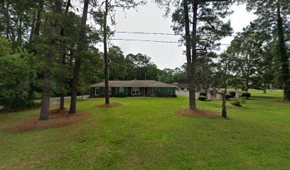
Where is Saint Philip's Episcopal Church Memorial Garden?
Saint Philip's Episcopal Church Memorial Garden is located at 302 East General Stewart Way Hinesville, Liberty County ,Georgia , 31313USA.
-
Saint Philip's Episcopal Church Memorial Garden cemetery's updated grave count on graveviews.com?
0 memorials
-
Where are the coordinates of the Saint Philip's Episcopal Church Memorial Garden?
Latitude: 31.8558420
Longitude: -81.5905660
Nearby Cemetories:
1. Flemington Presbyterian Church Cemetery
Flemington, Liberty County, USA
Coordinate: 31.8695100, -81.5711100
2. New Home Society Cemetery
Hinesville, Liberty County, USA
Coordinate: 31.8735400, -81.5755400
3. Oglethorpe Memorial Park
Hinesville, Liberty County, USA
Coordinate: 31.8115450, -81.6071000
4. Wilderness Baptist Church Cemetery
Hinesville, Liberty County, USA
Coordinate: 31.8358702, -81.5352460
5. Hinesville Cemetery
Hinesville, Liberty County, USA
Coordinate: 31.8043995, -81.6085968
6. First Calvary Missionary Baptist Church Cemetery
Hinesville, Liberty County, USA
Coordinate: 31.7956000, -81.6067000
7. Taylors Creek Cemetery New
Hinesville, Liberty County, USA
Coordinate: 31.7952000, -81.6068000
8. Pleasant Grove AME Church Cemetery
Hinesville, Liberty County, USA
Coordinate: 31.7941000, -81.6069000
9. Poppell Cemetery
Hinesville, Liberty County, USA
Coordinate: 31.8143997, -81.6492004
10. Faith Memorial Garden
Hinesville, Liberty County, USA
Coordinate: 31.8117000, -81.6495000
11. Allenhurst Presbyterian Church Cemetery
Liberty County, USA
Coordinate: 31.7880020, -81.6081590
12. Saint James Community Church Cemetery
Midway, Liberty County, USA
Coordinate: 31.8076440, -81.5306270
13. Saint Luke Missionary Baptist Church Cemetery
Hinesville, Liberty County, USA
Coordinate: 31.8085390, -81.6598060
14. Wells Cemetery
Gum Branch, Liberty County, USA
Coordinate: 31.8431000, -81.6786000
15. Zion Temple Church Cemetery
Midway, Liberty County, USA
Coordinate: 31.8163400, -81.5120100
16. Wilderness Baptist Church Cemetery
Dorchester, Liberty County, USA
Coordinate: 31.8152000, -81.5115000
17. Saint Peters Church Cemetery
Hinesville, Liberty County, USA
Coordinate: 31.8274400, -81.4984400
18. Trinity Cemetery
Fort Stewart, Liberty County, USA
Coordinate: 31.9307995, -81.5382996
19. Taylors Creek Cemetery
Fort Stewart, Liberty County, USA
Coordinate: 31.9356003, -81.6481018
20. Bacon Cemetery
Walthourville, Liberty County, USA
Coordinate: 31.7616997, -81.6082993
21. Baconton Missionary Baptist Church Cemetery
Liberty County, USA
Coordinate: 31.7589300, -81.6078500
22. Walthourville Presbyterian Church Cemetery
Walthourville, Liberty County, USA
Coordinate: 31.7569008, -81.6144028
23. Elim Baptist Church Cemetery
Ludowici, Long County, USA
Coordinate: 31.7888500, -81.6823300
24. Solomon Temple Church of Christ Cemetery
Dorchester, Liberty County, USA
Coordinate: 31.7899000, -81.4897000