
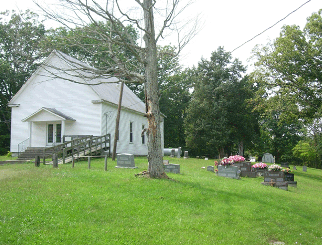
| Memorials | : | 9 |
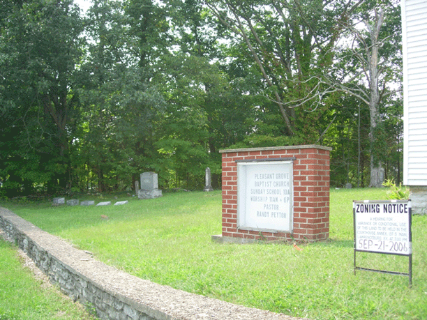
| Location | : | Anderson County, USA |
| Coordinate | : | 38.0043488, -85.1110229 |
| Description | : | On SR 1579: 1 mile from Hwy 44 |
frequently asked questions (FAQ):
-
Where is Pleasant Grove Baptist Church Cemetery?
Pleasant Grove Baptist Church Cemetery is located at Anderson County ,Kentucky ,USA.
-
Pleasant Grove Baptist Church Cemetery cemetery's updated grave count on graveviews.com?
9 memorials
-
Where are the coordinates of the Pleasant Grove Baptist Church Cemetery?
Latitude: 38.0043488
Longitude: -85.1110229
Nearby Cemetories:
1. Best Cemetery
Anderson County, USA
Coordinate: 38.0172005, -85.0950012
2. Shely Family Cemetery
Klondyke, Anderson County, USA
Coordinate: 37.9663670, -85.0730830
3. Cranfill Cemetery
Anderson County, USA
Coordinate: 37.9667702, -85.0646820
4. Bucy Cemetery
Anderson County, USA
Coordinate: 38.0071983, -85.0391998
5. New Liberty Christian Church Cemetery
Lawrenceburg, Anderson County, USA
Coordinate: 37.9478400, -85.1202900
6. Friendship Baptist Church Cemetery
Sinai, Anderson County, USA
Coordinate: 37.9573240, -85.0651240
7. Leathers Cemetery
Klondyke, Anderson County, USA
Coordinate: 37.9508018, -85.0753021
8. Stevens Gravesite
Anderson County, USA
Coordinate: 37.9803300, -85.0372100
9. Bruner-McMichael Cemetery
Anderson City, Anderson County, USA
Coordinate: 37.9909400, -85.0236990
10. Carlton-Grugin Cemetery
Birdie, Anderson County, USA
Coordinate: 38.0286713, -85.0244827
11. Petty Cemetery
Anderson County, USA
Coordinate: 38.0017014, -85.0168991
12. Pennys Chapel Cemetery
Anderson City, Anderson County, USA
Coordinate: 37.9314995, -85.0717697
13. Poulter-King Family Cemetery
Klondyke, Anderson County, USA
Coordinate: 37.9299876, -85.0713383
14. Green's Chapel United Methodist Church Cemetery
Nelson County, USA
Coordinate: 37.9472810, -85.1834820
15. Leathers Graveyard
Anderson County, USA
Coordinate: 37.9269530, -85.0714180
16. Sherwood Cemetery
Anderson County, USA
Coordinate: 38.0008507, -85.0033798
17. Fairmount Cemetery
Nelson County, USA
Coordinate: 37.9270350, -85.1590200
18. Corinth Cemetery
Lawrenceburg, Anderson County, USA
Coordinate: 38.0455960, -85.0101790
19. McMichael-Underhill Cemetery
Lawrenceburg, Anderson County, USA
Coordinate: 37.9865190, -84.9988680
20. Chesher Family Cemetery
Lawrenceburg, Anderson County, USA
Coordinate: 37.9895330, -84.9940830
21. Jordan Calvert Family Cemetery
Chaplin, Nelson County, USA
Coordinate: 37.9333350, -85.1883630
22. Brown Cemetery
Lawrenceburg, Anderson County, USA
Coordinate: 38.0416900, -85.0010950
23. Buntain Cemetery
Birdie, Anderson County, USA
Coordinate: 38.0260827, -84.9855554
24. Pigeon Fork Baptist Church Cemetery
Lawrenceburg, Anderson County, USA
Coordinate: 38.0969140, -85.0474840