
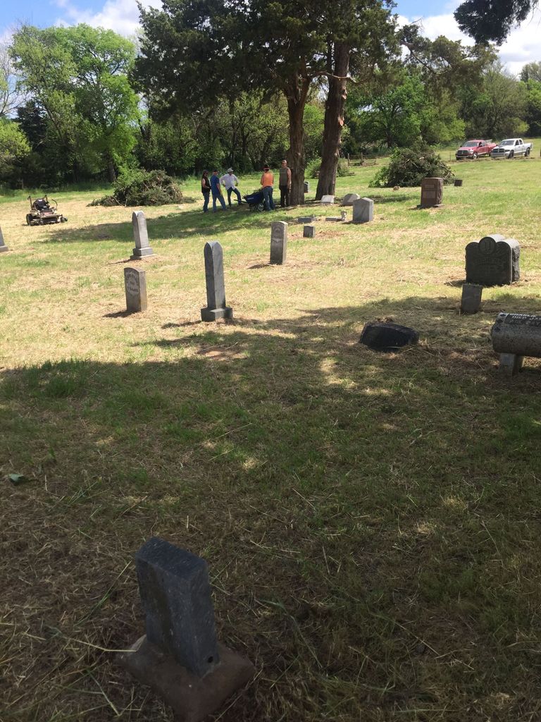
| Memorials | : | 2 |
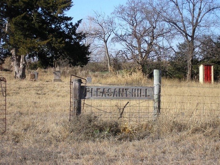
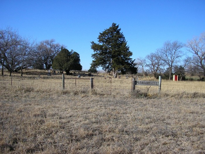
| Location | : | Medford, Grant County, USA |
| Coordinate | : | 36.7742900, -97.9130000 |
| Description | : | 10 Miles west of Medford on highway 11 to a cemetery sign. This should be N2860 Rd. (I don't recall a street sign there), then 2.5 miles south. The cemetery is on the West side of the road back about 1000 feet. There use to be an old church between the cemetery and the road. You may have to get out of your car and look around to see the cemetery. If you cross the rock road you have gone to far. |
frequently asked questions (FAQ):
-
Where is Pleasant Hill Cemetery?
Pleasant Hill Cemetery is located at Medford, Grant County ,Oklahoma ,USA.
-
Pleasant Hill Cemetery cemetery's updated grave count on graveviews.com?
2 memorials
-
Where are the coordinates of the Pleasant Hill Cemetery?
Latitude: 36.7742900
Longitude: -97.9130000
Nearby Cemetories:
1. Klondike Cemetery
Grant County, USA
Coordinate: 36.7592010, -97.8566971
2. Fairview Cemetery
Grant County, USA
Coordinate: 36.7813988, -97.8139038
3. Coldwater Cemetery
Grant County, USA
Coordinate: 36.6956900, -97.9571500
4. Hawley Cemetery
Hawley, Grant County, USA
Coordinate: 36.7667007, -98.0231018
5. Wakita Cemetery
Wakita, Grant County, USA
Coordinate: 36.8694000, -97.9302979
6. Saint Anthony Cemetery
Clyde, Grant County, USA
Coordinate: 36.8478012, -97.8193970
7. Mount Zion Cemetery
Nash, Grant County, USA
Coordinate: 36.6594009, -97.9285965
8. Old Pond Creek Ranch Cowboy Burials
Pond Creek, Grant County, USA
Coordinate: 36.7086920, -97.7909950
9. Fairview Cemetery
Wakita, Grant County, USA
Coordinate: 36.8699989, -98.0211029
10. Pond Creek Cemetery
Pond Creek, Grant County, USA
Coordinate: 36.6521988, -97.7936020
11. Dunkard Cemetery
Nash, Grant County, USA
Coordinate: 36.6803017, -98.0819016
12. Liberty Cemetery
Grant County, USA
Coordinate: 36.7235985, -97.7149963
13. Moore Cemetery
Grant County, USA
Coordinate: 36.8618200, -98.0921000
14. Rosemound Cemetery
Medford, Grant County, USA
Coordinate: 36.8044014, -97.7039032
15. Smith Cemetery
Jefferson, Grant County, USA
Coordinate: 36.7088800, -97.7139000
16. Saints Peter And Paul Cemetery
Manchester, Grant County, USA
Coordinate: 36.9131100, -98.0418100
17. Valley Center Cemetery
Pond Creek, Grant County, USA
Coordinate: 36.6081009, -97.8281021
18. Saint Mary Calvary Cemetery
Medford, Grant County, USA
Coordinate: 36.8471985, -97.7061005
19. Gibbon Cemetery
Grant County, USA
Coordinate: 36.9491997, -97.9756012
20. New Home Cemetery
Nash, Grant County, USA
Coordinate: 36.6436005, -98.0736008
21. Medford Mennonite Cemetery
Medford, Grant County, USA
Coordinate: 36.8403000, -97.6968000
22. Thrawl Cemetery
Jet, Alfalfa County, USA
Coordinate: 36.6944008, -98.1278000
23. Richland Cemetery
Grant County, USA
Coordinate: 36.8974991, -97.7055969
24. Hillsdale Cemetery
Hillsdale, Garfield County, USA
Coordinate: 36.5652800, -97.9701700