
| Memorials | : | 0 |
| Location | : | Washington County, USA |
| Coordinate | : | 39.5103516, -81.3381728 |
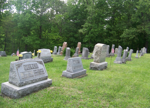
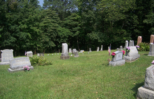
| Description | : | Located in Lawrence Township (Washington County) about 11 miles from Marietta, Ohio. it is situated on both sides of the Pleasant Hill United Methodist Church, it is not maintained by the church. (A sign posted on the fence reads: "Cemetery is maintained through private donations and is not funded by the church. To make a donation, please send to Millie Clark, 3075 Moss Run Road, Whipple, Ohio 45788." The cemetery is located in Lawrence Township, Washington County, Ohio, and is # 12463 (Pleasant Hill Cemetery / Pleasant Ridge Cemetery) in “Ohio Cemeteries 1803-2003”, compiled by the... Read More |
frequently asked questions (FAQ):
-
Where is Pleasant Hill United Methodist Church Cemetery?
Pleasant Hill United Methodist Church Cemetery is located at Stanleyville Road (County Road 42) Washington County ,Ohio , 45788USA.
-
Pleasant Hill United Methodist Church Cemetery cemetery's updated grave count on graveviews.com?
0 memorials
-
Where are the coordinates of the Pleasant Hill United Methodist Church Cemetery?
Latitude: 39.5103516
Longitude: -81.3381728


Nearby Cemetories:
1. Ludwig Cemetery
Washington County, USA
Coordinate: 39.4991989, -81.3463974
2. Epler Cemetery
Gasville, Washington County, USA
Coordinate: 39.5252304, -81.3166809
3. Bonn Cemetery
Bonn, Washington County, USA
Coordinate: 39.5240440, -81.3691020
4. Gerkin Cemetery
Bonn, Washington County, USA
Coordinate: 39.5263367, -81.3693390
5. Waxler Church Cemetery
Dalzell, Washington County, USA
Coordinate: 39.5417137, -81.3452606
6. Scott Ridge Cemetery
Gasville, Washington County, USA
Coordinate: 39.5436325, -81.3218307
7. Paw Paw Creek Cemetery
Lower Salem, Washington County, USA
Coordinate: 39.5483910, -81.3643440
8. Mossberg Cemetery
Dalzell, Washington County, USA
Coordinate: 39.5528340, -81.3179030
9. Berg Cemetery
Washington County, USA
Coordinate: 39.5023003, -81.3979034
10. Lehigh Cemetery
Washington County, USA
Coordinate: 39.5304260, -81.2791290
11. Moss Run Cemetery
Washington County, USA
Coordinate: 39.4620000, -81.3210000
12. Rake Cemetery
Washington County, USA
Coordinate: 39.4777985, -81.2780991
13. Paw Paw Cemetery
Germantown, Washington County, USA
Coordinate: 39.5682980, -81.3378500
14. Dye Cemetery
Washington County, USA
Coordinate: 39.4524994, -81.3336029
15. Salem Township Cemetery
Lower Salem, Washington County, USA
Coordinate: 39.5480003, -81.3970032
16. Dalzell Church Cemetery
Dalzell, Washington County, USA
Coordinate: 39.5639992, -81.3050003
17. Koon Cemetery
Germantown, Washington County, USA
Coordinate: 39.5718231, -81.3277512
18. Old German Cemetery
Sitka, Washington County, USA
Coordinate: 39.4482994, -81.3386002
19. Stanleyville Cemetery
Washington County, USA
Coordinate: 39.4717979, -81.4082870
20. Lawrence Baptist Cemetery
Lawrence Township, Washington County, USA
Coordinate: 39.4970000, -81.2510000
21. Tick Ridge Cemetery
Lower Salem, Washington County, USA
Coordinate: 39.5768250, -81.3642400
22. Chambers Cemetery
Washington County, USA
Coordinate: 39.4417000, -81.3531036
23. Flanders Cemetery
Washington County, USA
Coordinate: 39.5074997, -81.4285965
24. Heldman Cemetery
Washington County, USA
Coordinate: 39.5141716, -81.2459564