
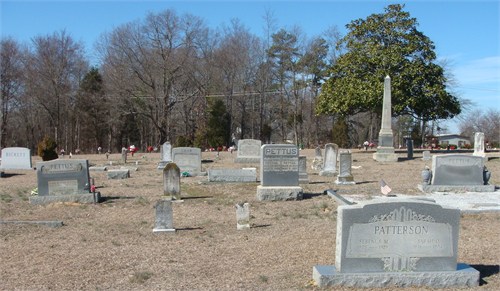
| Memorials | : | 176 |
| Location | : | Indian Land, Lancaster County, USA |
| Coordinate | : | 35.0006960, -80.8620870 |
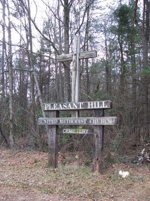
| Description | : | The cemetery is directly across the street from Pleasant Hill United Methodist Church. The church address is 238 Fort Mill Hwy, Indian Land, SC 29707 and phone number is 803 548-4922. |
frequently asked questions (FAQ):
-
Where is Pleasant Hill United Methodist Church Cemetery?
Pleasant Hill United Methodist Church Cemetery is located at Fort Mill Hwy Indian Land, Lancaster County ,South Carolina , 29707USA.
-
Pleasant Hill United Methodist Church Cemetery cemetery's updated grave count on graveviews.com?
176 memorials
-
Where are the coordinates of the Pleasant Hill United Methodist Church Cemetery?
Latitude: 35.0006960
Longitude: -80.8620870
Nearby Cemetories:
1. Pleasant Valley Baptist Church Cemetery
Lancaster County, USA
Coordinate: 34.9931793, -80.8495407
2. Silver Run Cemetery
Lancaster County, USA
Coordinate: 35.0149994, -80.8561020
3. Silver Hill Cemetery
Indian Land, Lancaster County, USA
Coordinate: 35.0149280, -80.8557590
4. Independent Bible Baptist Church Cemetery
Charlotte, Mecklenburg County, USA
Coordinate: 35.0179990, -80.8488210
5. Edwards Cemetery
Indian Land, Lancaster County, USA
Coordinate: 34.9770010, -80.8607570
6. Higher Ground Church Cemetery
Indian Land, Lancaster County, USA
Coordinate: 34.9713300, -80.8597020
7. Indian Hill AME Zion Church Cemetery
Indian Land, Lancaster County, USA
Coordinate: 35.0318830, -80.8775660
8. Banks Presbyterian Church Cemetery
Marvin, Union County, USA
Coordinate: 34.9930305, -80.8189697
9. Marvin United Methodist Church Cemetery
Marvin, Union County, USA
Coordinate: 34.9928894, -80.8166580
10. Harrison United Methodist Church Cemetery
Pineville, Mecklenburg County, USA
Coordinate: 35.0415450, -80.8637550
11. Big Pineville AME Zion Church and Cemetery
Pineville, Mecklenburg County, USA
Coordinate: 35.0466280, -80.8562640
12. Elbethel AME Zion Church Cemetery
Belair, Lancaster County, USA
Coordinate: 34.9626270, -80.8299860
13. Old Pleasant Valley Church Cemetery
Fort Mill, York County, USA
Coordinate: 34.9926280, -80.9181210
14. Marvin AME Zion Church Cemetery
Waxhaw, Union County, USA
Coordinate: 34.9920000, -80.8040000
15. Belair Methodist Church Cemetery
Lancaster County, USA
Coordinate: 34.9509964, -80.8433228
16. Old Elbethel AME Zion Church Cemetery
Indian Land, Lancaster County, USA
Coordinate: 34.9631250, -80.8125350
17. Green Hill Cemetery
Fort Mill, York County, USA
Coordinate: 35.0130150, -80.9293700
18. Macedonia Presbyterian Cemetery
Fort Mill, York County, USA
Coordinate: 35.0120690, -80.9331190
19. Old Six Mile Cemetery
Indian Land, Lancaster County, USA
Coordinate: 34.9484250, -80.8220320
20. Unity Cemetery
Fort Mill, York County, USA
Coordinate: 35.0076675, -80.9372864
21. Old Unity Cemetery
Fort Mill, York County, USA
Coordinate: 35.0155230, -80.9360810
22. Unity Presbyterian Church Columbarium
Fort Mill, York County, USA
Coordinate: 35.0080102, -80.9383740
23. Church of God Cemetery
Fort Mill, York County, USA
Coordinate: 34.9934820, -80.9433610
24. Saint Margarets Episcopal Church
Waxhaw, Union County, USA
Coordinate: 35.0104310, -80.7781500