
| Memorials | : | 7 |
| Location | : | Indian Land, Lancaster County, USA |
| Coordinate | : | 34.9484250, -80.8220320 |
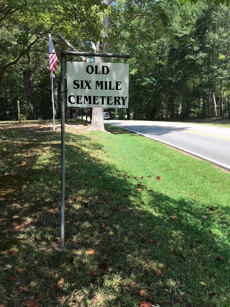
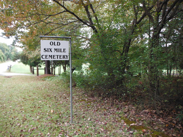
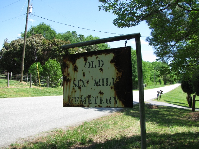
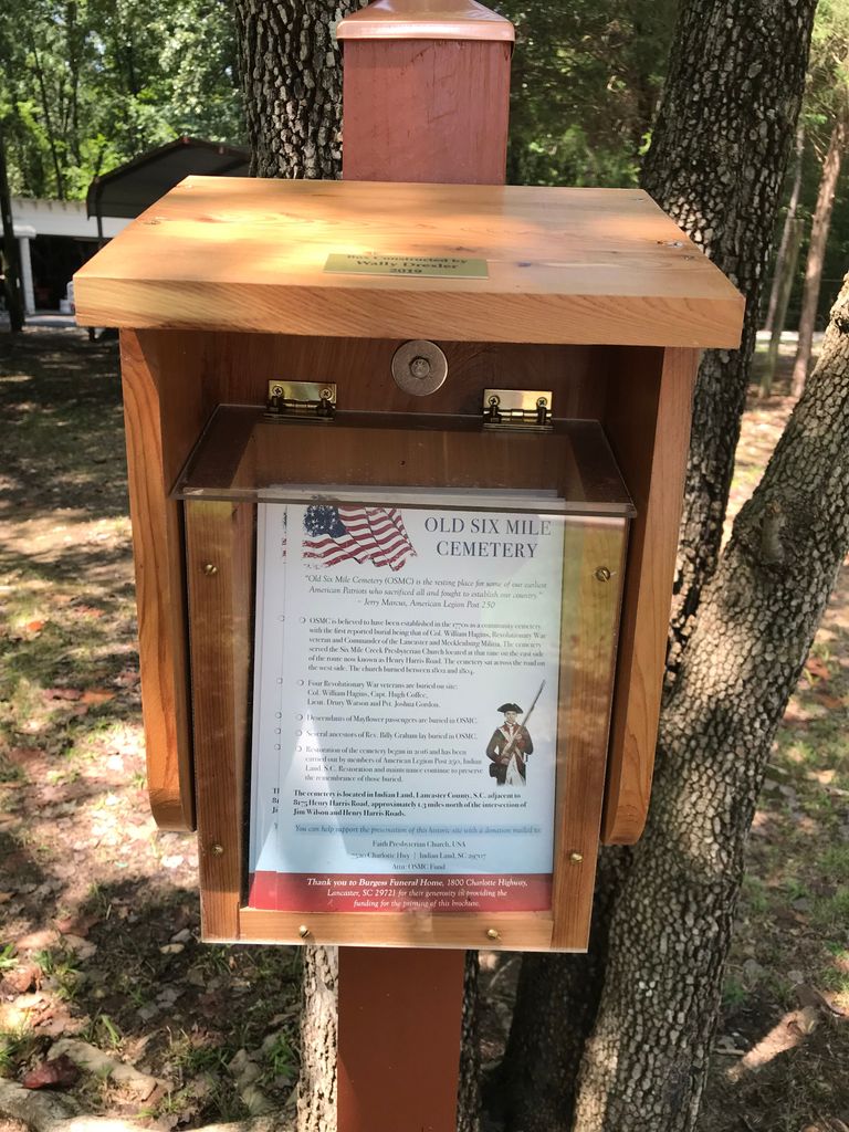
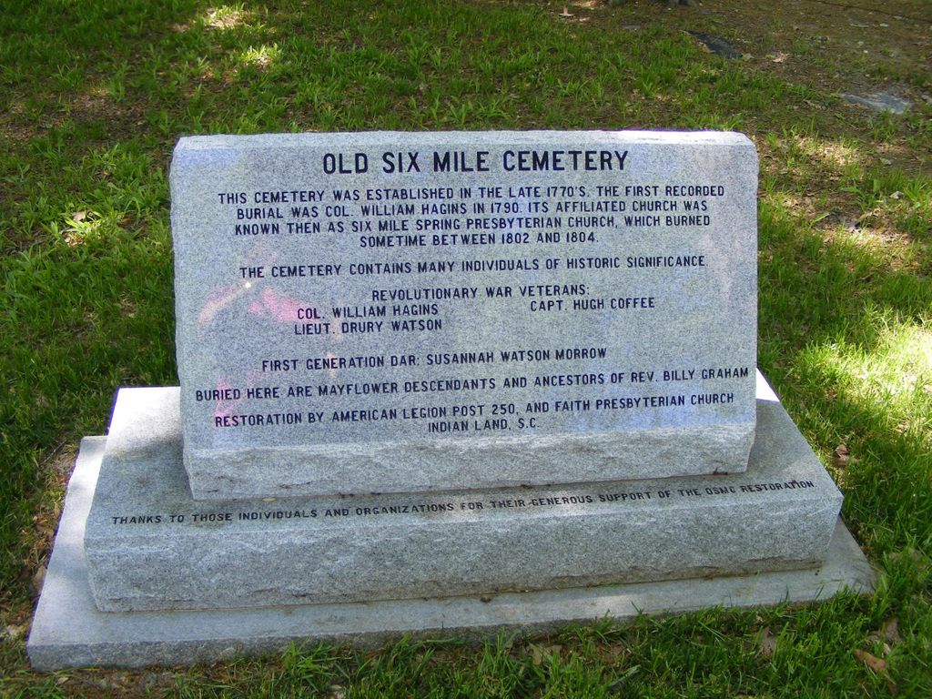
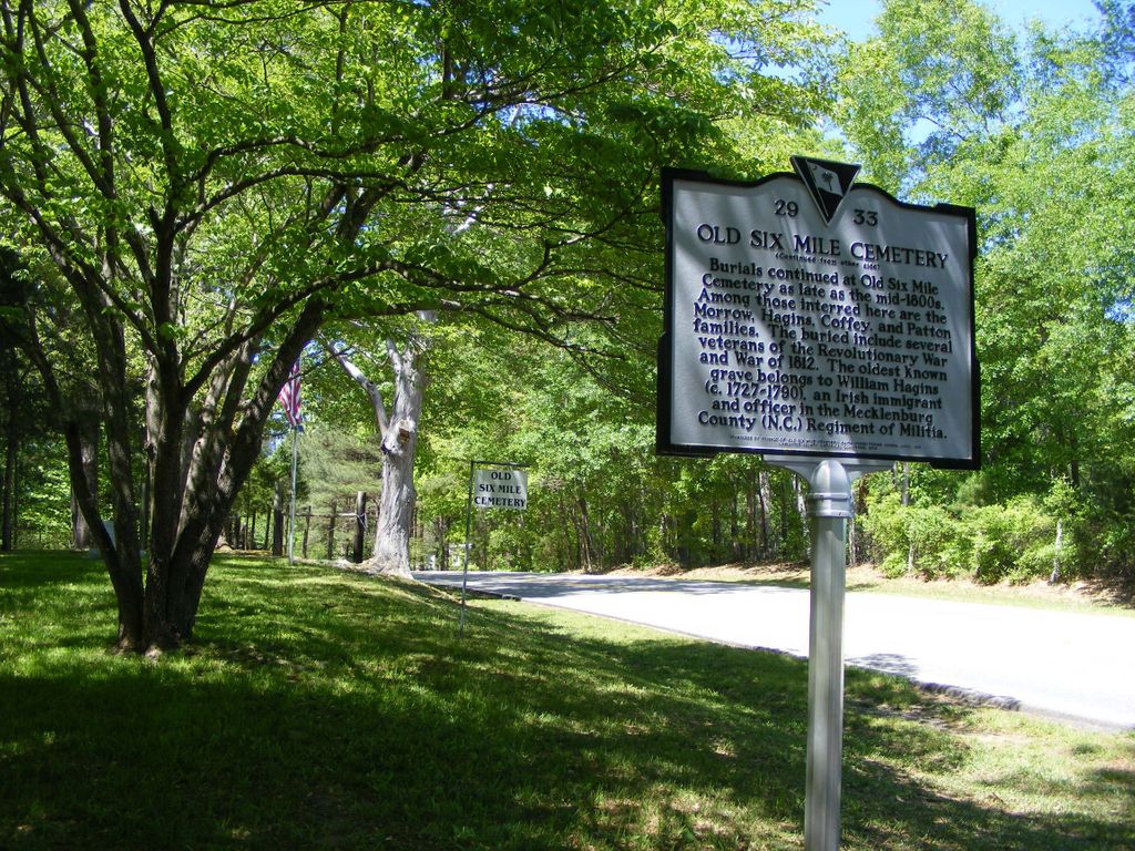
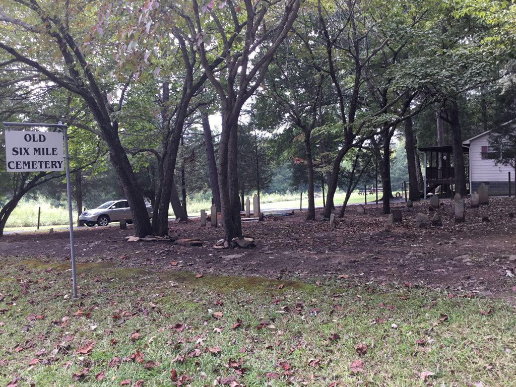
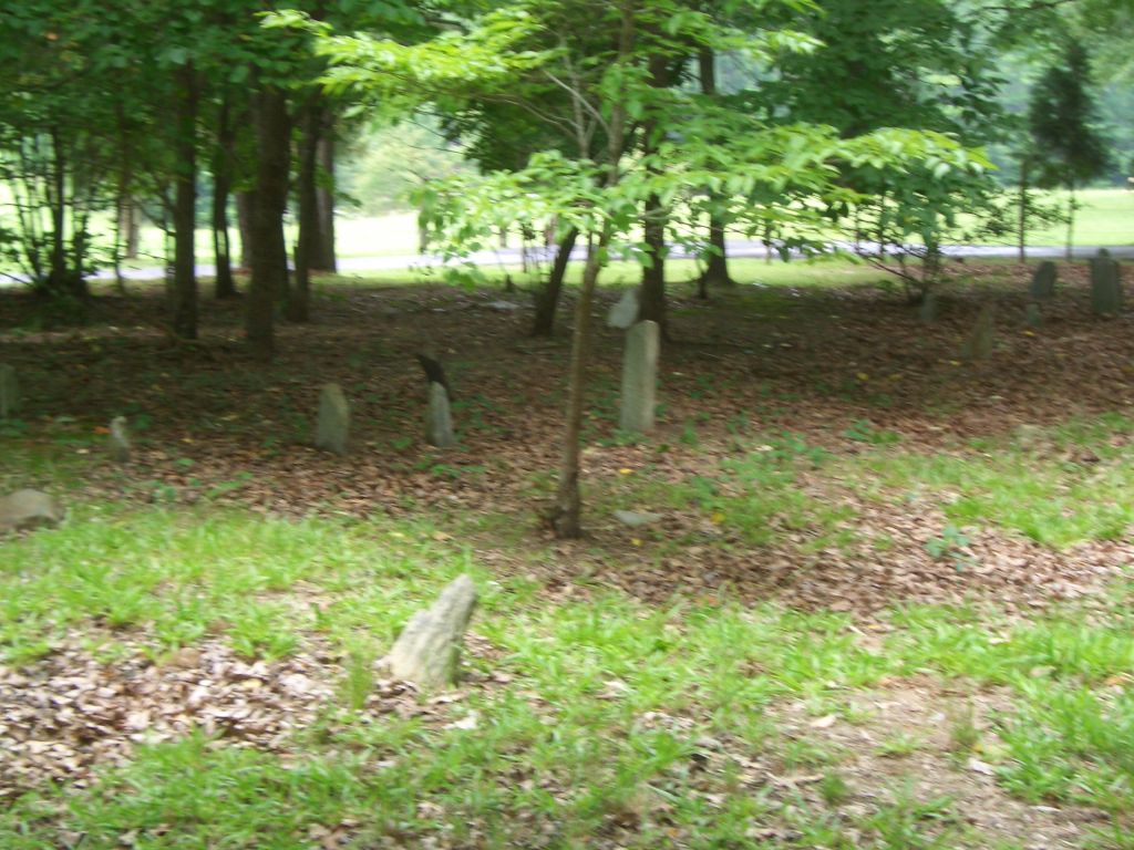
| Description | : | Located off Henry Harris Road, east of US 521, Indian Land, Lancaster County, South Carolina. This cemetery is located off Henry Harris Road which runs parallel to US 521 for about 7 miles on the east side. The words on all but five are illegible. The death dates seem to run from late 1700s to 1842. It contains veterans’ graves from both the American Revolution and the War of 1812. The oldest known tombstone in Old Six Mile Cemetery is that of Col. John William Hagins (1727-1790). Hagins served under Thomas Sumter at the Battle of Hanging Rock.... Read More |
frequently asked questions (FAQ):
-
Where is Old Six Mile Cemetery?
Old Six Mile Cemetery is located at Henry Harris Road Indian Land, Lancaster County ,South Carolina , 29707USA.
-
Old Six Mile Cemetery cemetery's updated grave count on graveviews.com?
7 memorials
-
Where are the coordinates of the Old Six Mile Cemetery?
Latitude: 34.9484250
Longitude: -80.8220320
Nearby Cemetories:
1. Elbethel AME Zion Church Cemetery
Belair, Lancaster County, USA
Coordinate: 34.9626270, -80.8299860
2. Old Elbethel AME Zion Church Cemetery
Indian Land, Lancaster County, USA
Coordinate: 34.9631250, -80.8125350
3. Belair Methodist Church Cemetery
Lancaster County, USA
Coordinate: 34.9509964, -80.8433228
4. Six Mile Cemetery
Indian Land, Lancaster County, USA
Coordinate: 34.9308014, -80.8319016
5. Indian Land Baptist Church Cemetery
Indian Land, Lancaster County, USA
Coordinate: 34.9318840, -80.8367260
6. Center Grove Memorial Park
Indian Land, Lancaster County, USA
Coordinate: 34.9205500, -80.8122100
7. Our Lady of Grace Catholic Church Cemetery
Indian Land, Lancaster County, USA
Coordinate: 34.9191510, -80.7933580
8. Higher Ground Church Cemetery
Indian Land, Lancaster County, USA
Coordinate: 34.9713300, -80.8597020
9. Edwards Cemetery
Indian Land, Lancaster County, USA
Coordinate: 34.9770010, -80.8607570
10. Osceola United Methodist Church Cemetery
Lancaster, Lancaster County, USA
Coordinate: 34.9056920, -80.8091770
11. Gold Hill AME Zion Church Cemetery
Van Wyck, Lancaster County, USA
Coordinate: 34.9094340, -80.8472940
12. Banks Presbyterian Church Cemetery
Marvin, Union County, USA
Coordinate: 34.9930305, -80.8189697
13. Marvin United Methodist Church Cemetery
Marvin, Union County, USA
Coordinate: 34.9928894, -80.8166580
14. Marvin AME Zion Church Cemetery
Waxhaw, Union County, USA
Coordinate: 34.9920000, -80.8040000
15. Bonds Grove United Methodist Church Cemetery
Waxhaw, Union County, USA
Coordinate: 34.9739609, -80.7715378
16. Price Chapel Baptist Church Cemetery
Waxhaw, Union County, USA
Coordinate: 34.9415283, -80.7617188
17. Pleasant Valley Baptist Church Cemetery
Lancaster County, USA
Coordinate: 34.9931793, -80.8495407
18. Providence Baptist Church Cemetery
Waxhaw, Union County, USA
Coordinate: 34.9441200, -80.7547200
19. Macedonia Baptist Church
Indian Land, Lancaster County, USA
Coordinate: 34.8975580, -80.8555820
20. Steele Hill AME Zion Church Cemetery
Lancaster, Lancaster County, USA
Coordinate: 34.8898697, -80.7984009
21. Pleasant Hill United Methodist Church Cemetery
Indian Land, Lancaster County, USA
Coordinate: 35.0006960, -80.8620870
22. Catawba Indian Nation Cemetery
Rock Hill, York County, USA
Coordinate: 34.9043999, -80.8824005
23. Redding Springs AME Zion Church Cemetery
Union County, USA
Coordinate: 34.9911919, -80.7594910
24. Heath Memorial United Methodist Church Cemetery
Union County, USA
Coordinate: 34.8889046, -80.7834396