
| Memorials | : | 0 |
| Location | : | Angel, Calhoun County, USA |
| Coordinate | : | 33.8704147, -85.8248520 |
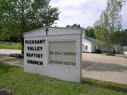
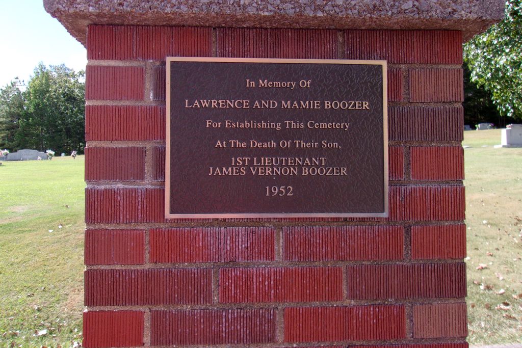
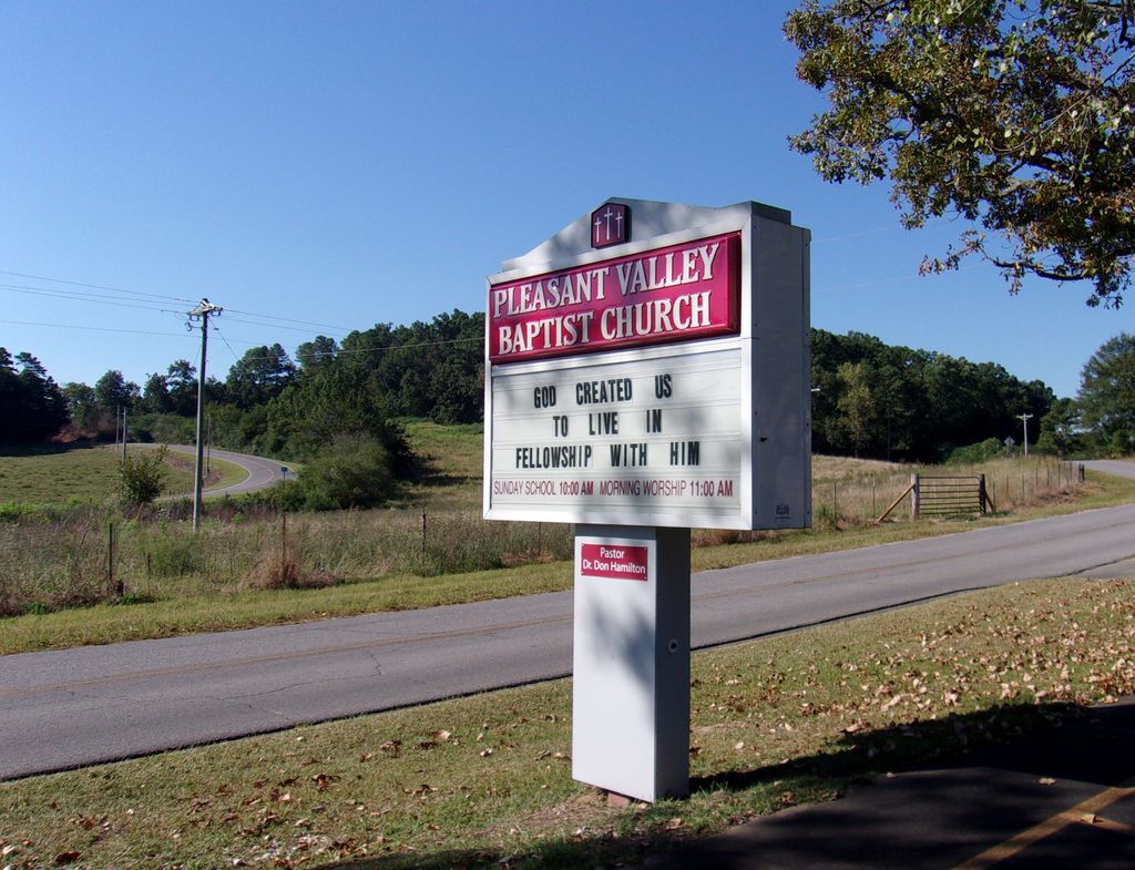
| Description | : | Pleasant Valley Baptist Church Cemetery is found west of the church building, both being off of County Road 73 at the conjunction of areas known as Pleasant Valley, Noah Valley and the northern edge of Angel Community. |
frequently asked questions (FAQ):
-
Where is Pleasant Valley Baptist Church Cemetery?
Pleasant Valley Baptist Church Cemetery is located at 2959 Pleasant Valley Road Angel, Calhoun County ,Alabama , 36265USA.
-
Pleasant Valley Baptist Church Cemetery cemetery's updated grave count on graveviews.com?
0 memorials
-
Where are the coordinates of the Pleasant Valley Baptist Church Cemetery?
Latitude: 33.8704147
Longitude: -85.8248520


Nearby Cemetories:
1. Seiber Cemetery
Jacksonville, Calhoun County, USA
Coordinate: 33.8786812, -85.8241653
2. Unity Cemetery at Church of Nine Gifts
Calhoun County, USA
Coordinate: 33.8678240, -85.8466060
3. Moore Cemetery
West Point, Calhoun County, USA
Coordinate: 33.8442001, -85.8091965
4. Seven Springs Cemetery
Jacksonville, Calhoun County, USA
Coordinate: 33.8480988, -85.8574982
5. First Baptist Church of Williams Cemetery
Jacksonville, Calhoun County, USA
Coordinate: 33.8993988, -85.7972031
6. Cross Cemetery
Angel, Calhoun County, USA
Coordinate: 33.8327200, -85.8317600
7. Mount Gilead Baptist Church Cemetery
Webster Chapel, Calhoun County, USA
Coordinate: 33.8875800, -85.8663780
8. West Point Baptist Church Cemetery
West Point, Calhoun County, USA
Coordinate: 33.8302116, -85.8058014
9. Munger Cemetery
Calhoun County, USA
Coordinate: 33.8417015, -85.7855988
10. Monger Cemetery
Tredegar, Calhoun County, USA
Coordinate: 33.8419800, -85.7845500
11. Friendship Baptist Church Cemetery
Tredegar, Calhoun County, USA
Coordinate: 33.8311119, -85.7988892
12. Prater Cemetery
Wellington, Calhoun County, USA
Coordinate: 33.9091140, -85.8582130
13. Pine Grove Congregational Holiness Church Cemetery
Webster Chapel, Calhoun County, USA
Coordinate: 33.9122100, -85.8547200
14. Carpenter Cemetery
Jacksonville, Calhoun County, USA
Coordinate: 33.8405991, -85.7707977
15. Thomas Cemetery
Jacksonville, Calhoun County, USA
Coordinate: 33.9046173, -85.7710006
16. Driskell Cemetery
Jacksonville, Calhoun County, USA
Coordinate: 33.8219490, -85.7888350
17. Broughton Cemetery
Cedar Springs, Calhoun County, USA
Coordinate: 33.8190010, -85.8559630
18. Landers Cemetery
Jacksonville, Calhoun County, USA
Coordinate: 33.9286003, -85.8206024
19. Greenlawn Cemetery
Jacksonville, Calhoun County, USA
Coordinate: 33.8252983, -85.7722015
20. Hillcrest Cemetery
Jacksonville, Calhoun County, USA
Coordinate: 33.8217010, -85.7724991
21. McGinnis Cemetery
Cedar Springs, Calhoun County, USA
Coordinate: 33.8070107, -85.8458481
22. Green Cemetery
Merrellton, Calhoun County, USA
Coordinate: 33.8706551, -85.7455215
23. Mountain View Cemetery
Webster Chapel, Calhoun County, USA
Coordinate: 33.9351000, -85.8479000
24. McCain Cemetery
Jacksonville, Calhoun County, USA
Coordinate: 33.8546982, -85.7455978