
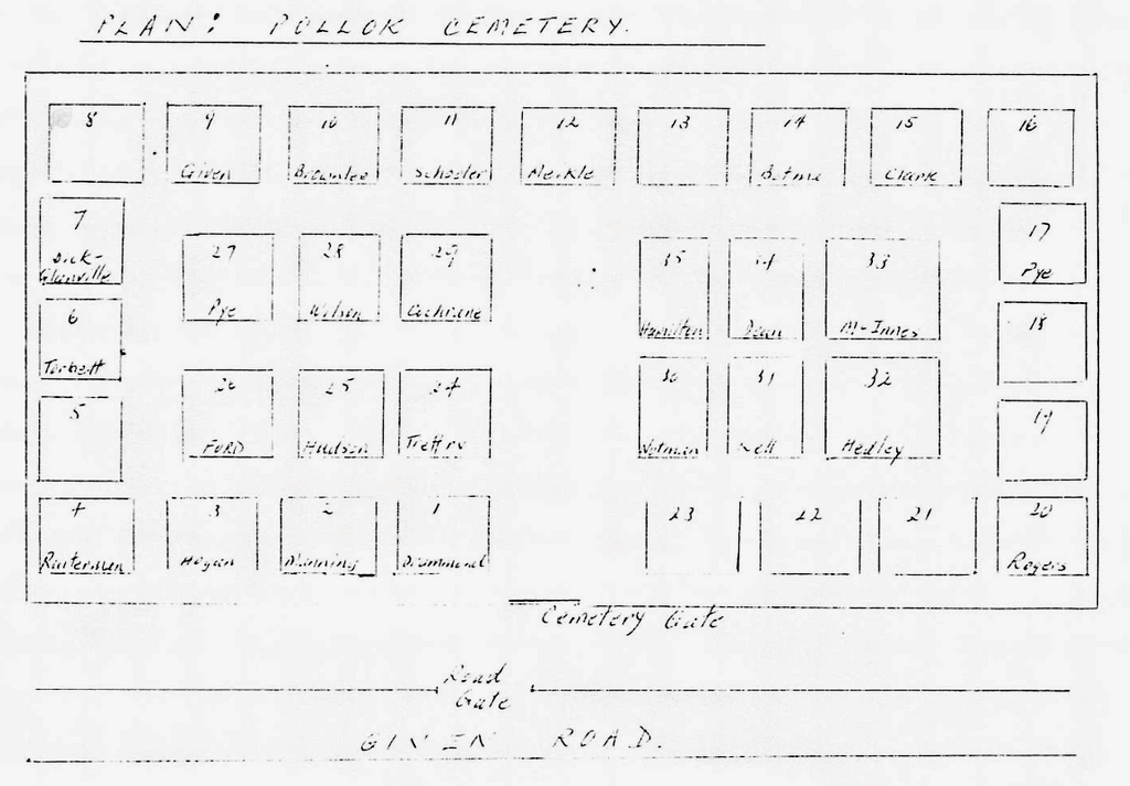
| Memorials | : | 8 |
| Location | : | Pollok, Auckland Council, New Zealand |
| Coordinate | : | -37.1469760, 174.6257190 |
| Description | : | Manukau Heads location |
frequently asked questions (FAQ):
-
Where is Pollok Cemetery?
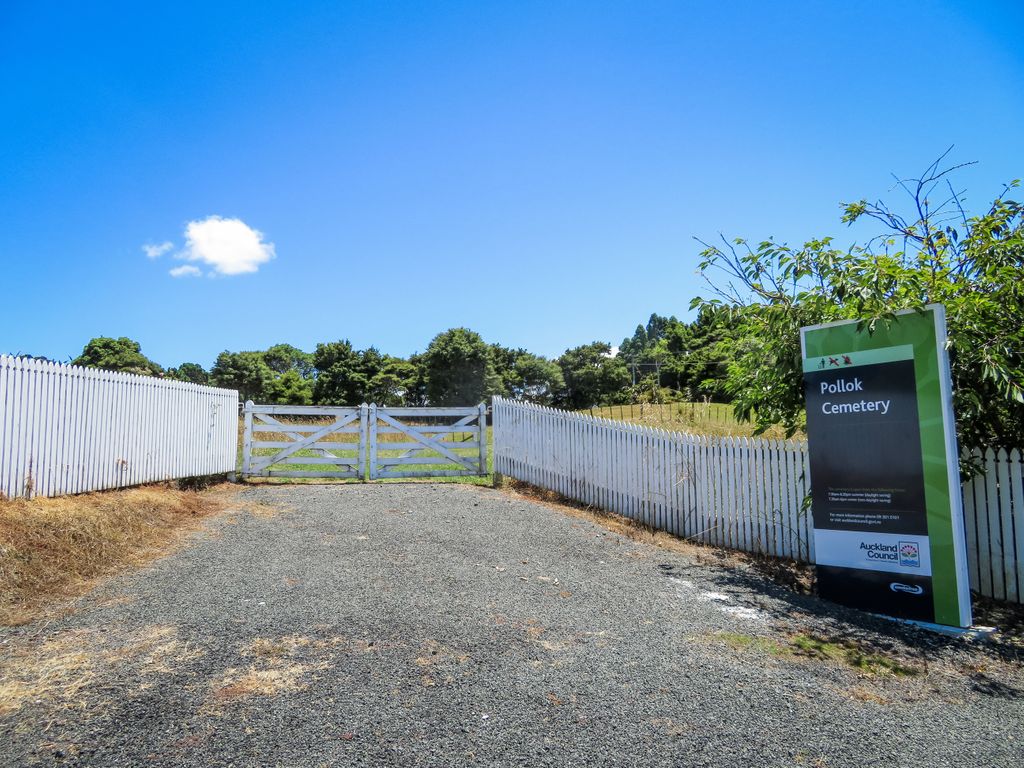
Pollok Cemetery is located at Given Road Pollok, Auckland Council ,Auckland ,New Zealand.
-
Pollok Cemetery cemetery's updated grave count on graveviews.com?
7 memorials
-
Where are the coordinates of the Pollok Cemetery?
Latitude: -37.1469760
Longitude: 174.6257190
Nearby Cemetories:
1. Kohekohe Cemetery
Pollok, Auckland Council, New Zealand
Coordinate: -37.1797380, 174.6508930
2. Awhitu Central Cemetery
Awhitu Central, Auckland Council, New Zealand
Coordinate: -37.0956340, 174.5813100
3. Waipipi Cemetery
Awhitu, Auckland Council, New Zealand
Coordinate: -37.2124964, 174.6845550
4. Tahuna Pa Road Urupā
Waiuku, Auckland Council, New Zealand
Coordinate: -37.2290900, 174.7080100
5. Waiau Pa Cemetery
Waiau Pa, Auckland Council, New Zealand
Coordinate: -37.1327190, 174.7573970
6. Mauku Historical Cemetery
Mauku, Auckland Council, New Zealand
Coordinate: -37.1743690, 174.7951870
7. Waiuku Cemetery
Waiuku, Auckland Council, New Zealand
Coordinate: -37.2612630, 174.7346520
8. Mauku Cemetery
Mauku, Auckland Council, New Zealand
Coordinate: -37.2011420, 174.8109100
9. St Brides Church of England Cemetery
Mauku, Auckland Council, New Zealand
Coordinate: -37.2011260, 174.8120370
10. Laurie-Gibbons Memorial Park
Weymouth, Auckland Council, New Zealand
Coordinate: -37.0440600, 174.8586790
11. Heights Park Cemetery
Paerata, Auckland Council, New Zealand
Coordinate: -37.1781928, 174.8938836
12. Mangere Presbyterian Cemetery
Mangere, Auckland Council, New Zealand
Coordinate: -36.9750197, 174.7924783
13. Mangere Lawn Cemetery
Mangere, Auckland Council, New Zealand
Coordinate: -36.9626150, 174.7857000
14. Pukekohe Catholic Cemetery
Pukekohe, Auckland Council, New Zealand
Coordinate: -37.1951510, 174.9014640
15. Pukekohe Public Cemetery
Pukekohe, Auckland Council, New Zealand
Coordinate: -37.2106400, 174.8974900
16. Oratia Combined Church Cemetery
Oratia, Auckland Council, New Zealand
Coordinate: -36.9196396, 174.6119362
17. Manukau Memorial Gardens
Manukau, Auckland Council, New Zealand
Coordinate: -36.9944380, 174.8397300
18. Papatoetoe Cemetery
Papatoetoe, Auckland Council, New Zealand
Coordinate: -36.9893110, 174.8373530
19. Tekohanga Urupā
Port Waikato, Waikato District, New Zealand
Coordinate: -37.3314940, 174.8085230
20. Oratia Cemetery
Oratia, Auckland Council, New Zealand
Coordinate: -36.9108800, 174.6218900
21. Settlers Cemetery
Oratia, Auckland Council, New Zealand
Coordinate: -36.9108770, 174.6218870
22. Mangere Piriti Urupā St. James Churchyard
Mangere, Auckland Council, New Zealand
Coordinate: -36.9418970, 174.7835260
23. Manutahi Urupā
Port Waikato, Waikato District, New Zealand
Coordinate: -37.3337939, 174.8210091
24. Hillsborough Cemetery
Hillsborough, Auckland Council, New Zealand
Coordinate: -36.9246600, 174.7524030