
| Memorials | : | 0 |
| Location | : | North Liberty, St. Joseph County, USA |
| Coordinate | : | 41.5493510, -86.3528070 |
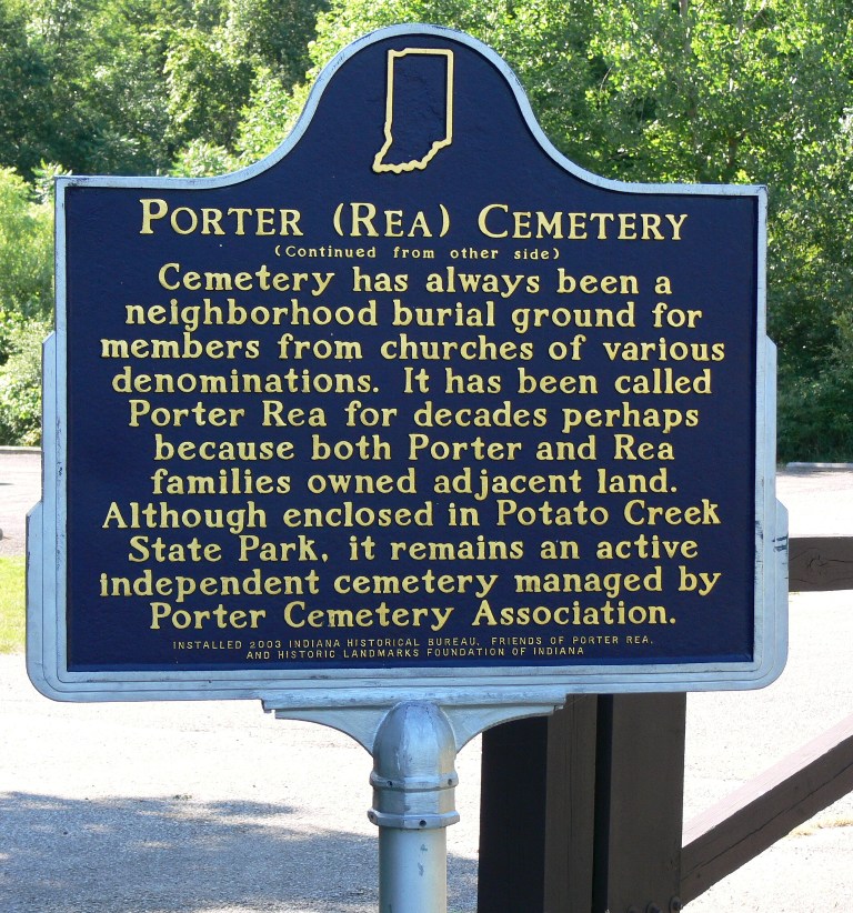
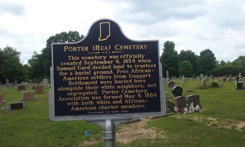
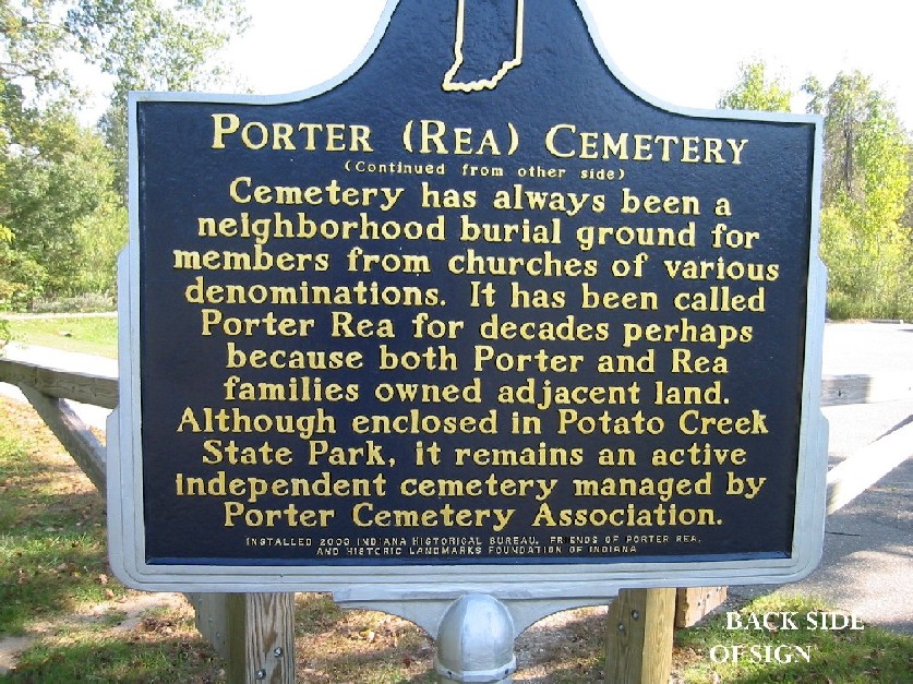
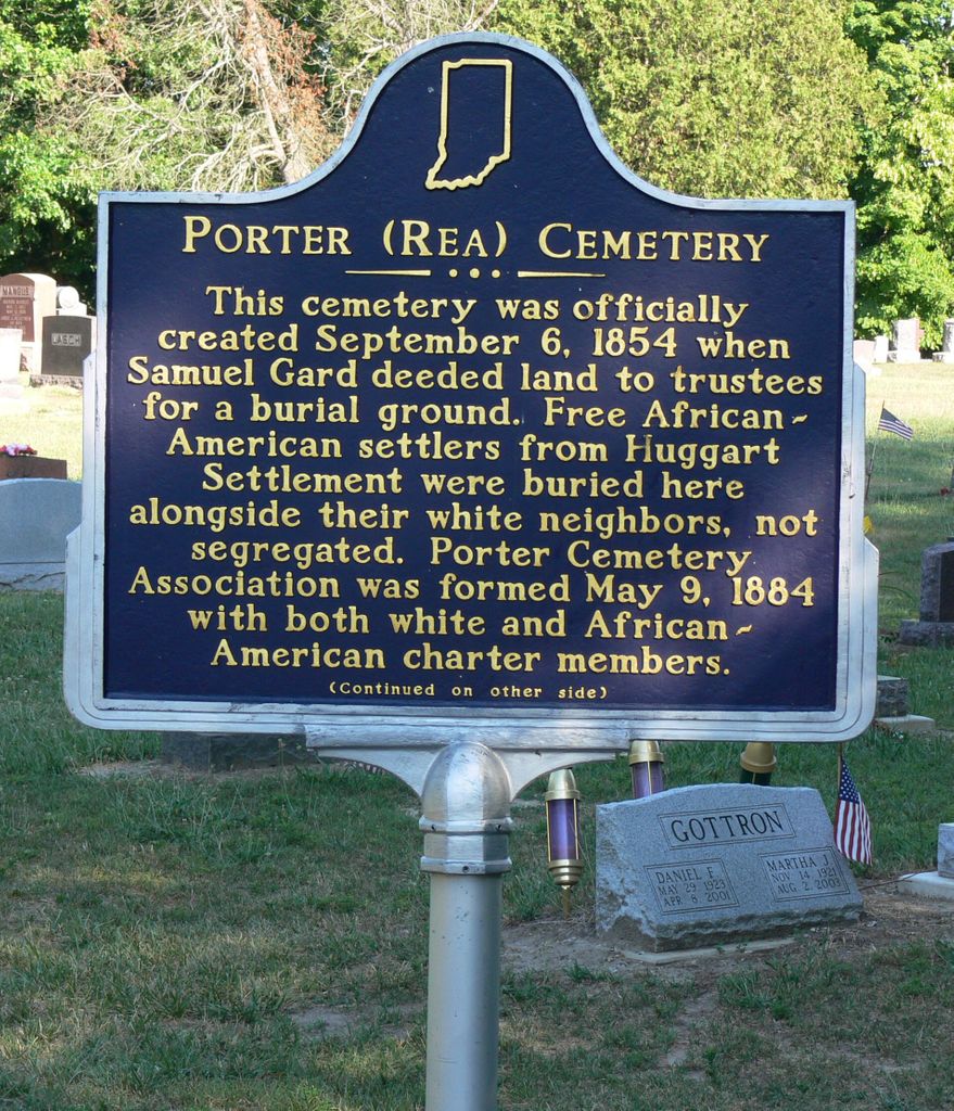
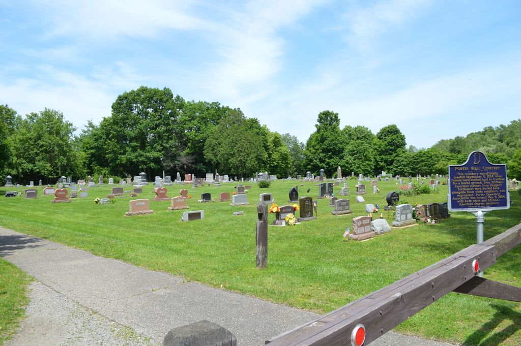
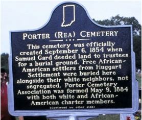
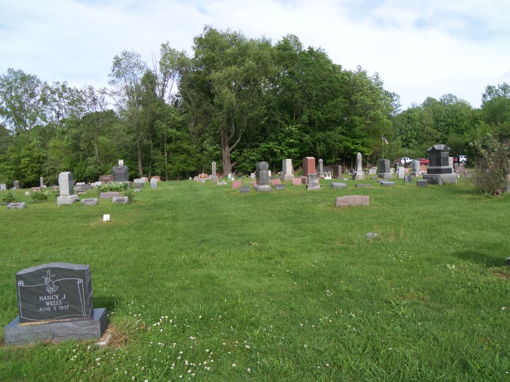
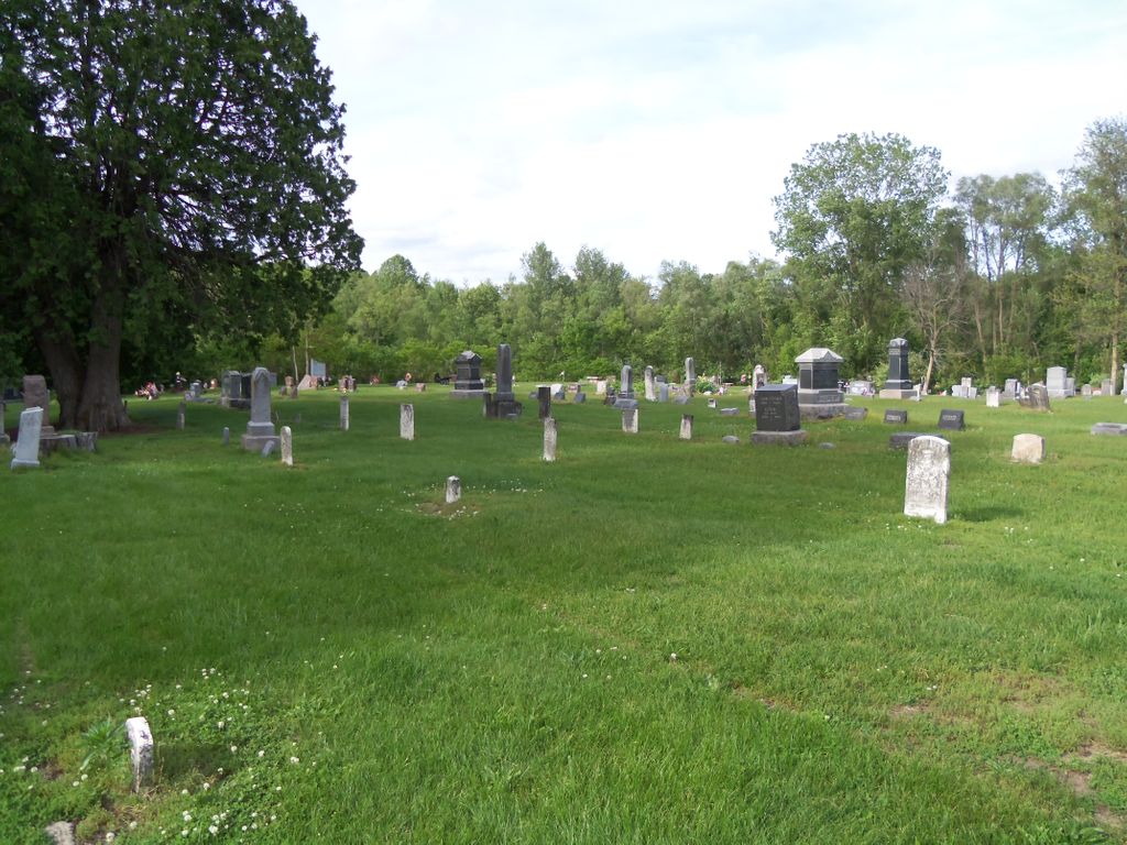
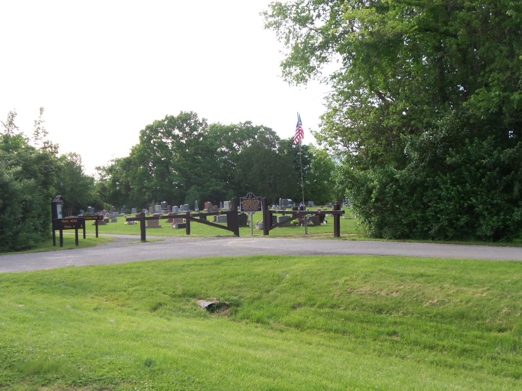
| Description | : | Location: Cemetery located in Potato Creek State Park, North Liberty. (St. Joseph County, Indiana) This cemetery was officially created September 6, 1854 when Samuel Gard deeded land to trustees for a burial ground. Free African-American settlers from Huggart Settlement were buried here alongside their white neighbors, not segregated. Porter Cemetery Association was formed May 9, 1884 with both white and African-American charter members. Cemetery has always been a neighborhood burial ground for members from churches of various denominations. It has been called Porter Rea for decades perhaps because both Porter and Rea families owned adjacent land. Although enclosed in Potato Creek... Read More |
frequently asked questions (FAQ):
-
Where is Porter-Rea Cemetery?
Porter-Rea Cemetery is located at 65065 – 65109 Pine Road North Liberty, St. Joseph County ,Indiana , 46614USA.
-
Porter-Rea Cemetery cemetery's updated grave count on graveviews.com?
0 memorials
-
Where are the coordinates of the Porter-Rea Cemetery?
Latitude: 41.5493510
Longitude: -86.3528070
Nearby Cemetories:
1. Reaves Cemetery
North Liberty, St. Joseph County, USA
Coordinate: 41.5766200, -86.3515170
2. Saint Johns Lutheran Cemetery
North Liberty, St. Joseph County, USA
Coordinate: 41.5069220, -86.3486550
3. Dice Cemetery
Lakeville, St. Joseph County, USA
Coordinate: 41.5072594, -86.3302078
4. Rhone Cemetery
Crumstown, St. Joseph County, USA
Coordinate: 41.5931800, -86.3888000
5. Eastlawn Cemetery
North Liberty, St. Joseph County, USA
Coordinate: 41.5349040, -86.4304350
6. Old Cemetery
North Liberty, St. Joseph County, USA
Coordinate: 41.5346985, -86.4313965
7. Sumption Prairie Cemetery
South Bend, St. Joseph County, USA
Coordinate: 41.6086006, -86.3305969
8. Lakeville Cemetery
Lakeville, St. Joseph County, USA
Coordinate: 41.5432280, -86.2695190
9. Fair Cemetery
North Liberty, St. Joseph County, USA
Coordinate: 41.4874992, -86.3328018
10. Westlawn Cemetery
North Liberty, St. Joseph County, USA
Coordinate: 41.5349998, -86.4408035
11. Mount Calvary Cemetery
Portage Township, St. Joseph County, USA
Coordinate: 41.5721580, -86.2637310
12. Crumstown Cemetery
North Liberty, St. Joseph County, USA
Coordinate: 41.6072388, -86.4136124
13. Henson Cemetery
South Bend, St. Joseph County, USA
Coordinate: 41.5868650, -86.2599980
14. Mount Zion Cemetery
La Paz, Marshall County, USA
Coordinate: 41.4766998, -86.3019028
15. Southlawn Cemetery
South Bend, St. Joseph County, USA
Coordinate: 41.6051407, -86.2551575
16. Lambs Settlement Cemetery
St. Joseph County, USA
Coordinate: 41.5568700, -86.2242900
17. Morris Cemetery
Marshall County, USA
Coordinate: 41.4492226, -86.3642349
18. Polk Township Cemetery
Walkerton, St. Joseph County, USA
Coordinate: 41.4491425, -86.3638687
19. Rupel Cemetery
South Bend, St. Joseph County, USA
Coordinate: 41.6303000, -86.2712000
20. Van Buskirk Cemetery
St. Joseph County, USA
Coordinate: 41.5932400, -86.2156770
21. Saint Joseph Cemetery
South Bend, St. Joseph County, USA
Coordinate: 41.6645622, -86.3485260
22. Rohrer Cemetery
St. Joseph County, USA
Coordinate: 41.6290588, -86.2406387
23. Barber Cemetery
Marshall County, USA
Coordinate: 41.4441340, -86.4208870
24. White Family Cemetery
Plymouth, Marshall County, USA
Coordinate: 41.4388900, -86.2967500