
| Memorials | : | 0 |
| Location | : | Stanardsville, Greene County, USA |
| Coordinate | : | 38.2807500, -78.4876170 |
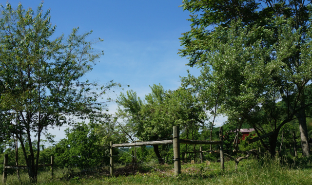
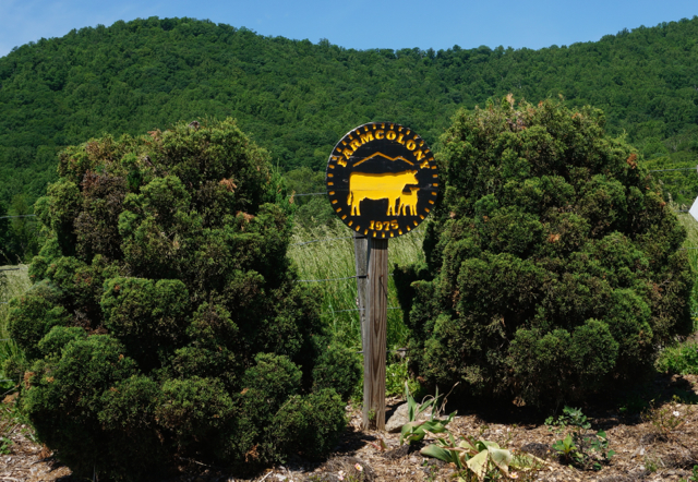
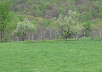
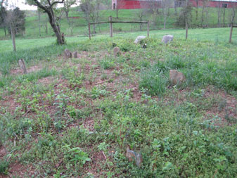
| Description | : | The cemetery is located in the field between Colony Drive and Pasturegate Lane at Farmcolony. Directions: at the intersection of Rt. 33 (Stanardsville Bypass) and Celt Road, continue south on Celt Road. Make the 4th right onto Parker Mountain Road. Colony Drive is the 1st right, Pasturgate is the 2nd right from Parker Mountain Road. The original family farmhouse is the first house on Colony Drive. In the field to the left is the small fenced in cemetery with 2 trees on either side. There are about 6-8 other unidentified graves in this plot. Another small family plot is located on... Read More |
frequently asked questions (FAQ):
-
Where is Powell Family Cemetery?
Powell Family Cemetery is located at Colony Drive Stanardsville, Greene County ,Virginia , 22973USA.
-
Powell Family Cemetery cemetery's updated grave count on graveviews.com?
0 memorials
-
Where are the coordinates of the Powell Family Cemetery?
Latitude: 38.2807500
Longitude: -78.4876170
Nearby Cemetories:
1. Powell Family Cemetery
Stanardsville, Greene County, USA
Coordinate: 38.2797860, -78.4887600
2. Moyers Graveyard
Stanardsville, Greene County, USA
Coordinate: 38.2862400, -78.4751400
3. Garth Graveyard
Stanardsville, Greene County, USA
Coordinate: 38.2930150, -78.4891220
4. Runkle Graveyard
Stanardsville, Greene County, USA
Coordinate: 38.2934940, -78.4832590
5. Crow Family Graveyard
Stanardsville, Greene County, USA
Coordinate: 38.2760070, -78.4716140
6. Steo Family Cemetery
Stanardsville, Greene County, USA
Coordinate: 38.2672340, -78.4832750
7. Lawson Family Cemetery
Stanardsville, Greene County, USA
Coordinate: 38.2921190, -78.4729960
8. Runkle Family Cemetery
Geer, Greene County, USA
Coordinate: 38.2954960, -78.5041020
9. Powell Graveyard
Stanardsville, Greene County, USA
Coordinate: 38.2988120, -78.4760930
10. Desmond Cemetery
Stanardsville, Greene County, USA
Coordinate: 38.2961820, -78.5063230
11. Hamm Family Cemetery
Amicus, Greene County, USA
Coordinate: 38.2608780, -78.4985980
12. Parrott Cemetery
Amicus, Greene County, USA
Coordinate: 38.2607730, -78.4988520
13. Nicol Family Cemetery
Geer, Greene County, USA
Coordinate: 38.2989490, -78.5062560
14. Chapman Family Cemetery
Amicus, Greene County, USA
Coordinate: 38.2576390, -78.4925000
15. Mitchell-Davis Family Cemetery
Dyke, Greene County, USA
Coordinate: 38.2716390, -78.5178330
16. Geer - Southard Cemetery
Stanardsville, Greene County, USA
Coordinate: 38.2872560, -78.4554610
17. Chapman Graveyard
Stanardsville, Greene County, USA
Coordinate: 38.2529720, -78.4821000
18. Blakey Family Cemetery
Dyke, Greene County, USA
Coordinate: 38.2977810, -78.5167240
19. Shifflett - Slaters Graveyard
Stanardsville, Greene County, USA
Coordinate: 38.3089950, -78.4986280
20. Dunnivan Cemetery
Stanardsville, Greene County, USA
Coordinate: 38.2794440, -78.4493330
21. Plunkett Family Cemetery
Dyke, Greene County, USA
Coordinate: 38.2539840, -78.5082220
22. Moyers Cemetery
Stanardsville, Greene County, USA
Coordinate: 38.2958170, -78.4511970
23. Shifflett Graveyard #2
Dyke, Greene County, USA
Coordinate: 38.2763890, -78.5308330
24. Naylor - Dickerson Family Cemetery
Dyke, Greene County, USA
Coordinate: 38.2654740, -78.5282230