
| Memorials | : | 0 |
| Location | : | Geer, Greene County, USA |
| Coordinate | : | 38.2954960, -78.5041020 |
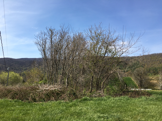
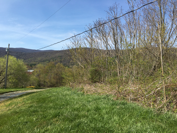
| Description | : | Located about 5.4 miles west of the town of Stanardsville. From that town, go west/northwest on Spotsville Trail / Highway 33, then turn left on Dyke Road / State Rd 810. Turn left on Lexington Way. and follow it up and back down a hairpin curve through the subdivision. The cemetery will be on your right, between Lexington Way street and the driveway for the house of the property owner. It looks like a small grove of trees and bramble bushes, the only non-landscaped area of the lawn. The cemetery space itself is in extremely... Read More |
frequently asked questions (FAQ):
-
Where is Runkle Family Cemetery?
Runkle Family Cemetery is located at Lexington Way Geer, Greene County ,Virginia , 22973USA.
-
Runkle Family Cemetery cemetery's updated grave count on graveviews.com?
0 memorials
-
Where are the coordinates of the Runkle Family Cemetery?
Latitude: 38.2954960
Longitude: -78.5041020
Nearby Cemetories:
1. Desmond Cemetery
Stanardsville, Greene County, USA
Coordinate: 38.2961820, -78.5063230
2. Nicol Family Cemetery
Geer, Greene County, USA
Coordinate: 38.2989490, -78.5062560
3. Blakey Family Cemetery
Dyke, Greene County, USA
Coordinate: 38.2977810, -78.5167240
4. Garth Graveyard
Stanardsville, Greene County, USA
Coordinate: 38.2930150, -78.4891220
5. Shifflett - Slaters Graveyard
Stanardsville, Greene County, USA
Coordinate: 38.3089950, -78.4986280
6. Runkle Graveyard
Stanardsville, Greene County, USA
Coordinate: 38.2934940, -78.4832590
7. Powell Family Cemetery
Stanardsville, Greene County, USA
Coordinate: 38.2807500, -78.4876170
8. Powell Family Cemetery
Stanardsville, Greene County, USA
Coordinate: 38.2797860, -78.4887600
9. Mount Hermon Mennonite Church Cemetery
Stanardsville, Greene County, USA
Coordinate: 38.3156920, -78.5053370
10. Powell Graveyard
Stanardsville, Greene County, USA
Coordinate: 38.2988120, -78.4760930
11. Moyers Graveyard
Stanardsville, Greene County, USA
Coordinate: 38.2862400, -78.4751400
12. Lawson Family Cemetery
Stanardsville, Greene County, USA
Coordinate: 38.2921190, -78.4729960
13. Shifflett Graveyard
Dyke, Greene County, USA
Coordinate: 38.2922750, -78.5353560
14. Mitchell-Davis Family Cemetery
Dyke, Greene County, USA
Coordinate: 38.2716390, -78.5178330
15. Shifflett Graveyard #2
Dyke, Greene County, USA
Coordinate: 38.2763890, -78.5308330
16. Dean Family Cemetery
Stanardsville, Greene County, USA
Coordinate: 38.3156670, -78.4743330
17. Crow Family Graveyard
Stanardsville, Greene County, USA
Coordinate: 38.2760070, -78.4716140
18. Steo Family Cemetery
Stanardsville, Greene County, USA
Coordinate: 38.2672340, -78.4832750
19. High Top Cemetery
Stanardsville, Greene County, USA
Coordinate: 38.3150730, -78.5402860
20. Hamm Family Cemetery
Amicus, Greene County, USA
Coordinate: 38.2608780, -78.4985980
21. Parrott Cemetery
Amicus, Greene County, USA
Coordinate: 38.2607730, -78.4988520
22. Naylor - Dickerson Family Cemetery
Dyke, Greene County, USA
Coordinate: 38.2654740, -78.5282230
23. Huckstep Family Graveyard
Dyke, Greene County, USA
Coordinate: 38.2630730, -78.5283570
24. Smith - Sheler Cemetery
Lydia, Greene County, USA
Coordinate: 38.3325280, -78.4956940