
| Memorials | : | 0 |
| Location | : | Briggs, Burnet County, USA |
| Coordinate | : | 30.8605995, -97.9119034 |
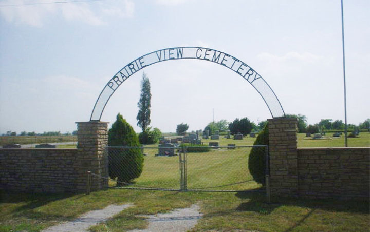
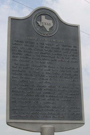
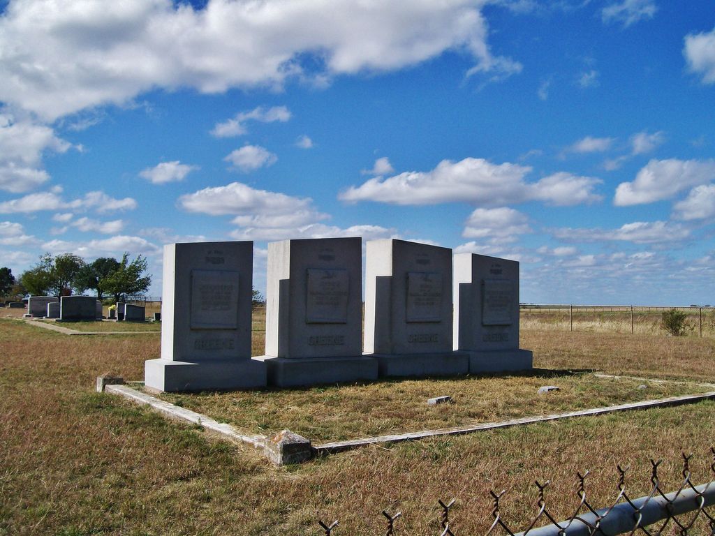
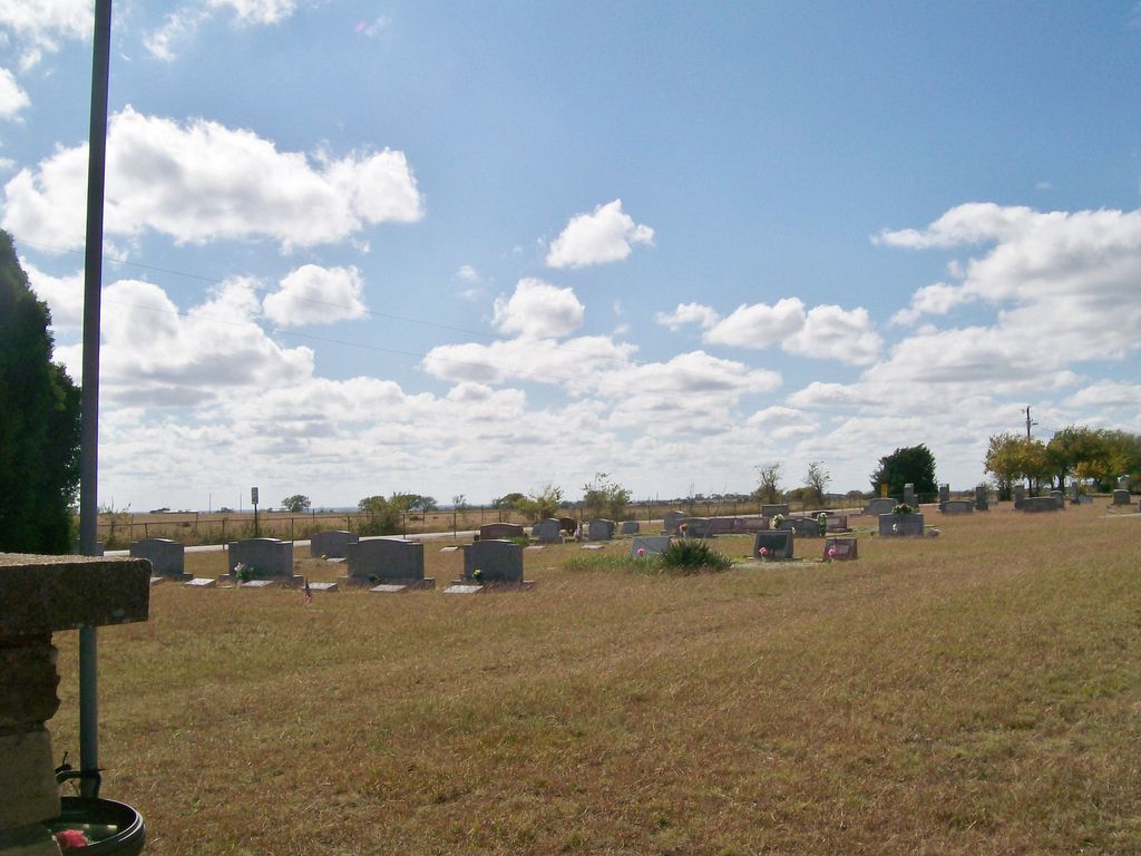
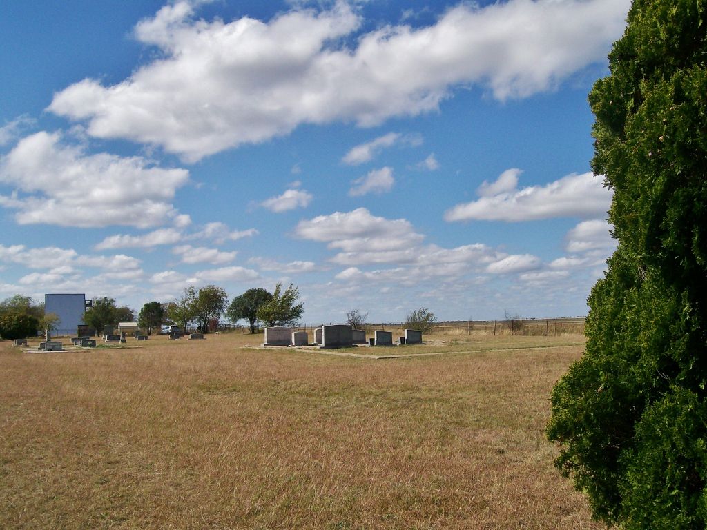
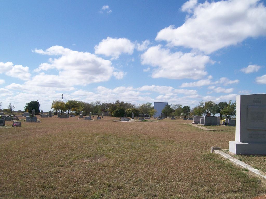
| Description | : | This small rural cemetery has a highway sign. The driveway provides metal signage in an arch over the gate. To the right of the driveway is a Historical Marker, and there are two large cedar trees with brick columns that flank the entrance. A flagpole is located adjacent to the entrance as are four very massive headstones for one family. The headstones are absolutely different from anything normally seen in this area. The cemetery is fenced and is clean. The graves are in nice rows but located across the entire property, yet there is room for future burials.... Read More |
frequently asked questions (FAQ):
-
Where is Prairie View Cemetery?
Prairie View Cemetery is located at C.R. 211 Briggs, Burnet County ,Texas , 78608USA.
-
Prairie View Cemetery cemetery's updated grave count on graveviews.com?
0 memorials
-
Where are the coordinates of the Prairie View Cemetery?
Latitude: 30.8605995
Longitude: -97.9119034
Nearby Cemetories:
1. Mount Moriah Cemetery
Briggs, Burnet County, USA
Coordinate: 30.8846610, -97.9092410
2. DeWolfe-Dillingham Cemetery
Briggs, Burnet County, USA
Coordinate: 30.9011200, -97.9263500
3. Mahomet Cemetery
Mahomet, Burnet County, USA
Coordinate: 30.8155994, -97.9332962
4. Bertram Place Cemetery
Bertram, Burnet County, USA
Coordinate: 30.7906700, -97.9423000
5. Davis Cemetery
Burnet County, USA
Coordinate: 30.9256672, -97.9962158
6. Gillum Cemetery
Oakalla, Burnet County, USA
Coordinate: 30.9627991, -97.9064026
7. Smith Cemetery
Oakalla, Burnet County, USA
Coordinate: 30.9626250, -97.9732940
8. Watson Cemetery
Oakalla, Burnet County, USA
Coordinate: 30.9351400, -98.0159500
9. Bachelor Peak Cemetery
Watson, Burnet County, USA
Coordinate: 30.9419400, -98.0252800
10. Glover Family Cemetery
Bell County, USA
Coordinate: 30.8983480, -97.7638470
11. Tobey Cemetery
Oakalla, Burnet County, USA
Coordinate: 31.0025005, -97.9021988
12. Maxdale Cemetery
Maxdale, Bell County, USA
Coordinate: 30.9867001, -97.8298035
13. Bear Creek Cemetery
Bertram, Burnet County, USA
Coordinate: 30.7625008, -98.0378036
14. McBryde Cemetery
Killeen, Bell County, USA
Coordinate: 30.9648640, -97.7793910
15. Shady Grove Cemetery
Shady Grove, Burnet County, USA
Coordinate: 30.8113995, -98.0821991
16. Ethridge Cemetery
Oakalla, Burnet County, USA
Coordinate: 31.0053005, -97.9772034
17. Strickling Cemetery
Burnet County, USA
Coordinate: 30.8435993, -98.0950012
18. Sharp Cemetery
Killeen, Bell County, USA
Coordinate: 30.9510994, -97.7543030
19. South San Gabriel Cemetery
South San Gabriel, Burnet County, USA
Coordinate: 30.7050400, -98.0246000
20. Boone-Hamlin Cemetery
Youngsport, Bell County, USA
Coordinate: 30.9517120, -97.7179060
21. Calvary Baptist Church Garden of Memories Cemetery
Killeen, Bell County, USA
Coordinate: 31.0042572, -97.7557068
22. Mayberry Cemetery
Bell County, USA
Coordinate: 31.0366993, -97.8078003
23. Cedar Valley Cemetery
Salado, Bell County, USA
Coordinate: 30.9045040, -97.6853150
24. Live Oak Cemetery
Youngsport, Bell County, USA
Coordinate: 30.9834995, -97.7163010