
| Memorials | : | 1 |
| Location | : | Mahomet, Burnet County, USA |
| Coordinate | : | 30.8155994, -97.9332962 |
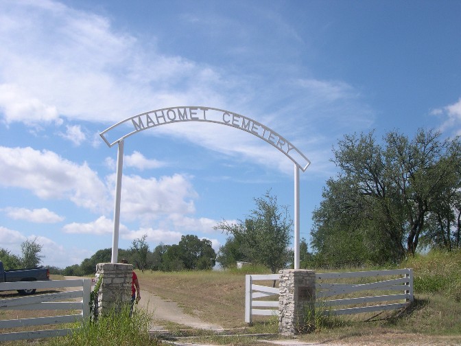
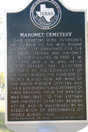
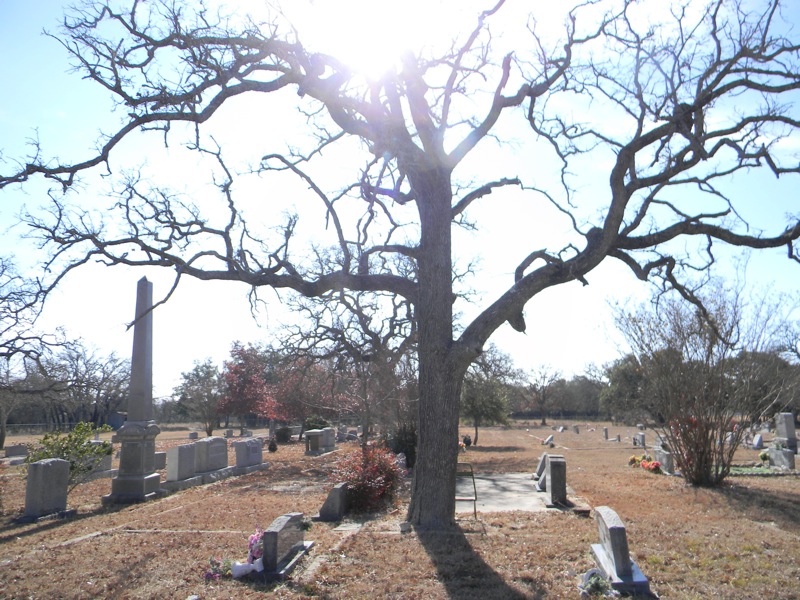
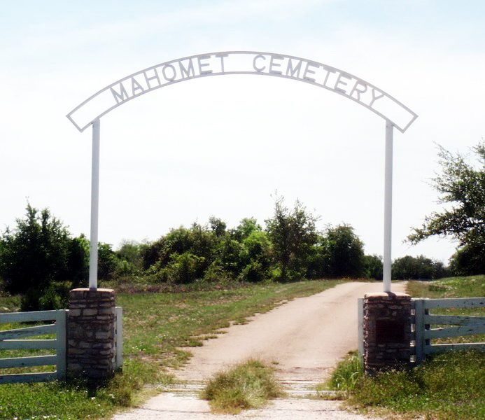
| Description | : | The Mahomet Community is located on Ranch Road 243 about 11 miles N.E. of Bertram and S. of Briggs in Eastern Burnet County almost on the Burnet & Williamson County Line. At one time it was a thriving agricultural community. Mahomet and neighboring Sycamore Springs once had 3 gins, a general store, a school and two churches. Latitude: 30°48'56"N, Longitude: 97°56'00"W. Mahomet Cemetery, with interments dating back to the 1850s, became a community graveyard for the Sycamore Branch and the Mahomet Rural Communities. In 1909 J.W. Williams and J.W. & Nellie Greer deeded the cemetery property to the Community of Mahomet.... Read More |
frequently asked questions (FAQ):
-
Where is Mahomet Cemetery?
Mahomet Cemetery is located at Mahomet, Burnet County ,Texas ,USA.
-
Mahomet Cemetery cemetery's updated grave count on graveviews.com?
1 memorials
-
Where are the coordinates of the Mahomet Cemetery?
Latitude: 30.8155994
Longitude: -97.9332962
Nearby Cemetories:
1. Bertram Place Cemetery
Bertram, Burnet County, USA
Coordinate: 30.7906700, -97.9423000
2. Prairie View Cemetery
Briggs, Burnet County, USA
Coordinate: 30.8605995, -97.9119034
3. Mount Moriah Cemetery
Briggs, Burnet County, USA
Coordinate: 30.8846610, -97.9092410
4. DeWolfe-Dillingham Cemetery
Briggs, Burnet County, USA
Coordinate: 30.9011200, -97.9263500
5. Bear Creek Cemetery
Bertram, Burnet County, USA
Coordinate: 30.7625008, -98.0378036
6. Davis Cemetery
Burnet County, USA
Coordinate: 30.9256672, -97.9962158
7. Shady Grove Cemetery
Shady Grove, Burnet County, USA
Coordinate: 30.8113995, -98.0821991
8. South San Gabriel Cemetery
South San Gabriel, Burnet County, USA
Coordinate: 30.7050400, -98.0246000
9. Watson Cemetery
Oakalla, Burnet County, USA
Coordinate: 30.9351400, -98.0159500
10. Strickling Cemetery
Burnet County, USA
Coordinate: 30.8435993, -98.0950012
11. Bachelor Peak Cemetery
Watson, Burnet County, USA
Coordinate: 30.9419400, -98.0252800
12. Gillum Cemetery
Oakalla, Burnet County, USA
Coordinate: 30.9627991, -97.9064026
13. Smith Cemetery
Oakalla, Burnet County, USA
Coordinate: 30.9626250, -97.9732940
14. Glover Family Cemetery
Bell County, USA
Coordinate: 30.8983480, -97.7638470
15. Oatmeal Cemetery
Oatmeal, Burnet County, USA
Coordinate: 30.6964910, -98.0820880
16. Mount Zion Cemetery
Burnet County, USA
Coordinate: 30.7275009, -98.1113968
17. Tobey Cemetery
Oakalla, Burnet County, USA
Coordinate: 31.0025005, -97.9021988
18. Maxdale Cemetery
Maxdale, Bell County, USA
Coordinate: 30.9867001, -97.8298035
19. Ethridge Cemetery
Oakalla, Burnet County, USA
Coordinate: 31.0053005, -97.9772034
20. McBryde Cemetery
Killeen, Bell County, USA
Coordinate: 30.9648640, -97.7793910
21. Bethel Cemetery
Burnet, Burnet County, USA
Coordinate: 30.8575001, -98.1628036
22. Sharp Cemetery
Killeen, Bell County, USA
Coordinate: 30.9510994, -97.7543030
23. Pleasant Hill Cemetery
Lake Victor, Burnet County, USA
Coordinate: 30.8705997, -98.1753006
24. Boone-Hamlin Cemetery
Youngsport, Bell County, USA
Coordinate: 30.9517120, -97.7179060