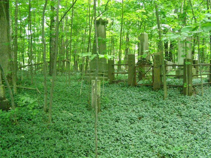
| Memorials | : | 0 |
| Location | : | Craryville, Columbia County, USA |
| Coordinate | : | 42.1884499, -73.5756226 |
| Description | : | West End Road |
frequently asked questions (FAQ):
-
Where is Presbyterian Church Cemetery?
Presbyterian Church Cemetery is located at West End Road Craryville, Columbia County ,New York ,USA.
-
Presbyterian Church Cemetery cemetery's updated grave count on graveviews.com?
0 memorials
-
Where are the coordinates of the Presbyterian Church Cemetery?
Latitude: 42.1884499
Longitude: -73.5756226
Nearby Cemetories:
1. West Hillsdale Baptist Cemetery
Hillsdale, Columbia County, USA
Coordinate: 42.1819801, -73.5800171
2. North Copake Cemetery
Craryville, Columbia County, USA
Coordinate: 42.1758003, -73.5935974
3. McAlpine Farm Cemetery
Hillsdale, Columbia County, USA
Coordinate: 42.2145850, -73.5363380
4. Foleys Corners Cemetery
Hillsdale, Columbia County, USA
Coordinate: 42.2163930, -73.5372720
5. Methodist Church Foster Cemetery
Hillsdale, Columbia County, USA
Coordinate: 42.1820717, -73.5217133
6. Old Community Cemetery
Hillsdale, Columbia County, USA
Coordinate: 42.1849022, -73.5190506
7. Hillsdale Rural Cemetery
Hillsdale, Columbia County, USA
Coordinate: 42.1854782, -73.5142365
8. Martindale Cemetery
Martindale, Columbia County, USA
Coordinate: 42.2075691, -73.6330109
9. Collins Cemetery
Hillsdale, Columbia County, USA
Coordinate: 42.2139015, -73.5224991
10. Krum Church Cemetery
Hillsdale, Columbia County, USA
Coordinate: 42.2449989, -73.5932999
11. Old Williams Cemetery
Hillsdale, Columbia County, USA
Coordinate: 42.1455994, -73.5066986
12. Petit Farm Cemetery
North Hillsdale, Columbia County, USA
Coordinate: 42.2449937, -73.5223278
13. Methodist Episcopal Churchyard Cemetery
North Hillsdale, Columbia County, USA
Coordinate: 42.2383804, -73.5077515
14. Van Deusen Cemetery
Hollowville, Columbia County, USA
Coordinate: 42.1973000, -73.6743000
15. Sacred Heart Catholic Cemetery
Philmont, Columbia County, USA
Coordinate: 42.2505989, -73.6350021
16. Harlemville German Cemetery
Harlemville, Columbia County, USA
Coordinate: 42.2655258, -73.5838699
17. Saint Johns Cemetery
Copake Falls, Columbia County, USA
Coordinate: 42.1219450, -73.5221800
18. Saint Bridgets Cemetery
Copake Falls, Columbia County, USA
Coordinate: 42.1175700, -73.5289500
19. Church of Saint John in the Wilderness Cemetery
Columbia County, USA
Coordinate: 42.1207390, -73.5180511
20. West Copake Cemetery
West Copake, Columbia County, USA
Coordinate: 42.1088880, -73.5919440
21. Knapp Farm Cemetery
Harlemville, Columbia County, USA
Coordinate: 42.2686000, -73.5631000
22. Harlemville Rural Cemetery
Harlemville, Columbia County, USA
Coordinate: 42.2710991, -73.5847015
23. E and M Cemetery
Copake, Columbia County, USA
Coordinate: 42.1044341, -73.5508333
24. School House Hill Cemetery
Spencertown, Columbia County, USA
Coordinate: 42.2732201, -73.5454407

