
| Memorials | : | 0 |
| Location | : | Tolona, Lewis County, USA |
| Coordinate | : | 40.0269600, -91.7678800 |
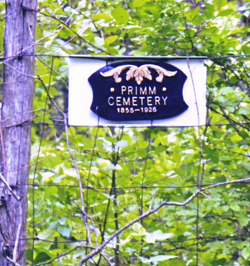
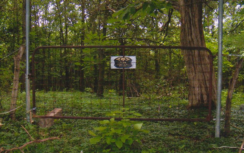
| Description | : | Sign is installed on Gate West of Ewing Missouri 3.2 miles on "260th Street" NW of Ewing on Hwy 6. Accessible from Farm at mailbox 151, north of 260th Street. The owners of the adjoining farm are very cooperative. The cemetery is back north in the field 1/4 mile, west to edge of timber along abandoned section line road. Last burial Joseph Samuel 1927 from Missouri death certificate now available online. This date not engraved on the tombstone. The Lewis County people who did the cemetery survey did a marvelously accurate job. This is a Pioneer Cemetery dating from burials in... Read More |
frequently asked questions (FAQ):
-
Where is Primm Cemetery?
Primm Cemetery is located at Tolona, Lewis County ,Missouri ,USA.
-
Primm Cemetery cemetery's updated grave count on graveviews.com?
0 memorials
-
Where are the coordinates of the Primm Cemetery?
Latitude: 40.0269600
Longitude: -91.7678800
Nearby Cemetories:
1. Tolona Cemetery
Lewis County, USA
Coordinate: 40.0358600, -91.7393300
2. Crain Family Farm Cemetery
Highland Township, Lewis County, USA
Coordinate: 40.0493010, -91.7568180
3. Mount Olivet Cemetery
Ewing, Lewis County, USA
Coordinate: 39.9914300, -91.7871100
4. German Lutheran Cemetery
Ewing, Lewis County, USA
Coordinate: 40.0100000, -91.7205556
5. Ewing Memorial Cemetery
Ewing, Lewis County, USA
Coordinate: 40.0094210, -91.7202510
6. Queen of Peace Cemetery
Ewing, Lewis County, USA
Coordinate: 40.0089600, -91.7194300
7. Bangert Cemetery
Lewis County, USA
Coordinate: 40.0694008, -91.7418976
8. Cason Cemetery
Lewis County, USA
Coordinate: 40.0346985, -91.6956024
9. Waggener Cemetery
Lewis County, USA
Coordinate: 39.9806713, -91.7252778
10. Shackleford Cemetery
Lewis County, USA
Coordinate: 39.9867200, -91.7158000
11. Briscoe Cemetery
Ewing, Lewis County, USA
Coordinate: 40.0074997, -91.6889038
12. Cool Spring Cemetery
Lewis County, USA
Coordinate: 40.0256004, -91.6810989
13. Gilead Cemetery
Ewing, Lewis County, USA
Coordinate: 40.0194600, -91.6778400
14. Lewistown Cemetery
Lewistown, Lewis County, USA
Coordinate: 40.0904390, -91.8138960
15. Nall Cemetery
Monticello, Lewis County, USA
Coordinate: 40.0717010, -91.6908035
16. Ewalt Cemetery
Dickerson Township, Lewis County, USA
Coordinate: 40.1046810, -91.7636490
17. Durham Cemetery
Durham, Lewis County, USA
Coordinate: 39.9802300, -91.6670200
18. Peak Cemetery
Naomi, Marion County, USA
Coordinate: 39.9427300, -91.7096700
19. Mount Sinai Cemetery
Naomi, Marion County, USA
Coordinate: 39.9436300, -91.7074800
20. Finley Cemetery
Lewis County, USA
Coordinate: 40.0900002, -91.6678009
21. Mount Pleasant Cemetery
Steffenville, Lewis County, USA
Coordinate: 39.9524400, -91.8549500
22. Nelsonville Baptist Church Cemetery
Nelsonville, Marion County, USA
Coordinate: 39.9283900, -91.7960500
23. Asbury Chapel Cemetery
Steffenville, Lewis County, USA
Coordinate: 39.9490900, -91.8518300
24. Garnett Cemetery
Lewis County, USA
Coordinate: 40.0886002, -91.6631012