
| Memorials | : | 0 |
| Location | : | Hope, Osage County, USA |
| Coordinate | : | 38.3021050, -91.4041480 |
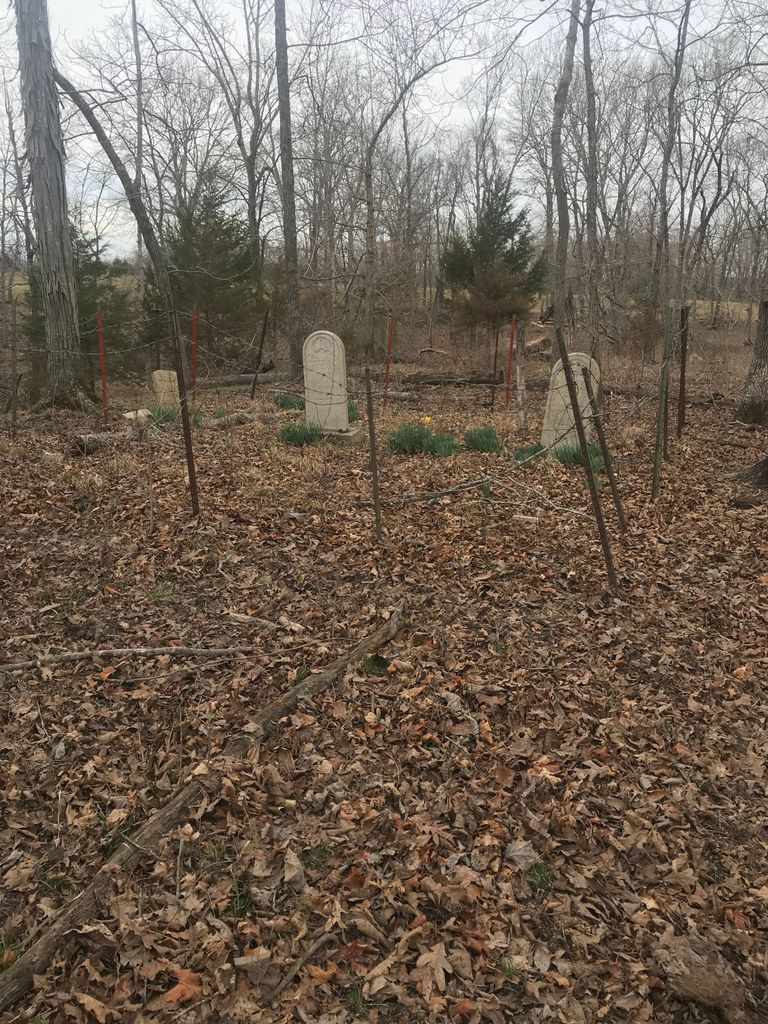
| Description | : | Discovery of the Prior Cemetery leaves more questions unanswered than answered. Located at the edge of a drainage ditch which flows into the Gasconade River are members of the family who operated the only known mill in the Mount Sterling area. Since the area was not covered by newspapers at the time and the census records lack authentication of oral history, the names of other mentioned family members are either buried in an unknown cemetery or in this one in non-monumented graves. The Osage County, MO, Historical Society has a short history of the Mill. |
frequently asked questions (FAQ):
-
Where is Prior Cemetery?
Prior Cemetery is located at At the end of County Road 221 Hope, Osage County ,Missouri , 65062USA.
-
Prior Cemetery cemetery's updated grave count on graveviews.com?
0 memorials
-
Where are the coordinates of the Prior Cemetery?
Latitude: 38.3021050
Longitude: -91.4041480
Nearby Cemetories:
1. Salem Cemetery
Gasconade County, USA
Coordinate: 38.3161011, -91.4119034
2. Red Brick Church Cemetery
Gerald, Franklin County, USA
Coordinate: 38.3100930, -91.3491800
3. Hinton Cemetery
Rosebud, Gasconade County, USA
Coordinate: 38.3460999, -91.4002991
4. Bohemian Catholic Cemetery
Owensville, Gasconade County, USA
Coordinate: 38.3122978, -91.4628983
5. Red Oak Cemetery
Gasconade County, USA
Coordinate: 38.3499985, -91.3822174
6. Plummer Farm Cemetery
Owensville, Gasconade County, USA
Coordinate: 38.3279900, -91.4644400
7. Lockhart Cemetery
Franklin County, USA
Coordinate: 38.2619019, -91.3550034
8. Ruwwe Cemetery
Gasconade County, USA
Coordinate: 38.2430992, -91.3792038
9. New Friendship Baptist Church Cemetery
Gerald, Franklin County, USA
Coordinate: 38.3298790, -91.3275870
10. Immaculate Conception Cemetery
Owensville, Gasconade County, USA
Coordinate: 38.3203011, -91.4891968
11. Saint Johns United Church of Christ Cemetery
Bem, Gasconade County, USA
Coordinate: 38.2524310, -91.4722280
12. Burchard Cemetery
Gasconade County, USA
Coordinate: 38.2681007, -91.4863968
13. Old Japan Cemetery
Franklin County, USA
Coordinate: 38.2494011, -91.3396988
14. Ficke-McCallister Cemetery
Franklin County, USA
Coordinate: 38.3177986, -91.3118973
15. Morris Cemetery
Gasconade County, USA
Coordinate: 38.2360992, -91.4483032
16. Old Holy Martyrs Cemetery
Japan, Franklin County, USA
Coordinate: 38.2615377, -91.3206522
17. Owensville City Cemetery
Owensville, Gasconade County, USA
Coordinate: 38.3400500, -91.4954840
18. Schannon Cemetery
Gasconade County, USA
Coordinate: 38.2289009, -91.4494019
19. Miller Cemetery
Gasconade County, USA
Coordinate: 38.2336006, -91.4644012
20. Leach Cemetery
Owensville, Gasconade County, USA
Coordinate: 38.3614006, -91.4792023
21. Immanuel Cemetery
Rosebud, Gasconade County, USA
Coordinate: 38.3869019, -91.4064026
22. Martin Cemetery
Franklin County, USA
Coordinate: 38.2350006, -91.3375015
23. Saint Peters Cemetery
Owensville, Gasconade County, USA
Coordinate: 38.3572006, -91.4931030
24. Methodist Cemetery
Rosebud, Gasconade County, USA
Coordinate: 38.3917660, -91.3999690