
| Memorials | : | 45 |
| Location | : | Whalley, Ribble Valley Borough, England |
| Coordinate | : | 53.8337490, -2.4127930 |
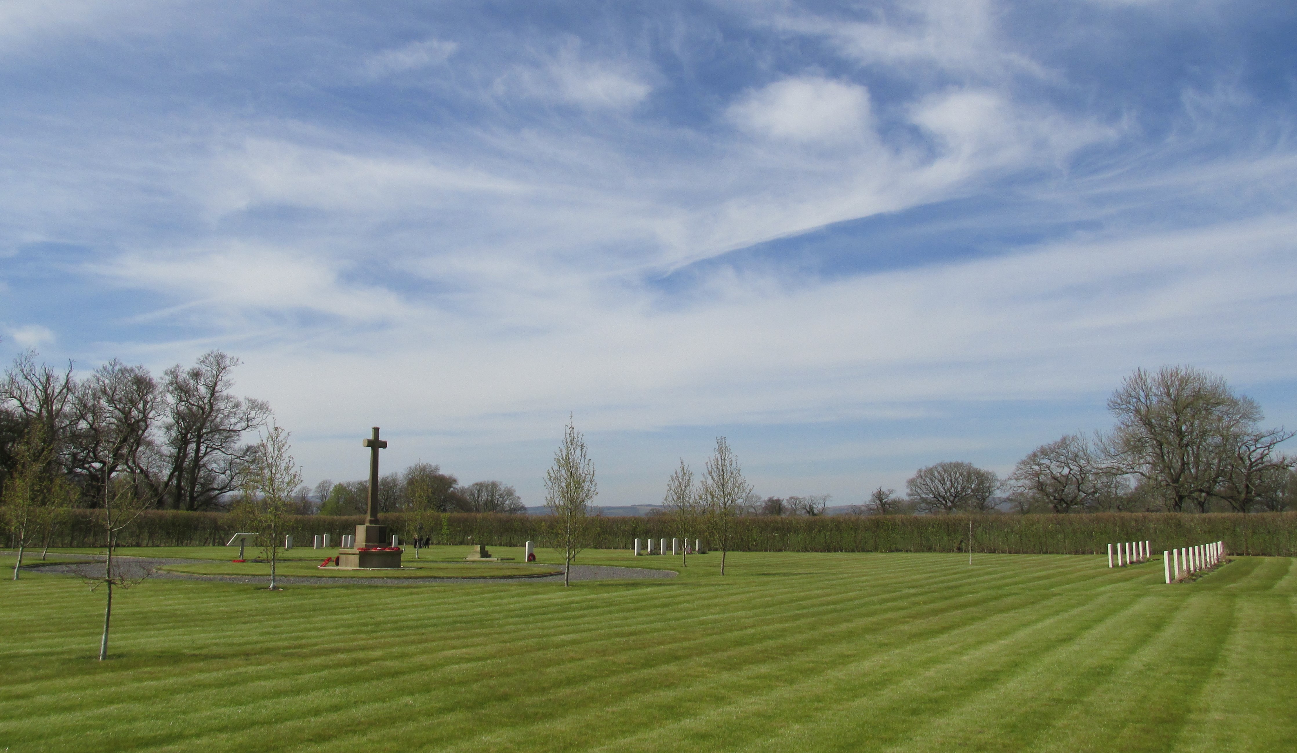
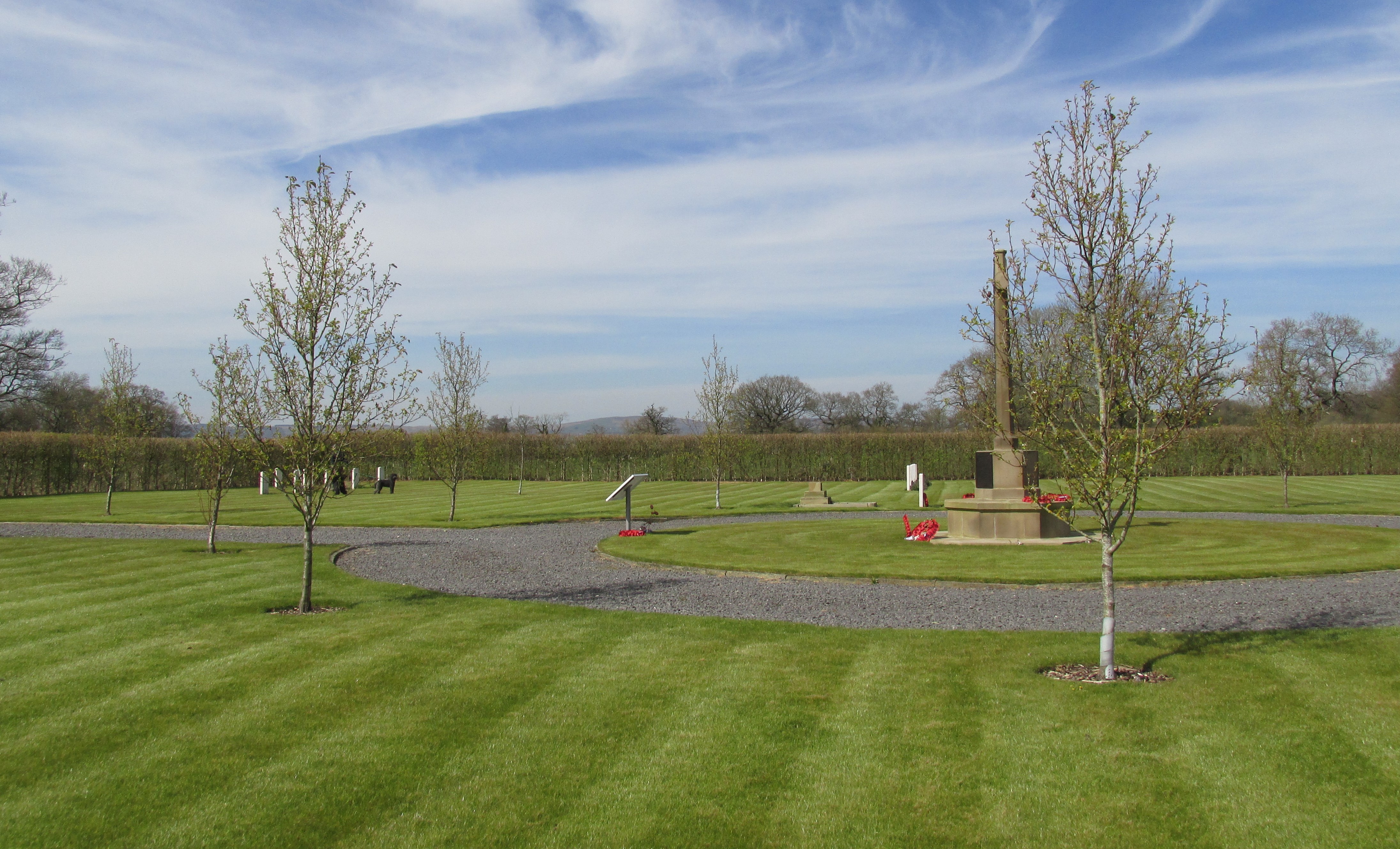
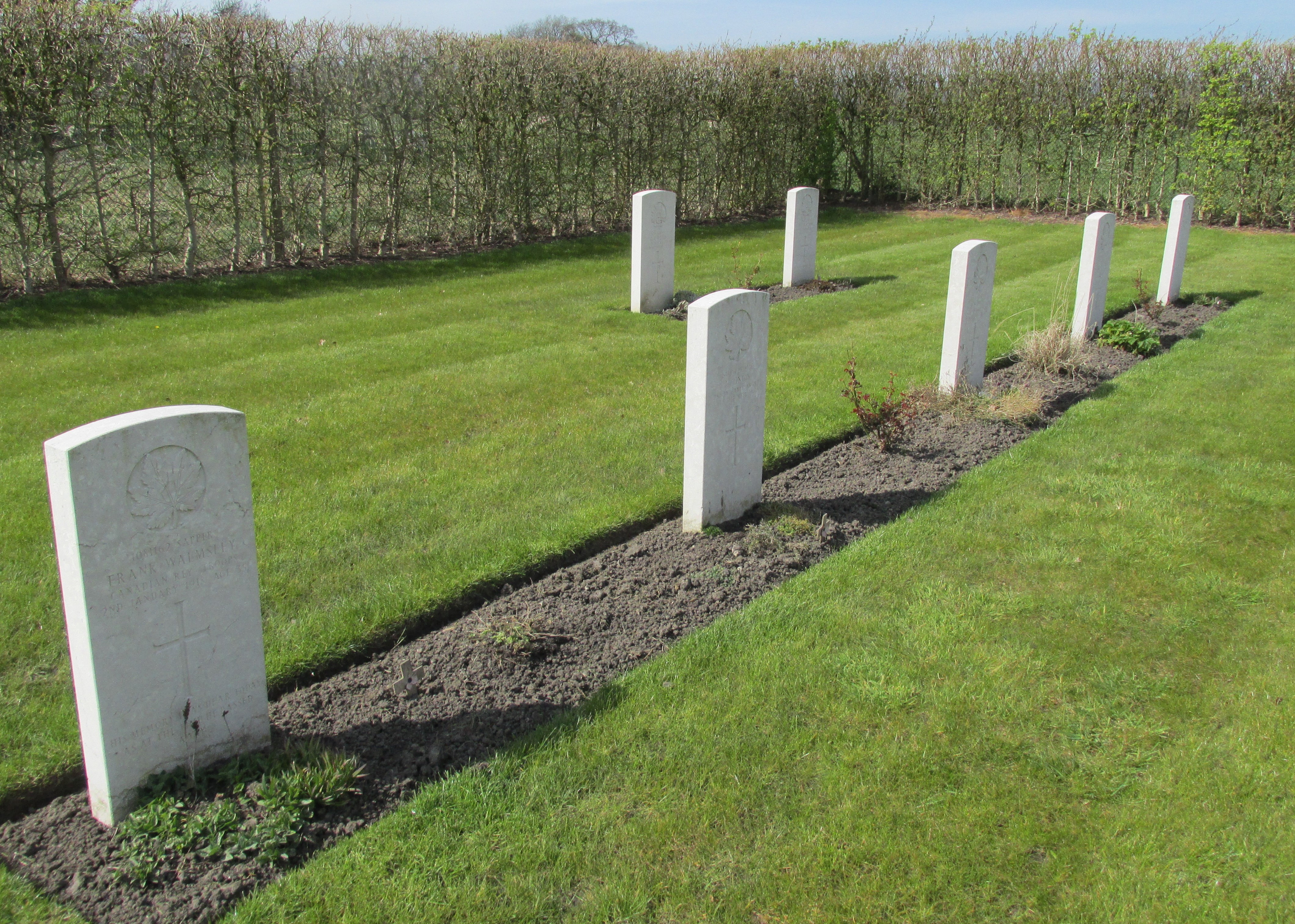
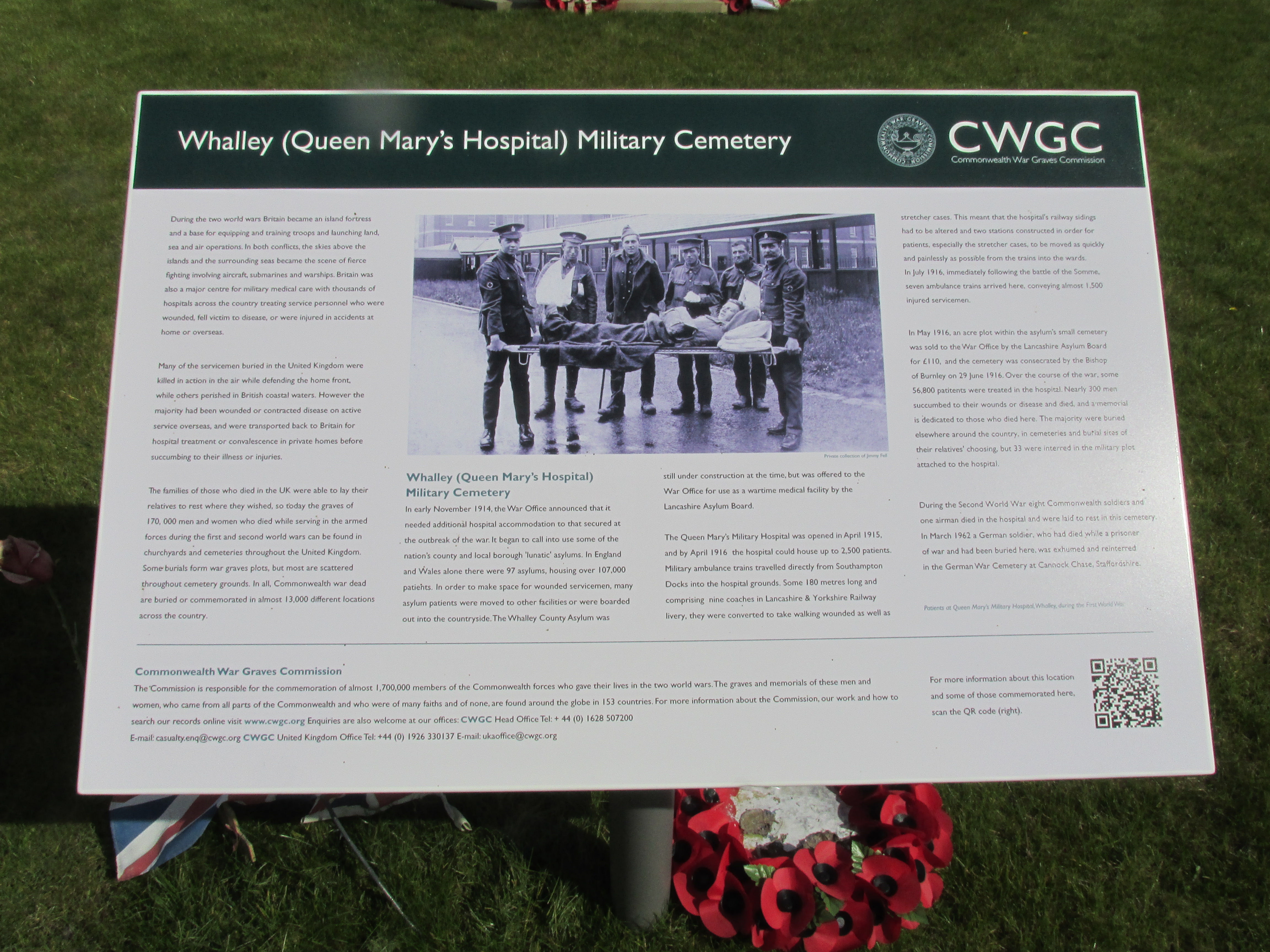
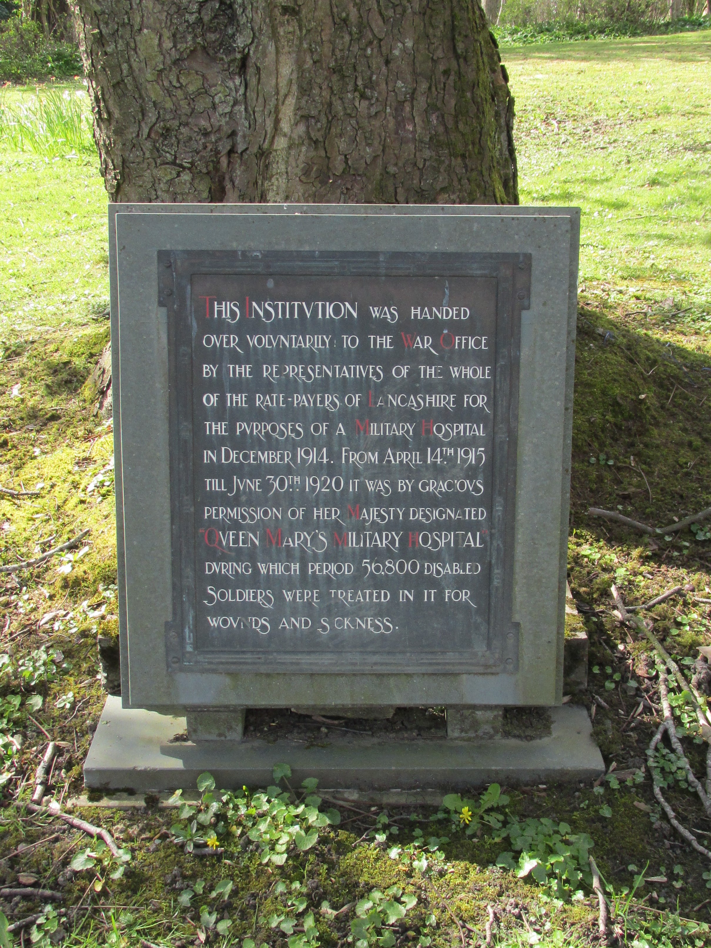
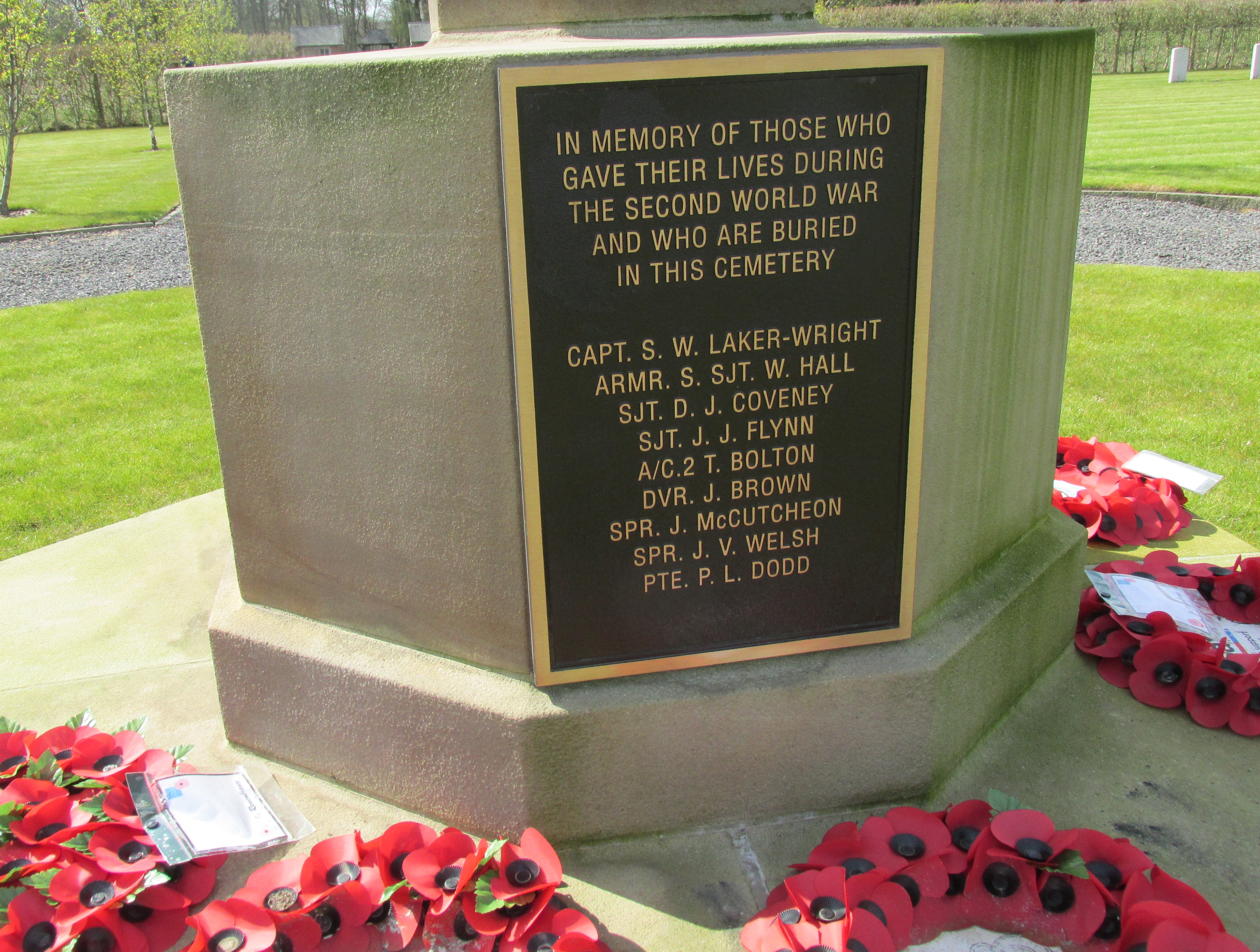
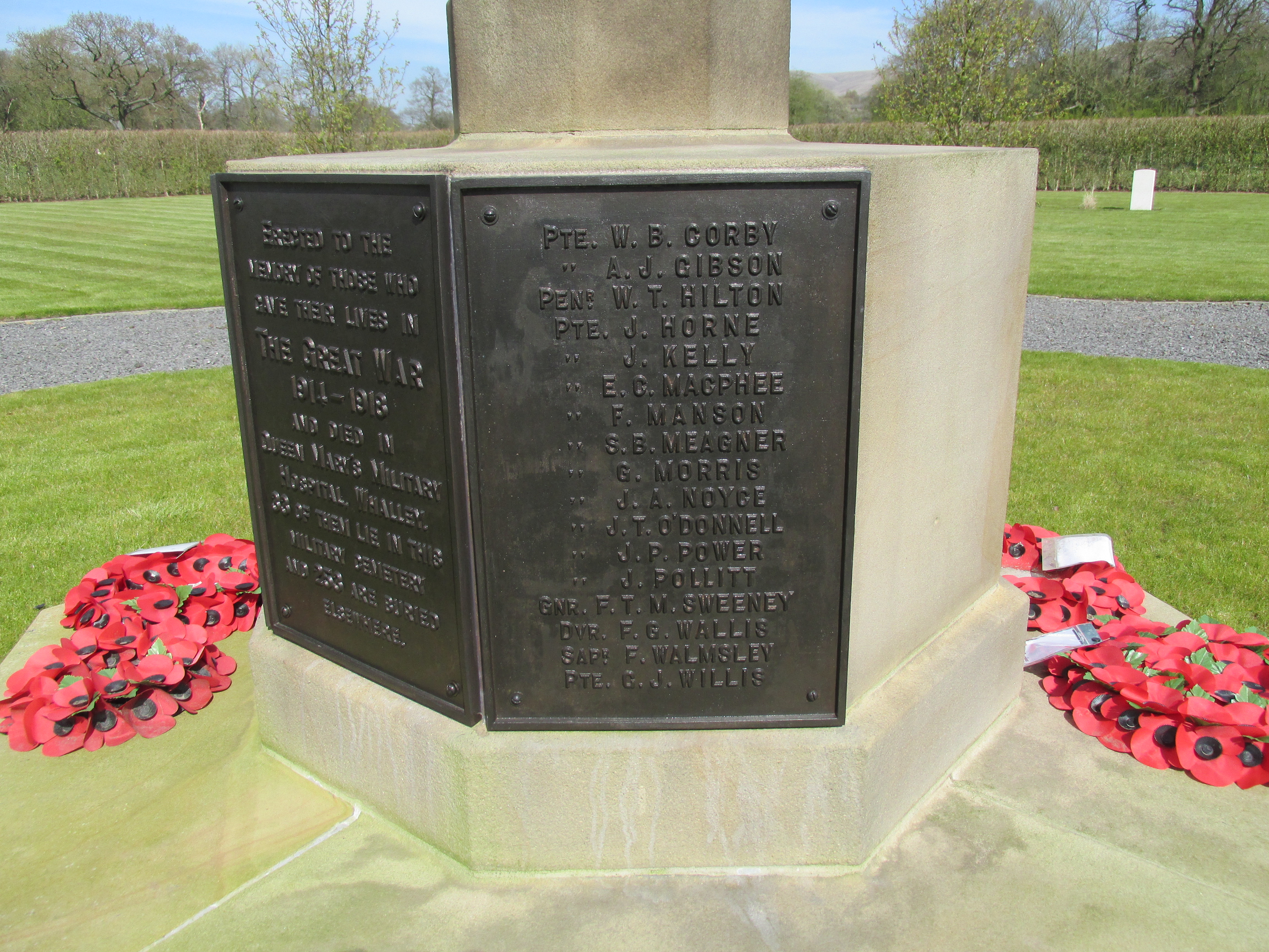
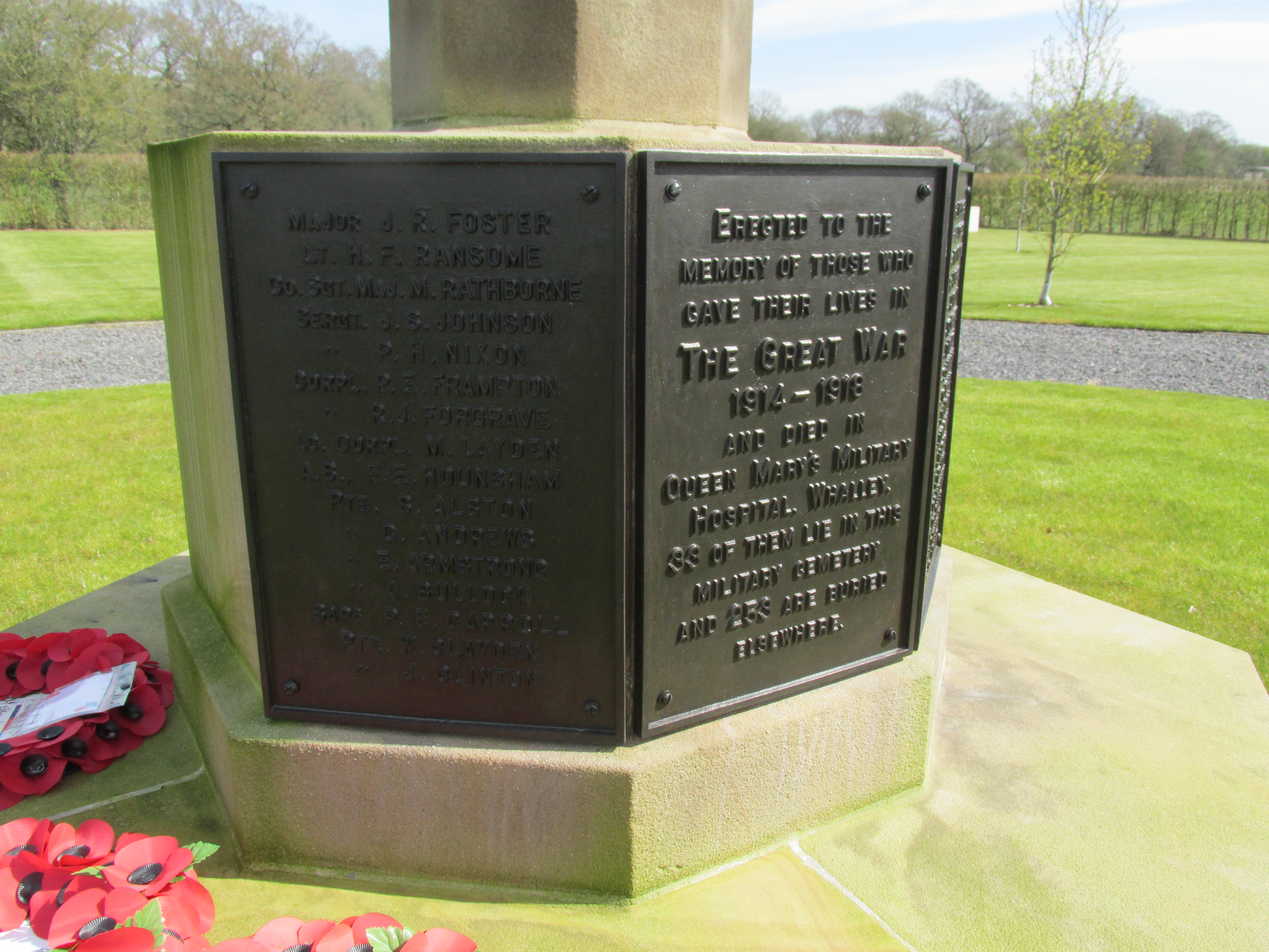
| Description | : | From Whalley village take the Mitton road, B6346, towards Mitton. Pass under railway bridge and continue on main road over two mini roundabouts, and the cemetery is on the right hand side about 200 metres after the last roundabout. Access is through large iron gates through the private cemetery. Access to this cemetery is via Ribble Valley Remembrance Park, a private cemetery which the owner plans to open during normal office hours and at weekends. The office at the cemetery can be contacted on 01695 732908 for further details. During the First World War, the 2,000 bed Queen Mary's Military Hospital... Read More |
frequently asked questions (FAQ):
-
Where is Queen Mary's Military Hospital Cemetery?
Queen Mary's Military Hospital Cemetery is located at Mitton Road Whalley, Ribble Valley Borough ,Lancashire , BB7 9YEEngland.
-
Queen Mary's Military Hospital Cemetery cemetery's updated grave count on graveviews.com?
2 memorials
-
Where are the coordinates of the Queen Mary's Military Hospital Cemetery?
Latitude: 53.8337490
Longitude: -2.4127930
Nearby Cemetories:
1. Calderstones Hospital Cemetery
Whalley, Ribble Valley Borough, England
Coordinate: 53.8338710, -2.4147160
2. Whalley, Wiswell and Barrow Cemetery
Whalley, Ribble Valley Borough, England
Coordinate: 53.8308490, -2.4057280
3. Saint Mary and All Saints Churchyard
Whalley, Ribble Valley Borough, England
Coordinate: 53.8211890, -2.4078080
4. All Hallows Churchyard
Great Mitton, Ribble Valley Borough, England
Coordinate: 53.8461500, -2.4339000
5. Brockhall Hospital Cemetery
Brockhall Village, Ribble Valley Borough, England
Coordinate: 53.8186850, -2.4560220
6. St. Leonard Old Churchyard
Langho, Ribble Valley Borough, England
Coordinate: 53.8178590, -2.4552870
7. St James Churchyard
Clitheroe, Ribble Valley Borough, England
Coordinate: 53.8659600, -2.3922700
8. Trinity Methodist Churchyard
Clitheroe, Ribble Valley Borough, England
Coordinate: 53.8709060, -2.3954550
9. St. John's Churchyard
Read, Ribble Valley Borough, England
Coordinate: 53.8088800, -2.3585600
10. St. Joseph Roman Catholic Churchyard
Hurst Green, Ribble Valley Borough, England
Coordinate: 53.8409900, -2.4820600
11. St Mary Magdalene Churchyard
Clitheroe, Ribble Valley Borough, England
Coordinate: 53.8740980, -2.3903420
12. Stonyhurst College Burial Ground
Hurst Green, Ribble Valley Borough, England
Coordinate: 53.8403420, -2.4840310
13. St John the Evangelist Churchyard
Hurst Green, Ribble Valley Borough, England
Coordinate: 53.8358000, -2.4852530
14. St. Bartholomew's Churchyard
Great Harwood, Hyndburn Borough, England
Coordinate: 53.7900670, -2.4055460
15. St. Joseph's Roman Catholic Cemetery
Clitheroe, Ribble Valley Borough, England
Coordinate: 53.8770700, -2.3960000
16. Clitheroe Cemetery
Clitheroe, Ribble Valley Borough, England
Coordinate: 53.8779250, -2.3984550
17. Saint Nicholas Parish Churchyard
Sabden, Ribble Valley Borough, England
Coordinate: 53.8346503, -2.3332764
18. Our Lady and Saint Hubert
Great Harwood, Hyndburn Borough, England
Coordinate: 53.7851070, -2.4009760
19. Great Harwood Cemetery
Great Harwood, Hyndburn Borough, England
Coordinate: 53.7796190, -2.4091680
20. St Helen Churchyard
Waddington, Ribble Valley Borough, England
Coordinate: 53.8898700, -2.4143900
21. St James Church
Altham, Hyndburn Borough, England
Coordinate: 53.7928940, -2.3465250
22. St Marys Burial Ground
Clayton-le-Moors, Hyndburn Borough, England
Coordinate: 53.7792778, -2.3705871
23. St Peter Churchyard
Salesbury, Ribble Valley Borough, England
Coordinate: 53.7915000, -2.4859100
24. Barnes Square Weslyan Methodist Churchyard
Clayton-le-Moors, Hyndburn Borough, England
Coordinate: 53.7744350, -2.3853800