
| Memorials | : | 9 |
| Location | : | Clayton-le-Moors, Hyndburn Borough, England |
| Coordinate | : | 53.7792778, -2.3705871 |
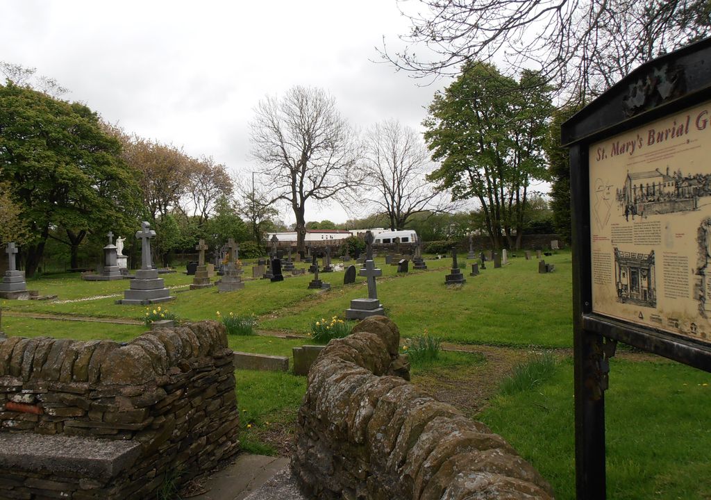
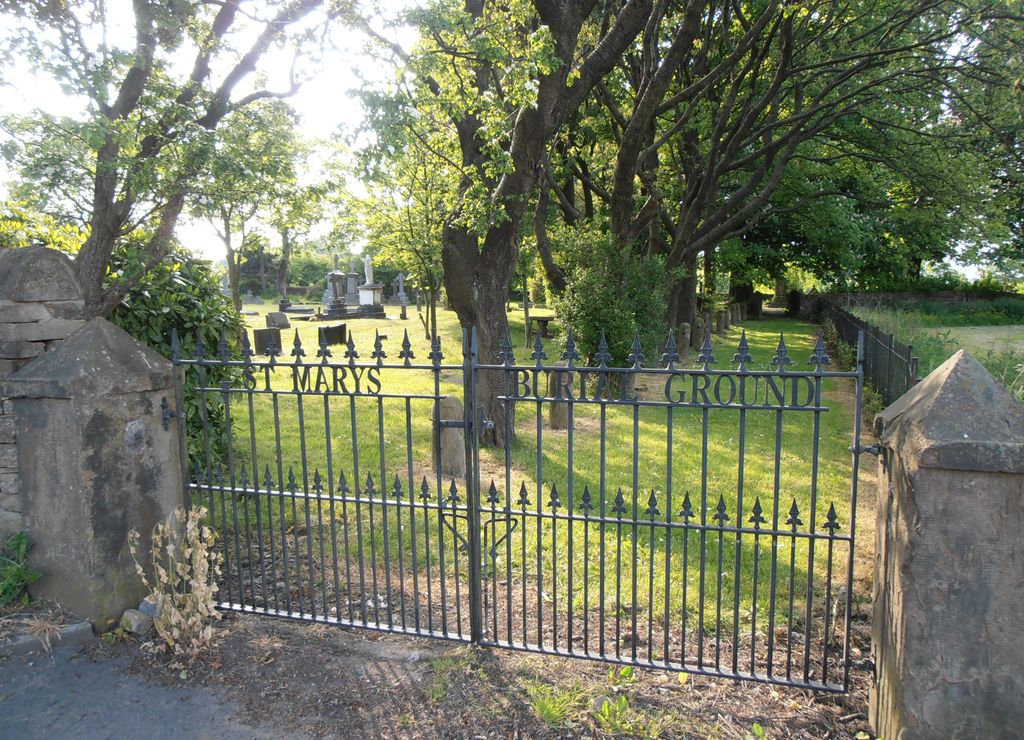
| Description | : | The burial ground of St.Mary's Roman Catholic Church - Clayton-le-Moors (Dunkenhalgh Chapel) is located in what is currently Altham, on the main road (A678) near the canal bridge. Clayton-le-Moors was formerly part of Altham parish. Inscriptions found at the Colne Library date from 1788 to 1973. Today, St. Mary's Roman Catholic Church is located on Devonshire Drive in Dunkenhalgh, 2.5 km west from the old burial ground. |
frequently asked questions (FAQ):
-
Where is St Marys Burial Ground?
St Marys Burial Ground is located at Clayton-le-Moors, Hyndburn Borough ,Lancashire ,England.
-
St Marys Burial Ground cemetery's updated grave count on graveviews.com?
9 memorials
-
Where are the coordinates of the St Marys Burial Ground?
Latitude: 53.7792778
Longitude: -2.3705871
Nearby Cemetories:
1. Barnes Square Weslyan Methodist Churchyard
Clayton-le-Moors, Hyndburn Borough, England
Coordinate: 53.7744350, -2.3853800
2. All Saints Churchyard
Clayton-le-Moors, Hyndburn Borough, England
Coordinate: 53.7738520, -2.3881690
3. Church and Clayton-le-Moors Cemetery
Accrington, Hyndburn Borough, England
Coordinate: 53.7630200, -2.3804820
4. Our Lady and Saint Hubert
Great Harwood, Hyndburn Borough, England
Coordinate: 53.7851070, -2.4009760
5. St James Church
Altham, Hyndburn Borough, England
Coordinate: 53.7928940, -2.3465250
6. Accrington Cemetery and Crematorium
Accrington, Hyndburn Borough, England
Coordinate: 53.7623787, -2.3508649
7. Great Harwood Cemetery
Great Harwood, Hyndburn Borough, England
Coordinate: 53.7796190, -2.4091680
8. St. Bartholomew's Churchyard
Great Harwood, Hyndburn Borough, England
Coordinate: 53.7900670, -2.4055460
9. St James Churchyard
Church, Hyndburn Borough, England
Coordinate: 53.7574640, -2.3942660
10. St. James' Parish Church
Accrington, Hyndburn Borough, England
Coordinate: 53.7519900, -2.3652600
11. St. John's Churchyard
Read, Ribble Valley Borough, England
Coordinate: 53.8088800, -2.3585600
12. St Margaret Churchyard
Hapton, Burnley Borough, England
Coordinate: 53.7802400, -2.3169230
13. Christ Church Churchyard
Accrington, Hyndburn Borough, England
Coordinate: 53.7478560, -2.3605820
14. St Leonard Churchyard Extension
Padiham, Burnley Borough, England
Coordinate: 53.7991800, -2.3222000
15. St. John's Cemetery
Padiham, Burnley Borough, England
Coordinate: 53.7948720, -2.3145290
16. Wesleyan Methodist Chapel Chapelyard
Padiham, Burnley Borough, England
Coordinate: 53.8018980, -2.3181730
17. St. Leonard's Churchyard
Padiham, Burnley Borough, England
Coordinate: 53.8022600, -2.3164300
18. New Lane Baptist Chapel Chapelyard
Oswaldwistle, Hyndburn Borough, England
Coordinate: 53.7381100, -2.4049500
19. St. John the Baptist Churchyard
Baxenden, Hyndburn Borough, England
Coordinate: 53.7346500, -2.3470230
20. Saint Mary and All Saints Churchyard
Whalley, Ribble Valley Borough, England
Coordinate: 53.8211890, -2.4078080
21. Immanuel Churchyard
Oswaldwistle, Hyndburn Borough, England
Coordinate: 53.7358300, -2.4056200
22. All Saints Churchyard
Habergham Eaves, Burnley Borough, England
Coordinate: 53.7971060, -2.2913770
23. Burnley Cemetery
Burnley, Burnley Borough, England
Coordinate: 53.7821730, -2.2795070
24. Burnley Crematorium
Burnley, Burnley Borough, England
Coordinate: 53.7821730, -2.2795070