
| Memorials | : | 0 |
| Location | : | Rackeby, Lidköpings kommun, Sweden |
| Phone | : | +46(510)484080 |
| Website | : | www.svenskakyrkan.se/sunnersberg/rackeby-kyrka |
| Coordinate | : | 58.5724700, 13.0354620 |
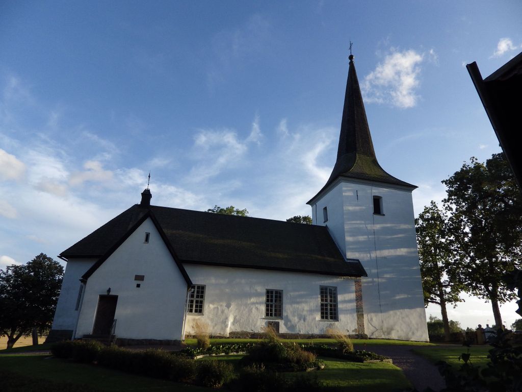
| Description | : | The original church was built in the 12th century from hewn sandstone in a rectangular nave with a small chancel and apse. From the beginning, the church had a flat wooden roof inside, but during the latter part of the Middle Ages, the church was vaulted in connection with the walls being given a brick extension. Traces of this can be seen on sloping stones on the west gable and the north wall. Parish magazine from the 17th century next to the church. |
frequently asked questions (FAQ):
-
Where is Rackeby Cemetery?
Rackeby Cemetery is located at Rackeby,Lidköping Rackeby, Lidköpings kommun ,Västra Götalands län , 531 98Sweden.
-
Rackeby Cemetery cemetery's updated grave count on graveviews.com?
0 memorials
-
Where are the coordinates of the Rackeby Cemetery?
Latitude: 58.5724700
Longitude: 13.0354620
Nearby Cemetories:
1. Strö Kyrka
Stro, Lidköpings kommun, Sweden
Coordinate: 58.5808360, 13.0729080
2. Skalunda Cemetery
Skalunda, Lidköpings kommun, Sweden
Coordinate: 58.5510150, 13.0075490
3. Lidköping Norra Begravningsplatsen
Lidkoping, Lidköpings kommun, Sweden
Coordinate: 58.4986490, 13.1585150
4. Norra Kedum Kyrkogård
Lidköpings kommun, Sweden
Coordinate: 58.4787120, 12.8992370
5. Skofteby ödekyrkogård
Lidköpings kommun, Sweden
Coordinate: 58.4334531, 13.1001628
6. Norra Härene kyrkogård
Lidköpings kommun, Sweden
Coordinate: 58.4392400, 13.1628230
7. Sävare kyrkogård
Lidköpings kommun, Sweden
Coordinate: 58.4575450, 13.2545380
8. Lindärva kyrkogård
Lindarva, Lidköpings kommun, Sweden
Coordinate: 58.4382988, 13.2306111
9. Lidköping Församling
Lidkoping, Lidköpings kommun, Sweden
Coordinate: 58.4176667, 13.2161632
10. Husaby kyrkogård
Götene, Götene kommun, Sweden
Coordinate: 58.5251910, 13.3797210
11. Järpås Cemetery
Jarpas, Lidköpings kommun, Sweden
Coordinate: 58.3765354, 12.9779452
12. Slädene Cemetery
Sparlosa, Vara kommun, Sweden
Coordinate: 58.3731650, 12.8834091
13. Kestads Kyrka
Kestad, Götene kommun, Sweden
Coordinate: 58.5653684, 13.4501088
14. Klöveskogs kyrkogård
Mellerud, Melleruds kommun, Sweden
Coordinate: 58.6452412, 12.6157530
15. Fullösa Kyrkogård
Fullosa, Götene kommun, Sweden
Coordinate: 58.5818900, 13.4789200
16. Forshem Cemetery
Forshem, Götene kommun, Sweden
Coordinate: 58.6197450, 13.4900355
17. Vättlösa kyrkogård
Götene kommun, Sweden
Coordinate: 58.5123370, 13.4918200
18. Jung kyrkogård
Jung, Vara kommun, Sweden
Coordinate: 58.3280660, 13.1174700
19. Händene kyrkogård
Skara kommun, Sweden
Coordinate: 58.3998830, 13.3779590
20. Västra Gerums kyrkogård
Skara kommun, Sweden
Coordinate: 58.3519070, 13.2764810
21. Sparlösa Kyrkogård
Sparlosa, Vara kommun, Sweden
Coordinate: 58.3358930, 12.8316680
22. Skarstad kyrkogård
Skarstad, Vara kommun, Sweden
Coordinate: 58.2956950, 13.0351750
23. Long Kyrkogård
Long, Vara kommun, Sweden
Coordinate: 58.2984400, 12.9601700
24. Marums kyrkogård
Skara kommun, Sweden
Coordinate: 58.3568350, 13.3682720