
| Memorials | : | 4 |
| Location | : | Rawbelle, North Burnett Region, Australia |
| Coordinate | : | -25.0303900, 150.8394100 |
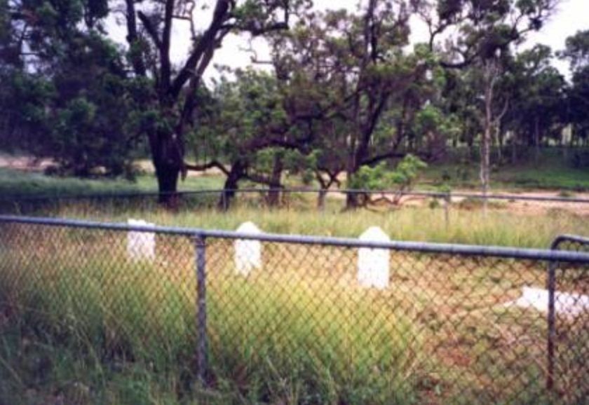
| Description | : | Rawebelle Station was taken up by Adolphus Henry Trevethan in 1848. The homestead was located on the southern bank of the Nogo River on a rise overlooking the station cemetery and the river; it is now marked by a lone date palm and a plaque. Other people who worked on the station are also buried in the cemetery, including a superintendent and bookkeeper of the station, four unidentified people: a European man and woman and two chinese men, the latter presumably shepherds and all allegedly buried before 1858. The homestead site was moved further north of the original location in 1890 and Rawebelle... Read More |
frequently asked questions (FAQ):
-
Where is Rawbelle Cemetery and Homestead?
Rawbelle Cemetery and Homestead is located at Nogo River, approximately thirty five kilometres southwest of Monto Rawbelle, North Burnett Region ,Queensland ,Australia.
-
Rawbelle Cemetery and Homestead cemetery's updated grave count on graveviews.com?
4 memorials
-
Where are the coordinates of the Rawbelle Cemetery and Homestead?
Latitude: -25.0303900
Longitude: 150.8394100
Nearby Cemetories:
1. Mulgildie Cemetery
Mulgildie, North Burnett Region, Australia
Coordinate: -24.9688690, 151.1355900
2. Monto Cemetery
Monto, North Burnett Region, Australia
Coordinate: -24.8481228, 151.1401369
3. Cania Cemetery
Cania, North Burnett Region, Australia
Coordinate: -24.6524500, 150.9827500
4. Eidsvold Cemetery
Eidsvold, North Burnett Region, Australia
Coordinate: -25.3948440, 151.1182060
5. Binjour Cemetery
Binjour, North Burnett Region, Australia
Coordinate: -25.3074300, 151.2626200
6. Cracow Cemetery
Cracow, Banana Shire, Australia
Coordinate: -25.2999992, 150.3000031
7. Apostolic Church of Queensland Cemetery Malmoe
O'Bil Bil, North Burnett Region, Australia
Coordinate: -25.5445737, 151.2313607
8. Theodore Cemetery
Theodore, Banana Shire, Australia
Coordinate: -24.9603670, 150.0998580
9. Biloela Lawn Cemetery
Biloela, Banana Shire, Australia
Coordinate: -24.4151320, 150.5343680
10. Biloela Monumental Cemetery
Biloela, Banana Shire, Australia
Coordinate: -24.3949580, 150.5203020
11. Edan Park Cemetery
Biloela, Banana Shire, Australia
Coordinate: -24.3928519, 150.5214024
12. Builyan Cemetery
Builyan, Gladstone Region, Australia
Coordinate: -24.5294091, 151.3854020
13. Mundubbera Cemetery
Mundubbera, North Burnett Region, Australia
Coordinate: -25.6057882, 151.3107160
14. Mount Perry Cemetery
Mount Perry, North Burnett Region, Australia
Coordinate: -25.1844540, 151.6523560
15. Boolboonda Cemetery
Boolboonda, Bundaberg Region, Australia
Coordinate: -25.0652000, 151.6921200
16. Banana Cemetery
Banana, Banana Shire, Australia
Coordinate: -24.4667020, 150.1226700
17. Moura Lawn Cemetery
Moura, Banana Shire, Australia
Coordinate: -24.5741290, 149.9839080
18. Gayndah Cemetery
Gayndah, North Burnett Region, Australia
Coordinate: -25.6310400, 151.6143200
19. Miriam Vale Pioneer Cemetery
Miriam Vale, Gladstone Region, Australia
Coordinate: -24.3226660, 151.5537650
20. Jambin Cemetery
Jambin, Banana Shire, Australia
Coordinate: -24.1653890, 150.3713830
21. Bororen Cemetery
Bororen, Gladstone Region, Australia
Coordinate: -24.2552740, 151.4997310
22. Gin Gin Cemetery
Gin Gin, Bundaberg Region, Australia
Coordinate: -24.9966870, 151.9487120
23. Walla Station Cemetery
Gin Gin, Bundaberg Region, Australia
Coordinate: -25.1250040, 151.9782540
24. Rosedale Cemetery
Rosedale, Gladstone Region, Australia
Coordinate: -24.6180630, 151.9158230