
| Memorials | : | 0 |
| Location | : | Pelahatchie, Rankin County, USA |
| Coordinate | : | 32.3527800, -89.8547200 |
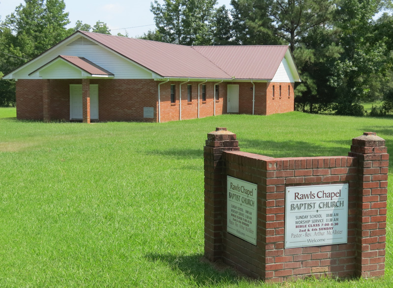
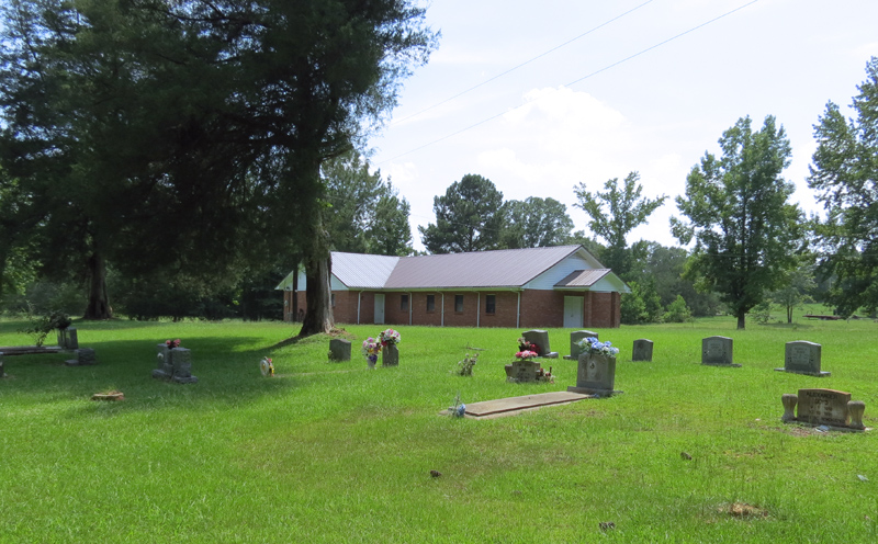
| Description | : | This Cemetery was established about 1976 by the Rawls Chapel Baptist Church. |
frequently asked questions (FAQ):
-
Where is Rawls Chapel Cemetery?
Rawls Chapel Cemetery is located at Lake Road and McCallister Lane, Pelahatchie, MS Pelahatchie, Rankin County ,Mississippi , 39145USA.
-
Rawls Chapel Cemetery cemetery's updated grave count on graveviews.com?
0 memorials
-
Where are the coordinates of the Rawls Chapel Cemetery?
Latitude: 32.3527800
Longitude: -89.8547200
Nearby Cemetories:
1. Bowman Memorial Cemetery
Pelahatchie, Rankin County, USA
Coordinate: 32.3778880, -89.8770240
2. Ragan Cemetery
Pelahatchie, Rankin County, USA
Coordinate: 32.3325005, -89.8082962
3. Gulde Cemetery
Gulde, Rankin County, USA
Coordinate: 32.3050003, -89.8606033
4. Holly Bush Cemetery
Rankin County, USA
Coordinate: 32.4043999, -89.8246994
5. Pelahatchie Cemetery
Pelahatchie, Rankin County, USA
Coordinate: 32.3171997, -89.7983017
6. Jordan Grove Cemetery
Rankin County, USA
Coordinate: 32.2957993, -89.8843994
7. Little Zion Cemetery
Pelahatchie, Rankin County, USA
Coordinate: 32.3135986, -89.7932968
8. McLaurin Cemetery
Rankin County, USA
Coordinate: 32.4035988, -89.9047012
9. Andrew Chapel Cemetery
Rankin, Rankin County, USA
Coordinate: 32.3249440, -89.9282590
10. Spring Hill Cemetery
Pelahatchie, Rankin County, USA
Coordinate: 32.3781013, -89.7797012
11. Mount Helm Cemetery Number One
Rankin County, USA
Coordinate: 32.4105988, -89.8985977
12. Evergreen Cemetery
Brandon, Rankin County, USA
Coordinate: 32.3177986, -89.9278030
13. Saint Hill Cemetery
Rankin, Rankin County, USA
Coordinate: 32.3017006, -89.9250031
14. Barefoot Springs Cemetery
Pelahatchie, Rankin County, USA
Coordinate: 32.3763110, -89.7659800
15. Rehobeth Cemetery
Pelahatchie, Rankin County, USA
Coordinate: 32.4235992, -89.8139038
16. Armond Hill Cemetery
Pelahatchie, Rankin County, USA
Coordinate: 32.4002660, -89.7798170
17. Williams Cemetery #2
Rankin County, USA
Coordinate: 32.2738991, -89.8985977
18. Farris Hill Cemetery
Pelahatchie, Rankin County, USA
Coordinate: 32.3255997, -89.7564011
19. Mount Carmel Cemetery
Rankin County, USA
Coordinate: 32.2756004, -89.9057999
20. Neal Cemetery
Pelahatchie, Rankin County, USA
Coordinate: 32.3792000, -89.7542038
21. Eastside Cemetery
Pelahatchie, Rankin County, USA
Coordinate: 32.3205986, -89.7561035
22. Pilgrim Rest Cemetery
Rankin, Rankin County, USA
Coordinate: 32.3130989, -89.9514008
23. Lodebar Methodist Church Cemetery
Pelahatchie, Rankin County, USA
Coordinate: 32.2806015, -89.7825012
24. Oakdale Baptist Church Cemetery
Langford, Rankin County, USA
Coordinate: 32.3486061, -89.9718170