| Memorials | : | 0 |
| Location | : | Miller County, USA |
| Coordinate | : | 38.1285095, -92.4371567 |
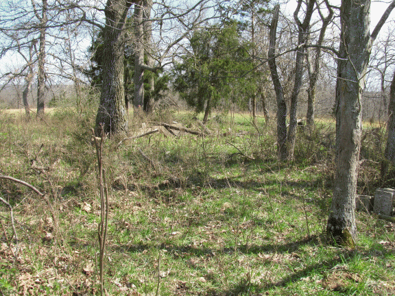
| Description | : | n Ulman, take County Side Road (it's hard to see as it's a left turn off of a curve), off of Route C, go .2 miles and turn right onto Howell Loop. Go 1.8 miles to the corner of Howell Loop and Bluebell Lane. At this corner, on the right side is a little side road with a gate across it. Open the gate and go about 500 feet or so, and what remains of the markers is in a group of trees, branches, thorns, and brush. Of the 7 stones known to be there, I... Read More |
frequently asked questions (FAQ):
-
Where is Reed Family Cemetery?
Reed Family Cemetery is located at Miller County ,Missouri ,USA.
-
Reed Family Cemetery cemetery's updated grave count on graveviews.com?
0 memorials
-
Where are the coordinates of the Reed Family Cemetery?
Latitude: 38.1285095
Longitude: -92.4371567
Nearby Cemetories:
1. Martin Family Cemetery
Miller County, USA
Coordinate: 38.1442500, -92.4374600
2. Jackson Cemetery
Ulman, Miller County, USA
Coordinate: 38.1394200, -92.4541700
3. Gott Cemetery
Ulman, Miller County, USA
Coordinate: 38.1231290, -92.4656910
4. Hawkins Cemetery
Brumley, Miller County, USA
Coordinate: 38.1006012, -92.4567032
5. Sullivan Cemetery
Kaiser, Miller County, USA
Coordinate: 38.1585600, -92.4596700
6. Hickory Point Cemetery
Iberia, Miller County, USA
Coordinate: 38.1239200, -92.3824700
7. Williams Cemetery
Miller County, USA
Coordinate: 38.0791900, -92.4043800
8. Nixdorf Cemetery
Tuscumbia, Miller County, USA
Coordinate: 38.1786200, -92.4033300
9. Robinett Cemetery
Brumley, Miller County, USA
Coordinate: 38.0861580, -92.4882990
10. Embry Family Cemetery
Brumley, Miller County, USA
Coordinate: 38.1220490, -92.5170490
11. Mount Union Cemetery
Brumley, Miller County, USA
Coordinate: 38.0614200, -92.4375400
12. Wright Cemetery
Brumley, Miller County, USA
Coordinate: 38.0833015, -92.5130997
13. Rodden Family Cemetery
Brumley, Miller County, USA
Coordinate: 38.0693357, -92.4991327
14. Livingston Cemetery
Iberia, Miller County, USA
Coordinate: 38.1368700, -92.3401200
15. Robinett Cemetery
Brumley, Miller County, USA
Coordinate: 38.0693400, -92.4996300
16. Boltz Cemetery
Miller County, USA
Coordinate: 38.1462100, -92.5325400
17. Hopewell Cemetery
Tuscumbia, Miller County, USA
Coordinate: 38.2024800, -92.4023100
18. Stark Cemetery
Miller County, USA
Coordinate: 38.1998200, -92.3935900
19. Wilson Cemetery
Miller County, USA
Coordinate: 38.1706009, -92.3507996
20. Mount Zion Cemetery
Tuscumbia, Miller County, USA
Coordinate: 38.2083900, -92.4254600
21. Ramsey Cemetery
Miller County, USA
Coordinate: 38.1889000, -92.3641968
22. Albertson Cemetery
Brumley, Miller County, USA
Coordinate: 38.0780280, -92.5275850
23. Rankin Wright Cemetery
Iberia, Miller County, USA
Coordinate: 38.0666100, -92.3588000
24. Curry Cemetery
Iberia, Miller County, USA
Coordinate: 38.0464400, -92.3917400


