| Memorials | : | 0 |
| Location | : | Kemper County, USA |
| Coordinate | : | 32.8481770, -88.8803250 |
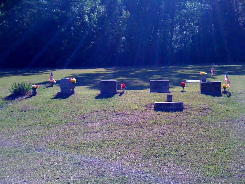
| Description | : | Photograph provided by Bernard Hulin (cousin of BJ Smith) of the Reed Road Cemetery. |
frequently asked questions (FAQ):
-
Where is Reed Road Cemetery?
Reed Road Cemetery is located at Kemper County ,Mississippi ,USA.
-
Reed Road Cemetery cemetery's updated grave count on graveviews.com?
0 memorials
-
Where are the coordinates of the Reed Road Cemetery?
Latitude: 32.8481770
Longitude: -88.8803250
Nearby Cemetories:
1. Mount Salem Cemetery
Preston, Kemper County, USA
Coordinate: 32.8569700, -88.8779600
2. Luke Cemetery
Preston, Kemper County, USA
Coordinate: 32.8728170, -88.8814000
3. Reed-Jordan Cemetery
Preston, Kemper County, USA
Coordinate: 32.8713000, -88.8995000
4. Coye Assembly of God Church Cemetery
Kemper County, USA
Coordinate: 32.8846500, -88.9020400
5. Bogue Chitto Community Cemetery
Bogue Chitto, Neshoba County, USA
Coordinate: 32.8332450, -88.9286180
6. I Sleep Cemetery Indian
Bogue Chitto, Neshoba County, USA
Coordinate: 32.8209000, -88.9274000
7. Anderson Jackson Memorial Cemetery
Preston, Kemper County, USA
Coordinate: 32.8970600, -88.8799700
8. Lynville Cemetery
Lynville, Kemper County, USA
Coordinate: 32.8569500, -88.8132400
9. Hensons Cemetery
Kemper County, USA
Coordinate: 32.7935982, -88.9011002
10. Pleasant Springs Presbyterian Church Cemetery
Preston, Kemper County, USA
Coordinate: 32.8832092, -88.8240433
11. Coy United Methodist Church Cemetery
Neshoba County, USA
Coordinate: 32.9039001, -88.9152985
12. Nanih Waiya Mennonite Church Cemetery
Neshoba County, USA
Coordinate: 32.9022360, -88.9259090
13. Long Cemetery
Neshoba County, USA
Coordinate: 32.8097000, -88.9533005
14. Dry Creek Cemetery
Preston, Kemper County, USA
Coordinate: 32.9206009, -88.8507996
15. Roundtree Cemetery
Neshoba County, USA
Coordinate: 32.7888985, -88.9496994
16. Goodin Cemetery
Winston County, USA
Coordinate: 32.9267090, -88.8405000
17. Macedonia United Methodist Church Cemetery
Neshoba County, USA
Coordinate: 32.8064130, -88.9690120
18. Bluff Springs Cemetery
Kemper County, USA
Coordinate: 32.7813988, -88.8139038
19. Shepard Cemetery
Kemper County, USA
Coordinate: 32.7647018, -88.8506012
20. Rosamond Family Cemetery
Handle, Winston County, USA
Coordinate: 32.9352875, -88.8649750
21. Mount Hebron Old Cemetery
Winston County, USA
Coordinate: 32.9360680, -88.8712760
22. Bond Methodist Church Cemetery
Philadelphia, Neshoba County, USA
Coordinate: 32.8581040, -88.9879810
23. Smyrna Cemetery
Kemper County, USA
Coordinate: 32.8011017, -88.7818985
24. Clark Chapel Church Cemetery
Kemper County, USA
Coordinate: 32.7651300, -88.8231100

