
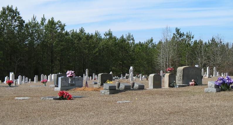
| Memorials | : | 0 |
| Location | : | Preston, Kemper County, USA |
| Coordinate | : | 32.8832092, -88.8240433 |
frequently asked questions (FAQ):
-
Where is Pleasant Springs Presbyterian Church Cemetery?
Pleasant Springs Presbyterian Church Cemetery is located at Preston, Kemper County ,Mississippi ,USA.
-
Pleasant Springs Presbyterian Church Cemetery cemetery's updated grave count on graveviews.com?
0 memorials
-
Where are the coordinates of the Pleasant Springs Presbyterian Church Cemetery?
Latitude: 32.8832092
Longitude: -88.8240433
Nearby Cemetories:
1. Lynville Cemetery
Lynville, Kemper County, USA
Coordinate: 32.8569500, -88.8132400
2. Dry Creek Cemetery
Preston, Kemper County, USA
Coordinate: 32.9206009, -88.8507996
3. Goodin Cemetery
Winston County, USA
Coordinate: 32.9267090, -88.8405000
4. Anderson Jackson Memorial Cemetery
Preston, Kemper County, USA
Coordinate: 32.8970600, -88.8799700
5. Hailey-Richey Cemetery
Gholson, Noxubee County, USA
Coordinate: 32.9261017, -88.7957993
6. Luke Cemetery
Preston, Kemper County, USA
Coordinate: 32.8728170, -88.8814000
7. Salem Cemetery
Preston, Kemper County, USA
Coordinate: 32.8717003, -88.7664032
8. Mount Salem Cemetery
Preston, Kemper County, USA
Coordinate: 32.8569700, -88.8779600
9. Old Salem Cemetery
Preston, Kemper County, USA
Coordinate: 32.9254200, -88.7815700
10. Tubb Cemetery
Kemper County, USA
Coordinate: 32.9258003, -88.7789001
11. Tubb Cemetery
Noxubee County, USA
Coordinate: 32.9259600, -88.7789400
12. Reed Road Cemetery
Kemper County, USA
Coordinate: 32.8481770, -88.8803250
13. Vernon Cemetery
Noxubee County, USA
Coordinate: 32.9272003, -88.7750015
14. Rosamond Family Cemetery
Handle, Winston County, USA
Coordinate: 32.9352875, -88.8649750
15. Chamberlin Cemetery West
Preston, Kemper County, USA
Coordinate: 32.8656578, -88.7511444
16. Chamberlain Cemetery East
Preston, Kemper County, USA
Coordinate: 32.8657990, -88.7506027
17. Reed-Jordan Cemetery
Preston, Kemper County, USA
Coordinate: 32.8713000, -88.8995000
18. Coye Assembly of God Church Cemetery
Kemper County, USA
Coordinate: 32.8846500, -88.9020400
19. Mount Hebron Old Cemetery
Winston County, USA
Coordinate: 32.9360680, -88.8712760
20. Jackson Field Cemetery
Winston County, USA
Coordinate: 32.9476940, -88.8457350
21. Mount Pisgah Cemetery
Winston County, USA
Coordinate: 32.9552994, -88.8416977
22. Coy United Methodist Church Cemetery
Neshoba County, USA
Coordinate: 32.9039001, -88.9152985
23. Mount Hebron Cemetery
Handle, Winston County, USA
Coordinate: 32.9557991, -88.8724976
24. Nanih Waiya Mennonite Church Cemetery
Neshoba County, USA
Coordinate: 32.9022360, -88.9259090