
| Memorials | : | 0 |
| Location | : | Michelfeld, Landkreis Schwäbisch Hall, Germany |
| Coordinate | : | 49.1002780, 9.7497220 |
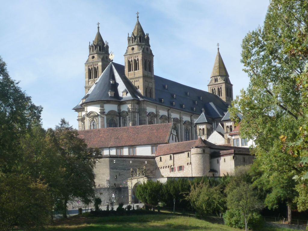
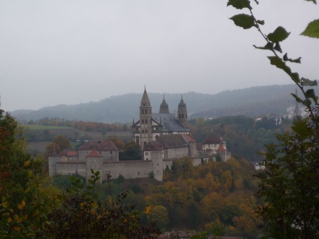
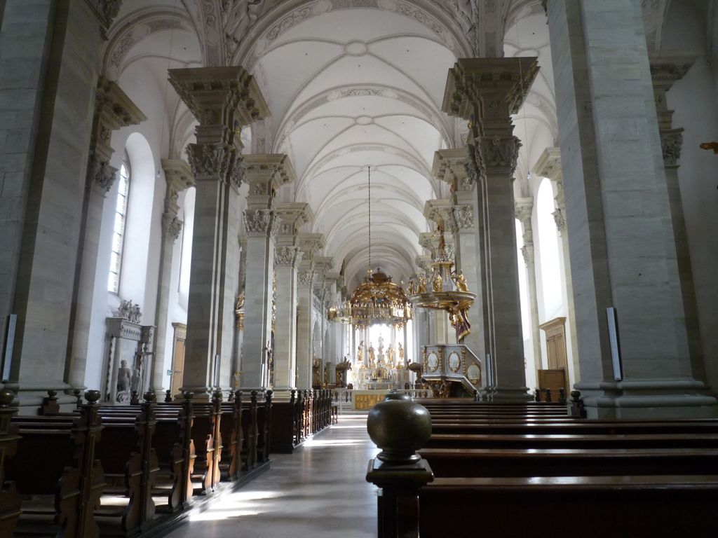
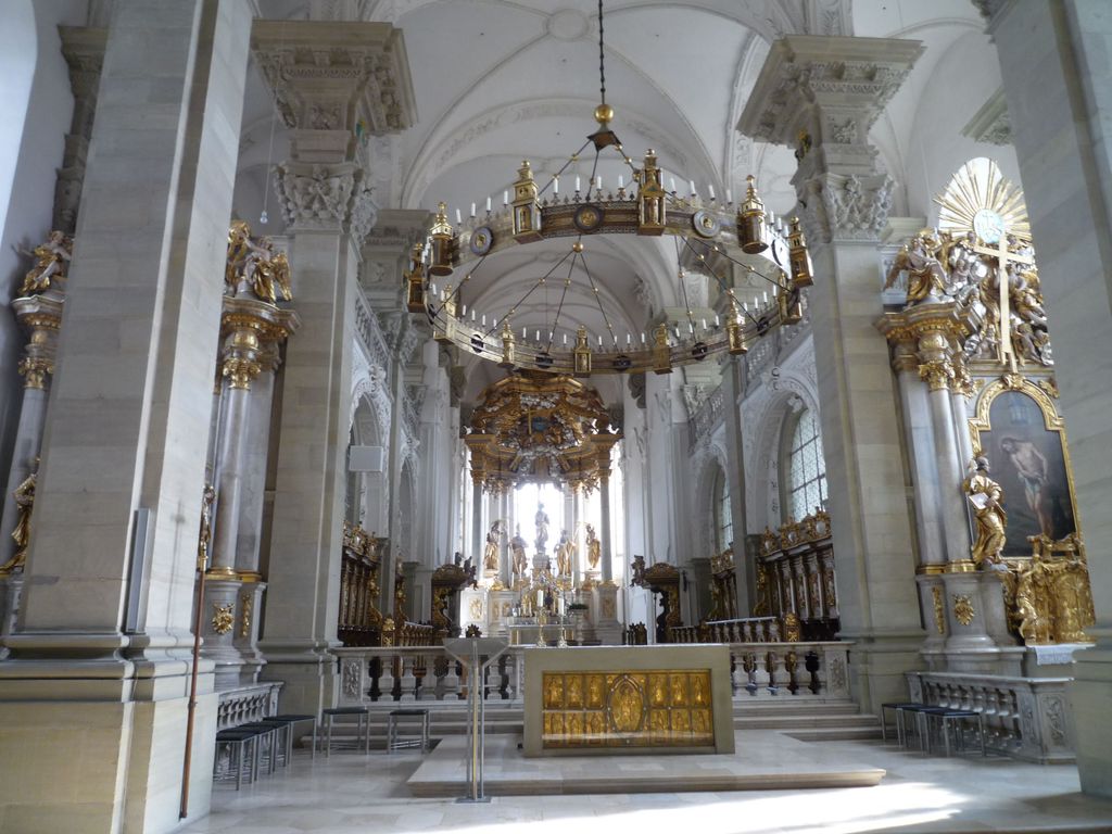
| Description | : | Comburg was a Benedictine monastery near Schwäbisch Hall in Baden-Württemberg in Germany. It was founded in the late 1070s by the Counts of Comburg-Rothenburg on the site of their castle. They retained the office of Vogt, which continued until their extinction in the Staufer dynasty. The first monks were from Brauweiler Abbey, but in the 1080s an abbot from Hirsau Abbey was appointed, and this brought Comburg into the movement of the Hirsau Reforms. The monks of Comburg were exclusively of noble birth, and accordingly resisted the Benedictine reforms (the Melk Reforms) of the 15th century, under the pressure of which the... Read More |
frequently asked questions (FAQ):
-
Where is Reichsstift Großcomburg?
Reichsstift Großcomburg is located at Michelfeld, Landkreis Schwäbisch Hall ,Baden-Württemberg ,Germany.
-
Reichsstift Großcomburg cemetery's updated grave count on graveviews.com?
0 memorials
-
Where are the coordinates of the Reichsstift Großcomburg?
Latitude: 49.1002780
Longitude: 9.7497220
Nearby Cemetories:
1. Jüdischer Friedhof Steinbach
Steinbach (Schwabisch Hall), Landkreis Schwäbisch Hall, Germany
Coordinate: 49.1031900, 9.7435900
2. Waldfriedhof Schwäbisch Hall
Schwäbisch Hall, Landkreis Schwäbisch Hall, Germany
Coordinate: 49.1088323, 9.6949541
3. Rosengarten Friedhof
Rosengarten, Landkreis Schwäbisch Hall, Germany
Coordinate: 49.0590900, 9.7309300
4. Kloster Gnadenthal
Michelfeld, Landkreis Schwäbisch Hall, Germany
Coordinate: 49.1277900, 9.6535500
5. Friedhof Ottendorf
Ottendorf, Landkreis Schwäbisch Hall, Germany
Coordinate: 49.0291098, 9.7470760
6. Friedhof Übrigshausen
Untermünkheim, Landkreis Schwäbisch Hall, Germany
Coordinate: 49.1763310, 9.7121548
7. Friedhof Gaildorf
Gaildorf, Landkreis Schwäbisch Hall, Germany
Coordinate: 49.0043678, 9.7684136
8. Friedhof Untersontheim
Untersontheim, Landkreis Schwäbisch Hall, Germany
Coordinate: 49.0655993, 9.8890324
9. Friedhof Grossaltdorf
Grossaltdorf (Vellberg), Landkreis Schwäbisch Hall, Germany
Coordinate: 49.1203889, 9.9034754
10. Jüdischer Friedhof Braunsbach
Braunsbach, Landkreis Schwäbisch Hall, Germany
Coordinate: 49.2031200, 9.7906800
11. Friedhof Obersontheim
Obersontheim, Landkreis Schwäbisch Hall, Germany
Coordinate: 49.0550600, 9.8983300
12. Stadtkirche Waldenburg
Waldenburg, Hohenlohekreis, Germany
Coordinate: 49.1893300, 9.6433300
13. Friedhof Fichtenberg
Fichtenberg, Landkreis Schwäbisch Hall, Germany
Coordinate: 48.9876663, 9.7182436
14. Friedhof Waldenburg
Waldenburg, Hohenlohekreis, Germany
Coordinate: 49.1842900, 9.6302300
15. Friedhof Orlach
Orlach, Landkreis Schwäbisch Hall, Germany
Coordinate: 49.2111723, 9.8152197
16. Pfedelbach Friedhof
Pfedelbach, Hohenlohekreis, Germany
Coordinate: 49.1417600, 9.5742300
17. Friedhof Unterrot
Unterrot, Landkreis Schwäbisch Hall, Germany
Coordinate: 48.9765775, 9.7710448
18. Friedhof Grab
Großerlach, Rems-Murr-Kreis, Germany
Coordinate: 49.0368442, 9.5785257
19. Friedhof Fornsbach
Murrhardt, Rems-Murr-Kreis, Germany
Coordinate: 48.9768793, 9.6450383
20. Friedhof Bühlerzell
Bühlerzell, Landkreis Schwäbisch Hall, Germany
Coordinate: 49.0007523, 9.9190135
21. Jüdischer Friedhof Dünsbach
Dünsbach, Landkreis Schwäbisch Hall, Germany
Coordinate: 49.2151800, 9.8967600
22. Friedhof Unterneustetten
Murrhardt, Rems-Murr-Kreis, Germany
Coordinate: 48.9634041, 9.6535061
23. Friedhof Neuenstein
Neuenstein, Hohenlohekreis, Germany
Coordinate: 49.2069300, 9.5846900
24. Kinderfriedhof Gantenwald
Bühlerzell, Landkreis Schwäbisch Hall, Germany
Coordinate: 48.9849334, 9.9064723