
| Memorials | : | 0 |
| Location | : | Bühlerzell, Landkreis Schwäbisch Hall, Germany |
| Coordinate | : | 48.9849334, 9.9064723 |
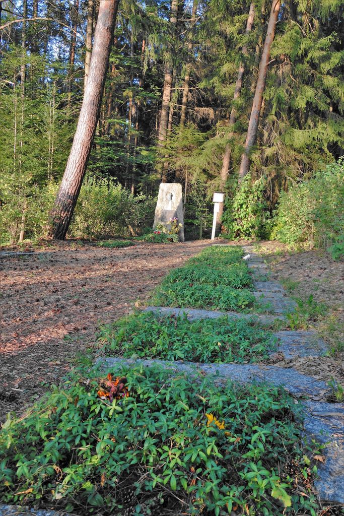
| Description | : | Gedenkstätte Gantenwald. |
frequently asked questions (FAQ):
-
Where is Kinderfriedhof Gantenwald?
Kinderfriedhof Gantenwald is located at Klingenbachstraße Bühlerzell, Landkreis Schwäbisch Hall ,Baden-Württemberg , 74426Germany.
-
Kinderfriedhof Gantenwald cemetery's updated grave count on graveviews.com?
0 memorials
-
Where are the coordinates of the Kinderfriedhof Gantenwald?
Latitude: 48.9849334
Longitude: 9.9064723
Nearby Cemetories:
1. Friedhof Bühlerzell
Bühlerzell, Landkreis Schwäbisch Hall, Germany
Coordinate: 49.0007523, 9.9190135
2. Friedhof Ellrichshausen
Satteldorf, Landkreis Schwäbisch Hall, Germany
Coordinate: 49.0000000, 10.0000000
3. Friedhof Obersontheim
Obersontheim, Landkreis Schwäbisch Hall, Germany
Coordinate: 49.0550600, 9.8983300
4. Friedhof Untersontheim
Untersontheim, Landkreis Schwäbisch Hall, Germany
Coordinate: 49.0655993, 9.8890324
5. Friedhof Rosenberg
Aalen, Ostalbkreis, Germany
Coordinate: 49.0188066, 10.0322812
6. Friedhof Unterrot
Unterrot, Landkreis Schwäbisch Hall, Germany
Coordinate: 48.9765775, 9.7710448
7. Friedhof Gaildorf
Gaildorf, Landkreis Schwäbisch Hall, Germany
Coordinate: 49.0043678, 9.7684136
8. Friedhof Ottendorf
Ottendorf, Landkreis Schwäbisch Hall, Germany
Coordinate: 49.0291098, 9.7470760
9. Friedhof Fichtenberg
Fichtenberg, Landkreis Schwäbisch Hall, Germany
Coordinate: 48.9876663, 9.7182436
10. Friedhof Göggingen
Göggingen, Ostalbkreis, Germany
Coordinate: 48.8594180, 9.8812790
11. Friedhof Grossaltdorf
Grossaltdorf (Vellberg), Landkreis Schwäbisch Hall, Germany
Coordinate: 49.1203889, 9.9034754
12. Rosengarten Friedhof
Rosengarten, Landkreis Schwäbisch Hall, Germany
Coordinate: 49.0590900, 9.7309300
13. Friedhof Sankt Wolfgang
Ellwangen, Ostalbkreis, Germany
Coordinate: 48.9568875, 10.1246099
14. Friedhof Jagstheim
Crailsheim, Landkreis Schwäbisch Hall, Germany
Coordinate: 49.0894933, 10.0633375
15. Basilika St. Vitus
Ellwangen, Ostalbkreis, Germany
Coordinate: 48.9619440, 10.1320830
16. Friedhof Kirchenkirnberg
Murrhardt, Rems-Murr-Kreis, Germany
Coordinate: 48.9488607, 9.6828888
17. Jüdischer Friedhof Ellwangen
Ellwangen, Ostalbkreis, Germany
Coordinate: 48.9536770, 10.1354183
18. Reichsstift Großcomburg
Michelfeld, Landkreis Schwäbisch Hall, Germany
Coordinate: 49.1002780, 9.7497220
19. Friedhof Iggingen
Iggingen, Ostalbkreis, Germany
Coordinate: 48.8296040, 9.8775230
20. Friedhof Hüttlingen
Hüttlingen, Ostalbkreis, Germany
Coordinate: 48.8883100, 10.0954900
21. Friedhof Schönenberg
Ellwangen, Ostalbkreis, Germany
Coordinate: 48.9729100, 10.1479800
22. Jüdischer Friedhof Steinbach
Steinbach (Schwabisch Hall), Landkreis Schwäbisch Hall, Germany
Coordinate: 49.1031900, 9.7435900
23. Friedhof Hellershof
Alfdorf, Rems-Murr-Kreis, Germany
Coordinate: 48.9066700, 9.6919700
24. Friedhof Unterneustetten
Murrhardt, Rems-Murr-Kreis, Germany
Coordinate: 48.9634041, 9.6535061