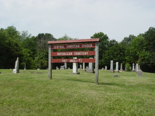
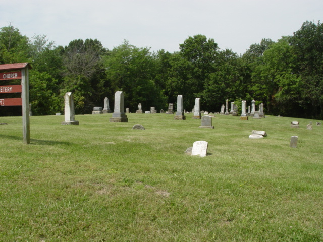
| Memorials | : | 0 |
| Location | : | Higginsville, Lafayette County, USA |
| Coordinate | : | 39.0586014, -93.6952972 |
| Description | : | The Central Christian Church Republican Cemetery is located between Aullville and Higginsville, Missouri in central Lafayette County, MO. The Central Christian Church that was formerly located here was established in 1860. From the business district of Higginsville, take Highway T southeast to Aullville. The cemetery is a short distance south of the intersection of Highway T and Republican Road and St. Mary's Road. The cemetery sits are on the west (right) side of the highway. If traveling from Interstate Highway 70, take exit 52 and turn north on Highway T. Go thru Aullville and continue northwest... Read More |
frequently asked questions (FAQ):
-
Where is Republican Cemetery?
Republican Cemetery is located at Higginsville, Lafayette County ,Missouri ,USA.
-
Republican Cemetery cemetery's updated grave count on graveviews.com?
0 memorials
-
Where are the coordinates of the Republican Cemetery?
Latitude: 39.0586014
Longitude: -93.6952972
Nearby Cemetories:
1. Saint Mary's Catholic Cemetery
Higginsville, Lafayette County, USA
Coordinate: 39.0613500, -93.6987300
2. Brand Cemetery
Higginsville, Lafayette County, USA
Coordinate: 39.0585700, -93.7134200
3. Mount Muncie Cemetery
Higginsville, Lafayette County, USA
Coordinate: 39.0589900, -93.7134600
4. Higginsville City Cemetery
Higginsville, Lafayette County, USA
Coordinate: 39.0712852, -93.7116623
5. Salem United Cemetery
Higginsville, Lafayette County, USA
Coordinate: 39.0802994, -93.6921997
6. Old Higginsville Cemetery
Lafayette County, USA
Coordinate: 39.0866870, -93.6636400
7. Peacock Cemetery
Higginsville, Lafayette County, USA
Coordinate: 39.0974280, -93.6923930
8. Sharp Cemetery
Lafayette County, USA
Coordinate: 39.0769005, -93.7497025
9. Missouri Veterans Cemetery at Higginsville
Higginsville, Lafayette County, USA
Coordinate: 39.0957985, -93.7338028
10. Confederate Cemetery
Higginsville, Lafayette County, USA
Coordinate: 39.1009674, -93.7269211
11. Corder Calvary Cemetery
Corder, Lafayette County, USA
Coordinate: 39.1082993, -93.6489029
12. Zion Lutheran Cemetery
Corder, Lafayette County, USA
Coordinate: 39.0980900, -93.6312600
13. Page Cemetery
Page City, Lafayette County, USA
Coordinate: 39.1166992, -93.7332993
14. Poole Cemetery
Mayview, Lafayette County, USA
Coordinate: 39.0597000, -93.7908020
15. Major Family Cemetery
Aullville, Lafayette County, USA
Coordinate: 38.9707400, -93.6943400
16. Ragland Family Cemetery
Mayview, Lafayette County, USA
Coordinate: 39.0205400, -93.8024300
17. Zion United Church of Christ Cemetery
Mayview, Lafayette County, USA
Coordinate: 39.0469400, -93.8178800
18. Marvin Chapel Cemetery
Lafayette County, USA
Coordinate: 39.0190048, -93.8088074
19. Mound Prairie Baptist Church Cemetery
Mayview, Lafayette County, USA
Coordinate: 39.0224180, -93.8147020
20. Zoar Methodist Cemetery
Concordia, Lafayette County, USA
Coordinate: 38.9840400, -93.6031600
21. New Hope Cemetery
Lafayette County, USA
Coordinate: 38.9664001, -93.6327972
22. Prairie Church Cemetery
Higginsville, Lafayette County, USA
Coordinate: 39.1123480, -93.8138870
23. Trinity Lutheran Cemetery
Alma, Lafayette County, USA
Coordinate: 39.1068993, -93.5618973
24. McGinness Cemetery
Freedom, Lafayette County, USA
Coordinate: 38.9663900, -93.7945200


