
| Memorials | : | 2 |
| Location | : | Freedom, Lafayette County, USA |
| Coordinate | : | 38.9663900, -93.7945200 |
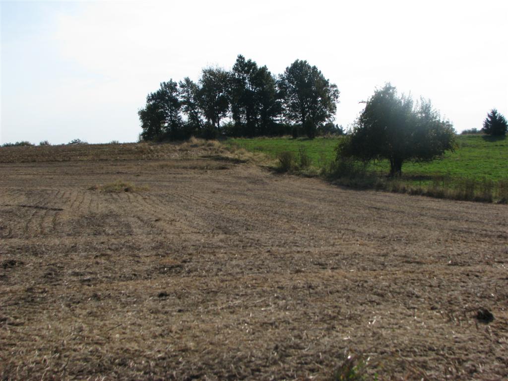
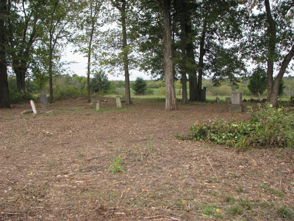
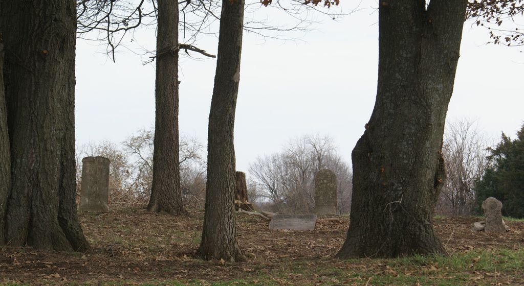
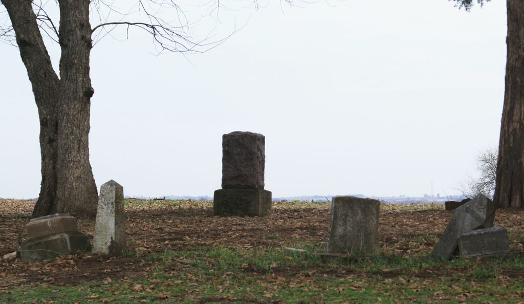
| Description | : | The McGinness Cemetery is located on "private" farmland, on the east side of Old Stage Coach Road, across from Varner Road and about 1 mile south of Hook Road. Directions: Take 13 south from Higginsville, take a right and go West on Route U for 3.25 miles. Take another right and go north on the gravel road for just over a mile. When you pass Varner road on your left (This street appears to be unmarked), the cemetery is located in a grove of trees, at the top of a small hill and you must pass 3 gates in the field... Read More |
frequently asked questions (FAQ):
-
Where is McGinness Cemetery?
McGinness Cemetery is located at Freedom, Lafayette County ,Missouri ,USA.
-
McGinness Cemetery cemetery's updated grave count on graveviews.com?
1 memorials
-
Where are the coordinates of the McGinness Cemetery?
Latitude: 38.9663900
Longitude: -93.7945200
Nearby Cemetories:
1. Marvin Chapel Cemetery
Lafayette County, USA
Coordinate: 39.0190048, -93.8088074
2. Ragland Family Cemetery
Mayview, Lafayette County, USA
Coordinate: 39.0205400, -93.8024300
3. Mound Prairie Baptist Church Cemetery
Mayview, Lafayette County, USA
Coordinate: 39.0224180, -93.8147020
4. Mount Tabor Cemetery
Odessa, Lafayette County, USA
Coordinate: 38.9409218, -93.8814163
5. Oak Grove Cemetery
Johnson County, USA
Coordinate: 38.9275690, -93.7150840
6. Summers-Helm Cemetery
Odessa, Lafayette County, USA
Coordinate: 38.9469200, -93.8900800
7. Major Family Cemetery
Aullville, Lafayette County, USA
Coordinate: 38.9707400, -93.6943400
8. Maxwell-Gordy Cemetery
Odessa, Lafayette County, USA
Coordinate: 38.9869510, -93.8955970
9. Zion United Church of Christ Cemetery
Mayview, Lafayette County, USA
Coordinate: 39.0469400, -93.8178800
10. Whitsitt Family Cemetery
Odessa, Lafayette County, USA
Coordinate: 38.9691150, -93.9055220
11. Poole Cemetery
Mayview, Lafayette County, USA
Coordinate: 39.0597000, -93.7908020
12. Mount Olive Cemetery
Warrensburg, Johnson County, USA
Coordinate: 38.9012000, -93.6961100
13. Mount Hebron Cemetery
Odessa, Lafayette County, USA
Coordinate: 39.0361200, -93.8923790
14. Hobson Cemetery
Johnson County, USA
Coordinate: 38.8659570, -93.7578120
15. Odessa Cemetery
Odessa, Lafayette County, USA
Coordinate: 39.0005989, -93.9244003
16. Zion Hill Cemetery
Concordia, Lafayette County, USA
Coordinate: 38.9339013, -93.6624380
17. Mount Hebron Cemetery
Mayview, Lafayette County, USA
Coordinate: 39.0455017, -93.8899002
18. Brand Cemetery
Higginsville, Lafayette County, USA
Coordinate: 39.0585700, -93.7134200
19. Mount Muncie Cemetery
Higginsville, Lafayette County, USA
Coordinate: 39.0589900, -93.7134600
20. Sharp Cemetery
Lafayette County, USA
Coordinate: 39.0769005, -93.7497025
21. Liberty Baptist Cemetery
Warrensburg, Johnson County, USA
Coordinate: 38.8582001, -93.7387009
22. Mount Maria Cemetery
Johnson County, USA
Coordinate: 38.8492012, -93.7855988
23. Mount Moriah Cemetery
Hazel Hill Township, Johnson County, USA
Coordinate: 38.8489900, -93.7859500
24. Republican Cemetery
Higginsville, Lafayette County, USA
Coordinate: 39.0586014, -93.6952972