
| Memorials | : | 0 |
| Location | : | Louisville, Clay County, USA |
| Coordinate | : | 38.8061562, -88.5681076 |
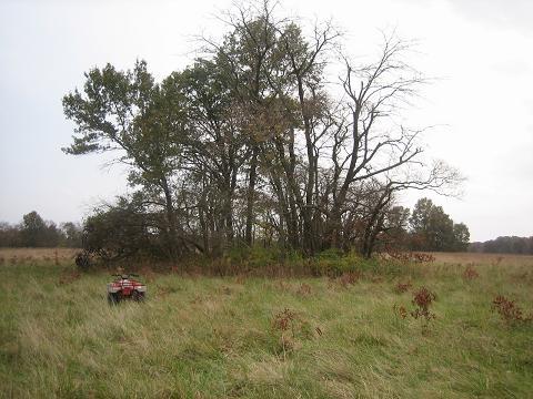
| Description | : | SW/4 NE/4 of Sec. 7, Sec. 7, T4N, R6E; 3 mi. NW of Louisville, W where road crosses tracks, in thicket 200 ft. SW of tracks. Note: About 10 unmarked graves; footstones W. L. D., W. H. D., F. A. B. Information taken from John Tanner's Book "Clay County Cemetery Inscriptions" The U.S. Geological Survey (USGS) Geographic Names Information System (GNIS) feature ID for the cemetery is 1952655 (Brown Cemetery) and 1952692 (Riffle Cemetery / Brown Cemetery). |
frequently asked questions (FAQ):
-
Where is Riffle Cemetery?
Riffle Cemetery is located at Bob White Road (County Road 1325 N) Louisville, Clay County ,Illinois , 62858USA.
-
Riffle Cemetery cemetery's updated grave count on graveviews.com?
0 memorials
-
Where are the coordinates of the Riffle Cemetery?
Latitude: 38.8061562
Longitude: -88.5681076
Nearby Cemetories:
1. Christian Home Cemetery
Louisville, Clay County, USA
Coordinate: 38.7883900, -88.5572400
2. Newton Chapel Cemetery
Louisville, Clay County, USA
Coordinate: 38.8310200, -88.5623100
3. Speaks Cemetery
Clay County, USA
Coordinate: 38.7780991, -88.5663986
4. Tolliver Cemetery
Louisville, Clay County, USA
Coordinate: 38.8217010, -88.5171967
5. Old Baptist Cemetery
Iola, Clay County, USA
Coordinate: 38.8054695, -88.6248245
6. Red Brush Cemetery
Louisville, Clay County, USA
Coordinate: 38.7969250, -88.5085415
7. Rogers Cemetery
Iola, Clay County, USA
Coordinate: 38.8464355, -88.6128311
8. Orchard Hill Cemetery
Louisville, Clay County, USA
Coordinate: 38.7764500, -88.5097800
9. Burge Cemetery
Iola, Clay County, USA
Coordinate: 38.8636017, -88.5813980
10. Iola Cemetery
Iola, Clay County, USA
Coordinate: 38.8309700, -88.6400300
11. Old Louisville Cemetery
Louisville, Clay County, USA
Coordinate: 38.7667000, -88.5075000
12. Old Louisville Cemetery
Clay County, USA
Coordinate: 38.7652800, -88.5066700
13. Woods Cemetery
Iola, Clay County, USA
Coordinate: 38.8610992, -88.6157990
14. Oskaloosa Cemetery
Oskaloosa, Clay County, USA
Coordinate: 38.7626670, -88.6529520
15. Golden Cemetery
Flora, Clay County, USA
Coordinate: 38.7244500, -88.5553800
16. Old Union Cemetery
Louisville, Clay County, USA
Coordinate: 38.8708000, -88.5000000
17. Fender Cemetery
Clay County, USA
Coordinate: 38.8883781, -88.6028290
18. Kinnamon Cemetery
Louisville, Clay County, USA
Coordinate: 38.7872009, -88.4586029
19. Conly Cemetery
Clay County, USA
Coordinate: 38.8725014, -88.4899979
20. Jenkins Cemetery
Louisville, Clay County, USA
Coordinate: 38.7369003, -88.4847031
21. Stipp Cemetery
Clay County, USA
Coordinate: 38.7397003, -88.6678009
22. Higginbothan Cemetery
Oskaloosa Township, Clay County, USA
Coordinate: 38.7705952, -88.6925463
23. Keens Chapel Cemetery
Iola, Clay County, USA
Coordinate: 38.8567123, -88.6892166
24. Littleton Cemetery
Clay County, USA
Coordinate: 38.8713989, -88.6797028