
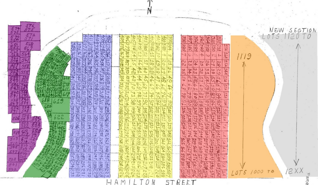
| Memorials | : | 12 |
| Location | : | Fox Lake, Dodge County, USA |
| Coordinate | : | 43.5688800, -88.9073300 |
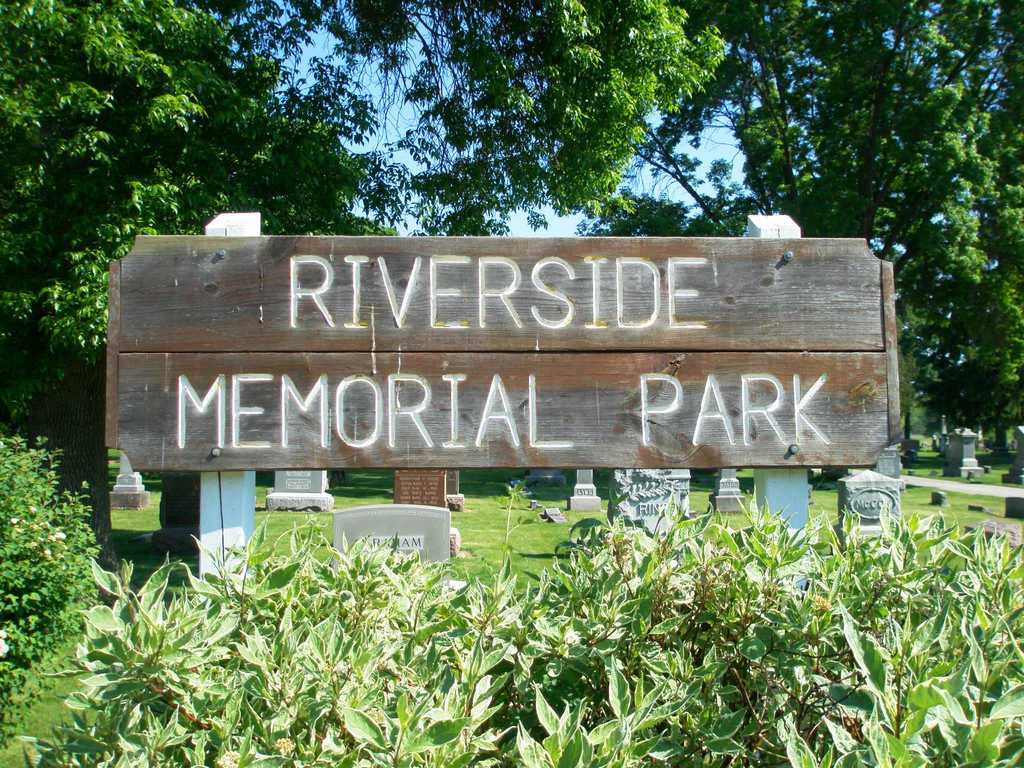
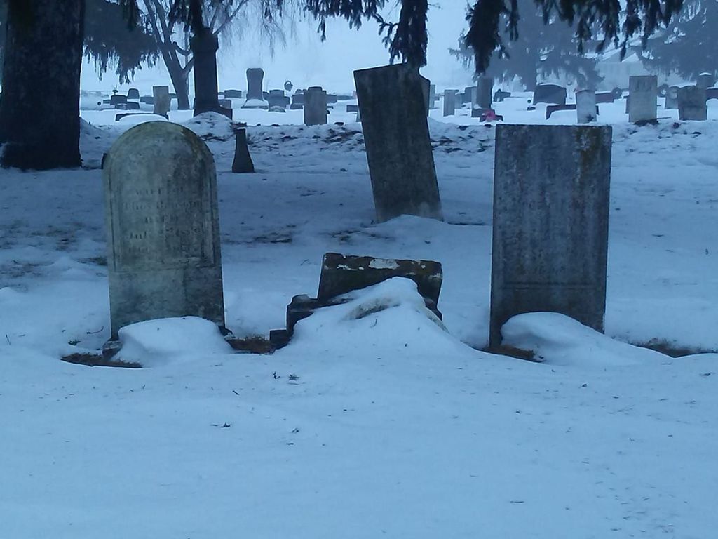
| Description | : | The first recorded burials took place in the late 1840's, and was known as Waushara (an early name of present-day Fox Lake). The cemetery was maintained by a Cemetery Association until the early 1950's, when the Association disbanded and ownership was transferred to the City of Fox Lake. At that time, the name of the cemetery was changed from Waushara Cemetery to Riverside Memorial Park. There are over 2500 known burials as of March 2022. There are about 60 "rumored" additional burials that are in the process of being researched and confirmed. Over 270 confirmed Veterans have been laid... Read More |
frequently asked questions (FAQ):
-
Where is Riverside Memorial Park?
Riverside Memorial Park is located at Fox Lake, Dodge County ,Wisconsin ,USA.
-
Riverside Memorial Park cemetery's updated grave count on graveviews.com?
10 memorials
-
Where are the coordinates of the Riverside Memorial Park?
Latitude: 43.5688800
Longitude: -88.9073300
Nearby Cemetories:
1. Annunciation Cemetery
Fox Lake, Dodge County, USA
Coordinate: 43.5311012, -88.8660965
2. Trenton Cemetery
Trenton, Dodge County, USA
Coordinate: 43.5671997, -88.8313980
3. Lake Emily Cemetery
Fox Lake, Dodge County, USA
Coordinate: 43.6081009, -88.9674988
4. Grand Prairie Cemetery
Fox Lake, Dodge County, USA
Coordinate: 43.6314011, -88.8968964
5. Hall Cemetery
South Randolph, Dodge County, USA
Coordinate: 43.5238991, -88.9867020
6. English Prairie Cemetery
South Beaver Dam, Dodge County, USA
Coordinate: 43.4953499, -88.9002075
7. Annunciation Catholic Cemetery
Randolph, Columbia County, USA
Coordinate: 43.5455620, -89.0155650
8. Randolph Cemetery
Randolph, Columbia County, USA
Coordinate: 43.5466500, -89.0162200
9. Engedi Cemetery
Friesland, Columbia County, USA
Coordinate: 43.6114900, -89.0120100
10. Highland Memory Gardens
Trenton, Dodge County, USA
Coordinate: 43.5470009, -88.7809982
11. West Alto Cemetery
Alto, Fond du Lac County, USA
Coordinate: 43.6697006, -88.8660965
12. Mackford Union Cemetery
Markesan, Green Lake County, USA
Coordinate: 43.6772003, -88.9180984
13. Calvary Cemetery
Alto, Fond du Lac County, USA
Coordinate: 43.6624400, -88.8177600
14. Friesland Cemetery
Friesland, Columbia County, USA
Coordinate: 43.5871990, -89.0666340
15. Beaver Dam City Cemetery
Beaver Dam, Dodge County, USA
Coordinate: 43.4658200, -88.8287200
16. Courtland Methodist Cemetery
Randolph, Columbia County, USA
Coordinate: 43.4971733, -89.0364075
17. Lake Maria Cemetery
Manchester, Green Lake County, USA
Coordinate: 43.6666985, -89.0156021
18. Annunciation Cemetery
Lost Lake, Dodge County, USA
Coordinate: 43.4583200, -88.9920500
19. Saint Marks Episcopal Church Columbarium
Beaver Dam, Dodge County, USA
Coordinate: 43.4535620, -88.8248650
20. First Evangelical Lutheran Church Cemetery
Beaver Dam, Dodge County, USA
Coordinate: 43.4436000, -88.8595500
21. Old Saint Michaels Cemetery
Beaver Dam, Dodge County, USA
Coordinate: 43.4438870, -88.8579740
22. Saint Marys Cemetery
Beaver Dam, Dodge County, USA
Coordinate: 43.4436000, -88.8587200
23. Oakwood Cemetery
Beaver Dam, Dodge County, USA
Coordinate: 43.4571991, -88.8127975
24. Saint Michaels Catholic Cemetery
Beaver Dam, Dodge County, USA
Coordinate: 43.4422100, -88.8598300