
| Memorials | : | 2 |
| Location | : | Clutier, Tama County, USA |
| Coordinate | : | 42.0574800, -92.3548800 |
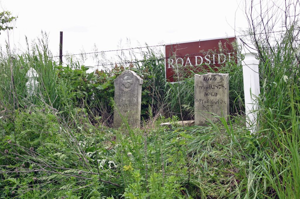
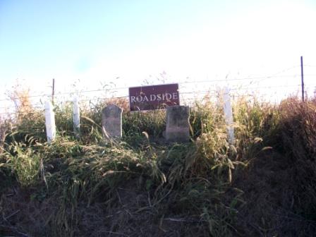
| Description | : | This Cemetery is located across from 3107 265th Street, Tama County, Iowa. A farmer unearthed these stones while tilling his land. The Cemetery association designated the spot as Roadside Cemetery. There are two stones there. The spot is designated with 4 fence posts. The nearest intersection would be 265th Street and V Avenue. |
frequently asked questions (FAQ):
-
Where is Roadside Cemetery?
Roadside Cemetery is located at Clutier, Tama County ,Iowa ,USA.
-
Roadside Cemetery cemetery's updated grave count on graveviews.com?
2 memorials
-
Where are the coordinates of the Roadside Cemetery?
Latitude: 42.0574800
Longitude: -92.3548800
Nearby Cemetories:
1. Waltham Cemetery
Elberon, Tama County, USA
Coordinate: 42.0355988, -92.3328018
2. Clutier Cemetery
Clutier, Tama County, USA
Coordinate: 42.0792007, -92.3858032
3. Lone Pine Cemetery
Tama County, USA
Coordinate: 42.0797005, -92.3082962
4. Oneida Cemetery
Clutier, Tama County, USA
Coordinate: 42.1007996, -92.3966980
5. Twogood Cemetery
Benton County, USA
Coordinate: 42.0499992, -92.2799988
6. Holy Trinity Cemetery
Vining, Tama County, USA
Coordinate: 42.0293999, -92.4222031
7. Saint Marys Cemetery
Vining, Tama County, USA
Coordinate: 41.9906000, -92.3556000
8. Saint Wenceslaus Cemetery
Clutier, Tama County, USA
Coordinate: 42.0870000, -92.4460000
9. Houghton Cemetery
Benton County, USA
Coordinate: 42.1088982, -92.2794037
10. Dvorak Cemetery
Elberon, Tama County, USA
Coordinate: 41.9713000, -92.3417000
11. National Cemetery
Vining, Tama County, USA
Coordinate: 41.9702988, -92.3705978
12. Stayskal Cemetery
Vining, Tama County, USA
Coordinate: 41.9788000, -92.4080000
13. Redman Cemetery
Benton County, USA
Coordinate: 41.9710999, -92.2917023
14. Dysart Cemetery
Dysart, Tama County, USA
Coordinate: 42.1608009, -92.3193970
15. Kirchner Cemetery
Benton County, USA
Coordinate: 42.0727300, -92.2027400
16. Fee Chapel Cemetery
Tama County, USA
Coordinate: 42.0643997, -92.5117035
17. Hayes Cemetery
Toledo, Tama County, USA
Coordinate: 41.9789009, -92.4730988
18. Gnagy Cemetery
Benton County, USA
Coordinate: 42.1418991, -92.2416992
19. Keystone Cemetery
Keystone, Benton County, USA
Coordinate: 41.9939003, -92.2172012
20. Irving Cemetery
Irving, Benton County, USA
Coordinate: 41.9505997, -92.2797012
21. Saint Josephs Catholic Cemetery
Benton County, USA
Coordinate: 42.1719017, -92.2981033
22. Arbuthnot Cemetery
Chelsea, Tama County, USA
Coordinate: 41.9416550, -92.3001787
23. Big Grove-Homer Cemetery
Benton County, USA
Coordinate: 42.0867004, -92.1821976
24. Saint Josephs Cemetery
Chelsea, Tama County, USA
Coordinate: 41.9267006, -92.3850021