
| Memorials | : | 0 |
| Location | : | Mouth of Wilson, Grayson County, USA |
| Coordinate | : | 36.5803090, -81.3478010 |
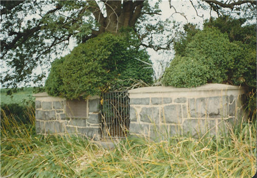
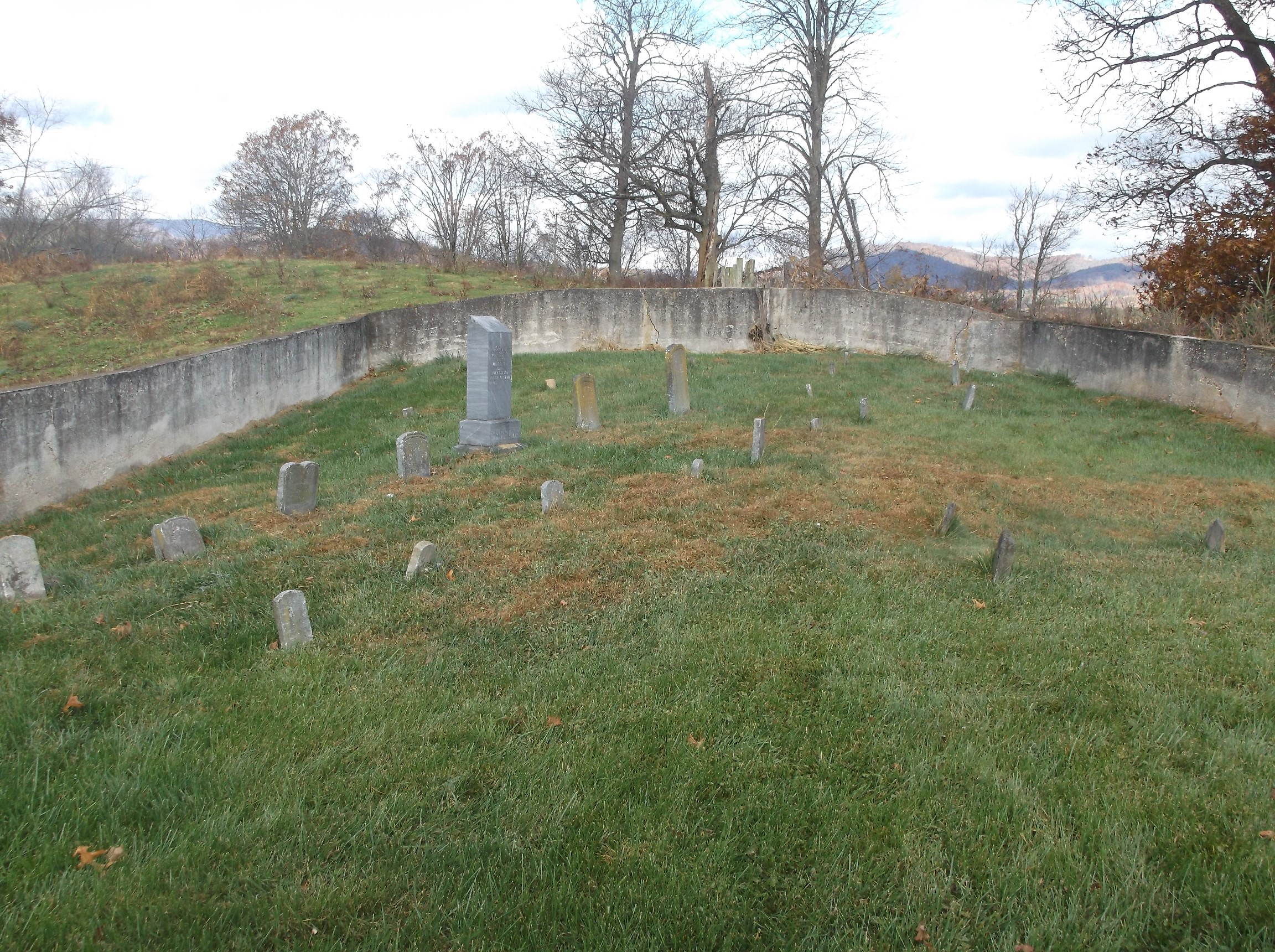
| Description | : | GPS Coordinates: N36.580524 W81.348122 Directions: From the junction of Wilson Hwy (US 58) and Old Mill Rd (Rt 767) go west about 1.25 miles on Old Mill Rd to Deacon Rd (Rt 718). Go north approximately 0.3 miles to the end of Deacon Rd. The cemetery is north on the hilltop. Details: on a hill behind the original Robert Parsons brick home on the farm owned by the Phipps family in 1978. 16markers were identified and surveyed in Jul 1978, of which 3 had no legible writing. |
frequently asked questions (FAQ):
-
Where is Robert Parsons Cemetery?
Robert Parsons Cemetery is located at Old Mill Road (Rt. 767) Mouth of Wilson, Grayson County ,Virginia , 24363USA.
-
Robert Parsons Cemetery cemetery's updated grave count on graveviews.com?
0 memorials
-
Where are the coordinates of the Robert Parsons Cemetery?
Latitude: 36.5803090
Longitude: -81.3478010
Nearby Cemetories:
1. Robert McCoy Halsey Family Cemetery
Mouth of Wilson, Grayson County, USA
Coordinate: 36.5781940, -81.3352710
2. Senter Cemetery
Mouth of Wilson, Grayson County, USA
Coordinate: 36.5907630, -81.3531370
3. Thomas Marion Cox Cemetery
Mouth of Wilson, Grayson County, USA
Coordinate: 36.5871890, -81.3350280
4. Vertigan Family Cemetery
Mouth of Wilson, Grayson County, USA
Coordinate: 36.5876100, -81.3348900
5. Fielden Young Cemetery
Mouth of Wilson, Grayson County, USA
Coordinate: 36.5889530, -81.3620970
6. Youngs Chapel Baptist Church Cemetery
Mouth of Wilson, Grayson County, USA
Coordinate: 36.5976770, -81.3389190
7. William Halsey Cemetery
Mouth of Wilson, Grayson County, USA
Coordinate: 36.5938470, -81.3265710
8. Wilborn Ross Cemetery
Mouth of Wilson, Grayson County, USA
Coordinate: 36.5870800, -81.3177700
9. Jesse Young Cemetery
Mouth of Wilson, Grayson County, USA
Coordinate: 36.6015870, -81.3668570
10. Big Rock Cemetery
Alleghany County, USA
Coordinate: 36.5583690, -81.3236520
11. Kendrick Ridge
Oak Hill, Grayson County, USA
Coordinate: 36.6101620, -81.3400160
12. William Pugh Family Cemetery
Mouth of Wilson, Grayson County, USA
Coordinate: 36.5865160, -81.3867230
13. Fields M Young Cemetery
Mouth of Wilson, Grayson County, USA
Coordinate: 36.6105280, -81.3622860
14. J Masten Halsey Cemetery
Mouth of Wilson, Grayson County, USA
Coordinate: 36.5823930, -81.3024720
15. William C. Halsey Cemetery
Mouth of Wilson, Grayson County, USA
Coordinate: 36.5970730, -81.3052600
16. George D Reeves Cemetery
Mouth of Wilson, Grayson County, USA
Coordinate: 36.5906010, -81.3948010
17. John Andrew Peak Cemetery
Mouth of Wilson, Grayson County, USA
Coordinate: 36.6016060, -81.3908140
18. Bell & Pritchet Cemetery
Alleghany County, USA
Coordinate: 36.5402400, -81.3299000
19. Hash-Osborne Cemetery
Mouth of Wilson, Grayson County, USA
Coordinate: 36.6188220, -81.3215860
20. George W Delp Cemetery
Mouth of Wilson, Grayson County, USA
Coordinate: 36.5879040, -81.2934230
21. Pierce-Garvey Family Cemetery
Chestnut Hill, Ashe County, USA
Coordinate: 36.5349500, -81.3482700
22. Allen Hash Family Cemetery
Fox, Grayson County, USA
Coordinate: 36.6136000, -81.3092500
23. Hugh Peak Cemetery
Mouth of Wilson, Grayson County, USA
Coordinate: 36.5946860, -81.4018440
24. Davis-Peak-Pugh Cemetery
Mouth of Wilson, Grayson County, USA
Coordinate: 36.5820770, -81.4058040