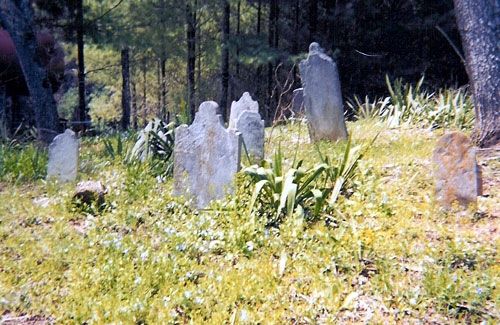
| Memorials | : | 0 |
| Location | : | Mouth of Wilson, Grayson County, USA |
| Coordinate | : | 36.5907630, -81.3531370 |
frequently asked questions (FAQ):
-
Where is Senter Cemetery?
Senter Cemetery is located at Jefferson Highway (Rt. 16) Mouth of Wilson, Grayson County ,Virginia , 24363USA.
-
Senter Cemetery cemetery's updated grave count on graveviews.com?
0 memorials
-
Where are the coordinates of the Senter Cemetery?
Latitude: 36.5907630
Longitude: -81.3531370
Nearby Cemetories:
1. Fielden Young Cemetery
Mouth of Wilson, Grayson County, USA
Coordinate: 36.5889530, -81.3620970
2. Robert Parsons Cemetery
Mouth of Wilson, Grayson County, USA
Coordinate: 36.5803090, -81.3478010
3. Youngs Chapel Baptist Church Cemetery
Mouth of Wilson, Grayson County, USA
Coordinate: 36.5976770, -81.3389190
4. Thomas Marion Cox Cemetery
Mouth of Wilson, Grayson County, USA
Coordinate: 36.5871890, -81.3350280
5. Vertigan Family Cemetery
Mouth of Wilson, Grayson County, USA
Coordinate: 36.5876100, -81.3348900
6. Jesse Young Cemetery
Mouth of Wilson, Grayson County, USA
Coordinate: 36.6015870, -81.3668570
7. Robert McCoy Halsey Family Cemetery
Mouth of Wilson, Grayson County, USA
Coordinate: 36.5781940, -81.3352710
8. Fields M Young Cemetery
Mouth of Wilson, Grayson County, USA
Coordinate: 36.6105280, -81.3622860
9. William Halsey Cemetery
Mouth of Wilson, Grayson County, USA
Coordinate: 36.5938470, -81.3265710
10. Kendrick Ridge
Oak Hill, Grayson County, USA
Coordinate: 36.6101620, -81.3400160
11. William Pugh Family Cemetery
Mouth of Wilson, Grayson County, USA
Coordinate: 36.5865160, -81.3867230
12. Wilborn Ross Cemetery
Mouth of Wilson, Grayson County, USA
Coordinate: 36.5870800, -81.3177700
13. John Andrew Peak Cemetery
Mouth of Wilson, Grayson County, USA
Coordinate: 36.6016060, -81.3908140
14. George D Reeves Cemetery
Mouth of Wilson, Grayson County, USA
Coordinate: 36.5906010, -81.3948010
15. Hash-Osborne Cemetery
Mouth of Wilson, Grayson County, USA
Coordinate: 36.6188220, -81.3215860
16. William C. Halsey Cemetery
Mouth of Wilson, Grayson County, USA
Coordinate: 36.5970730, -81.3052600
17. Hugh Peak Cemetery
Mouth of Wilson, Grayson County, USA
Coordinate: 36.5946860, -81.4018440
18. Big Rock Cemetery
Alleghany County, USA
Coordinate: 36.5583690, -81.3236520
19. Joseph Hash Family Cemetery
Fox, Grayson County, USA
Coordinate: 36.6264040, -81.3271960
20. J Masten Halsey Cemetery
Mouth of Wilson, Grayson County, USA
Coordinate: 36.5823930, -81.3024720
21. Allen Hash Family Cemetery
Fox, Grayson County, USA
Coordinate: 36.6136000, -81.3092500
22. Davis-Peak-Pugh Cemetery
Mouth of Wilson, Grayson County, USA
Coordinate: 36.5820770, -81.4058040
23. K. C. Ward Cemetery
Grayson County, USA
Coordinate: 36.6316620, -81.3344060
24. Thomas Hash Family Cemetery
Fox, Grayson County, USA
Coordinate: 36.6137480, -81.3033860

