| Memorials | : | 0 |
| Location | : | Rock Hill, Escambia County, USA |
| Coordinate | : | 31.1165530, -87.0024490 |
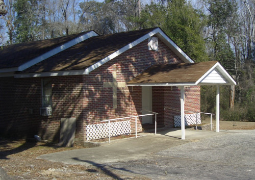
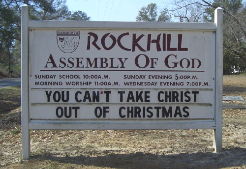
| Description | : | Rock Hill is a small rural community located on CR-22 east of the city of East Brewton. There is only one church at Rock Hill and that is the Rock Hill Assembly of God. In the near vicinity is the May Creek Methodist Church and cemetery and the Ridge Road Baptist Church and cemetery. To reach Rock Hill from East Brewton, exit off Hwy-29 eastward at either Magnolia or Shoffner street. At the Fort Crawford Cemetery, Magnolia will merge with Shoffner and it becomes Ridge Road or CR-22. The distance from Hwy-29 to Rock Hill will... Read More |
frequently asked questions (FAQ):
-
Where is Rock Hill Assembly of God Church Cemetery?
Rock Hill Assembly of God Church Cemetery is located at 4705 Ridge Road County Road 22 Rock Hill, Escambia County ,Alabama , 36426USA.
-
Rock Hill Assembly of God Church Cemetery cemetery's updated grave count on graveviews.com?
0 memorials
-
Where are the coordinates of the Rock Hill Assembly of God Church Cemetery?
Latitude: 31.1165530
Longitude: -87.0024490
Nearby Cemetories:
1. Ridge Road Cemetery
East Brewton, Escambia County, USA
Coordinate: 31.1150000, -87.0083000
2. Second Saint John's Baptist Church Cemetery
East Brewton, Escambia County, USA
Coordinate: 31.1056050, -87.0384620
3. Weaver Cemetery
East Brewton, Escambia County, USA
Coordinate: 31.0855999, -87.0196991
4. Brown Cemetery
Escambia County, USA
Coordinate: 31.0813999, -87.0046997
5. May Creek Church Cemetery
Brewton, Escambia County, USA
Coordinate: 31.1124992, -86.9546967
6. Bergen Community Cemetery
Brewton, Escambia County, USA
Coordinate: 31.1358030, -87.0494630
7. Spring Hill Cemetery
East Brewton, Escambia County, USA
Coordinate: 31.0952050, -87.0509860
8. McConnell Cemetery
Brewton, Escambia County, USA
Coordinate: 31.1271400, -87.0600700
9. Fort Crawford Cemetery
East Brewton, Escambia County, USA
Coordinate: 31.1000004, -87.0591965
10. Mayo Family Cemetery
Riverview, Escambia County, USA
Coordinate: 31.0745100, -86.9657600
11. Baptist Hill Cemetery
Brewton, Escambia County, USA
Coordinate: 31.1133000, -87.0638000
12. First Saint Siloam Baptist Church Cemetery
Brewton, Escambia County, USA
Coordinate: 31.1217100, -87.0638870
13. Second Saint Siloam Baptist Church Cemetery
Brewton, Escambia County, USA
Coordinate: 31.1091580, -87.0646820
14. Second Shady Grove Cemetery
Escambia County, USA
Coordinate: 31.1297300, -86.9412500
15. First Shady Grove Cemetery
Brewton, Escambia County, USA
Coordinate: 31.1162000, -86.9376000
16. Spear Cemetery
Brewton, Escambia County, USA
Coordinate: 31.0577340, -86.9927610
17. Black Cemetery
East Brewton, Escambia County, USA
Coordinate: 31.0660800, -86.9645900
18. Old Travis Cemetery
Riverview, Escambia County, USA
Coordinate: 31.0583000, -87.0492000
19. Union Cemetery
Brewton, Escambia County, USA
Coordinate: 31.1075001, -87.0852966
20. Franklin Cemetery
Brewton, Escambia County, USA
Coordinate: 31.1052100, -87.0852050
21. Dixon Cemetery
Riverview, Escambia County, USA
Coordinate: 31.0458000, -87.0242000
22. Pilgrims Rest Cemetery
Brewton, Escambia County, USA
Coordinate: 31.0974998, -87.0868988
23. New Travis Cemetery
Riverview, Escambia County, USA
Coordinate: 31.0408001, -87.0306015
24. Oak Grove Cemetery
Brewton, Escambia County, USA
Coordinate: 31.1114006, -87.0960999


