
| Memorials | : | 0 |
| Location | : | Chester-Le-Street, Durham Unitary Authority, England |
| Coordinate | : | 54.8514400, -1.5690300 |
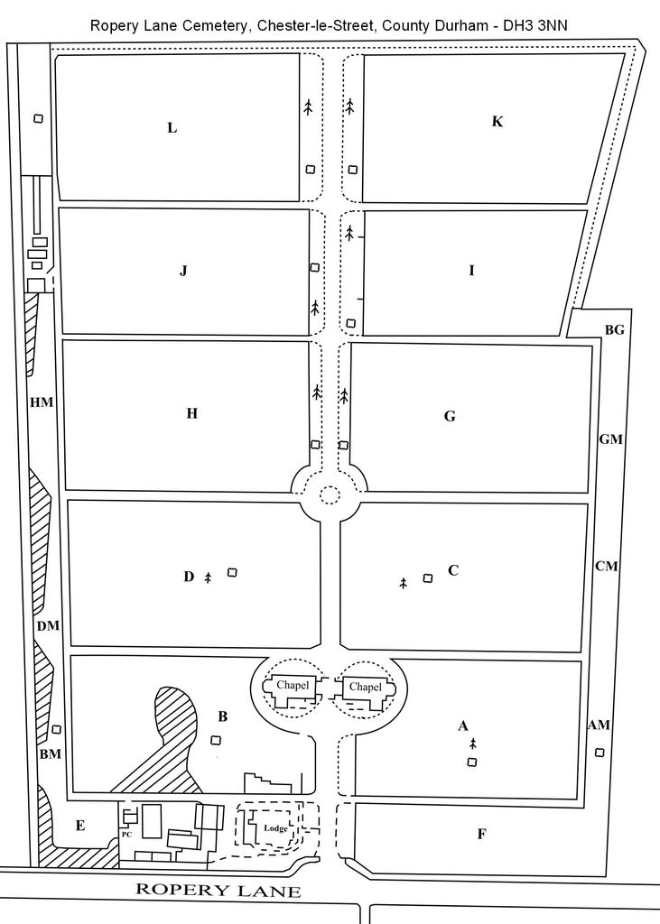
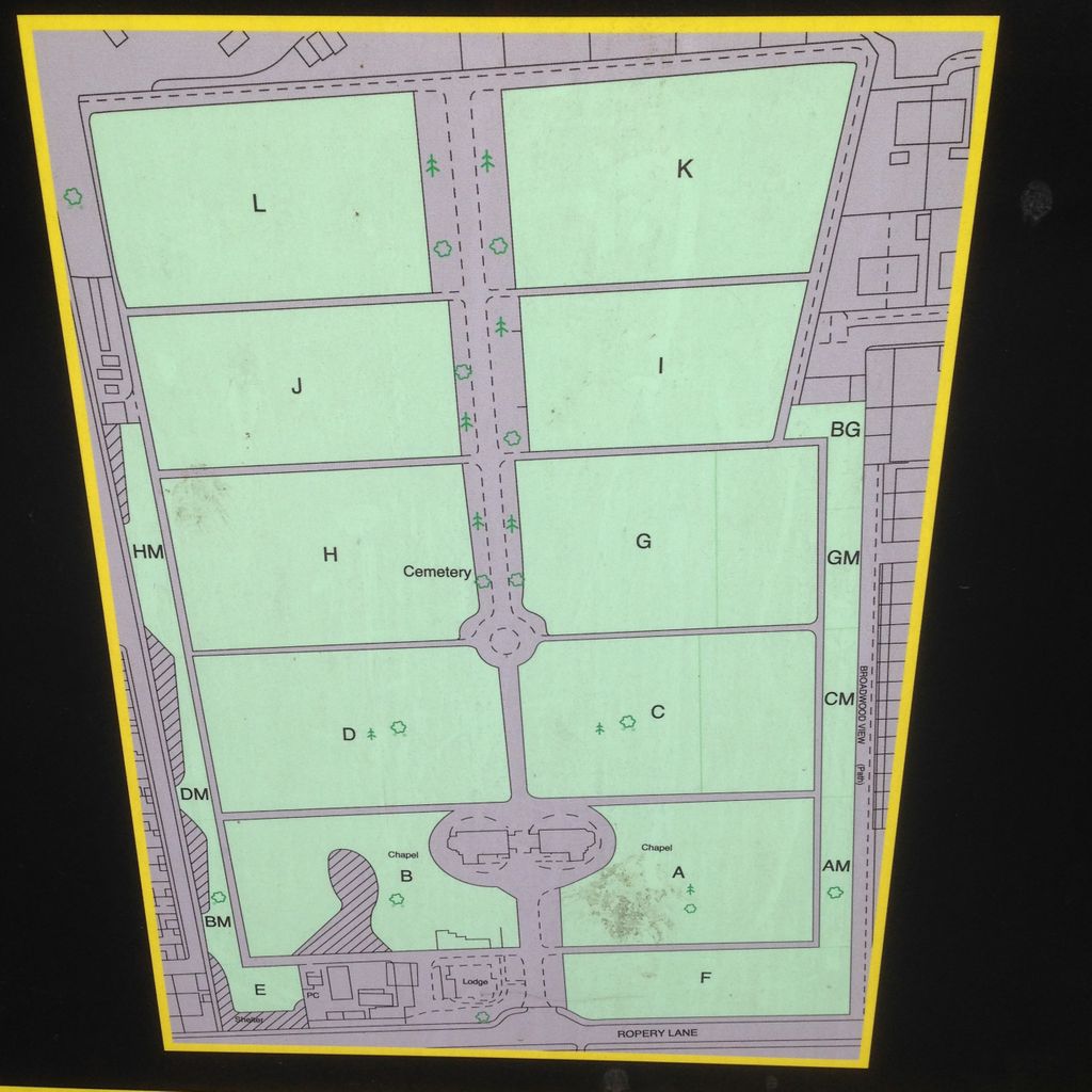
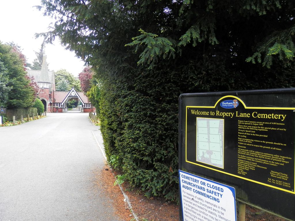
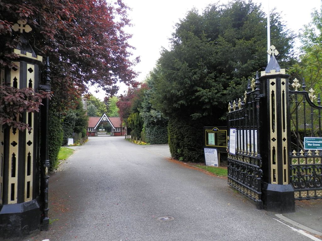
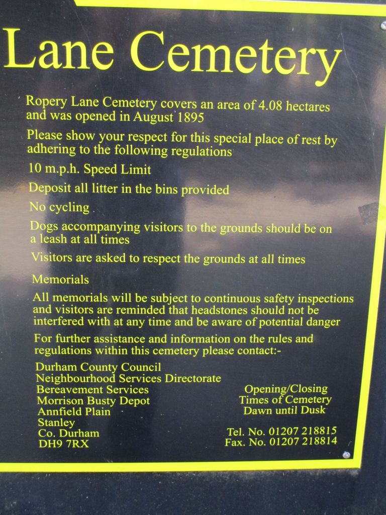
| Description | : | Opened 11 August 1895, the cemetery and burial records are maintained by Durham County Council |
frequently asked questions (FAQ):
-
Where is Ropery Lane Cemetery?
Ropery Lane Cemetery is located at Chester-Le-Street, Durham Unitary Authority ,County Durham ,England.
-
Ropery Lane Cemetery cemetery's updated grave count on graveviews.com?
0 memorials
-
Where are the coordinates of the Ropery Lane Cemetery?
Latitude: 54.8514400
Longitude: -1.5690300
Nearby Cemetories:
1. St Mary and St Cuthbert Churchyard
Chester-Le-Street, Durham Unitary Authority, England
Coordinate: 54.8559050, -1.5717160
2. Christchurch Churchyard
Great Lumley, Durham Unitary Authority, England
Coordinate: 54.8370890, -1.5417950
3. Great Lumley Cemetery
Great Lumley, Durham Unitary Authority, England
Coordinate: 54.8362470, -1.5421175
4. St. Barnabas Churchyard
Bournmoor, Durham Unitary Authority, England
Coordinate: 54.8571260, -1.5195110
5. St Philip & St James Churchyard
Kimblesworth, Durham Unitary Authority, England
Coordinate: 54.8209600, -1.5956900
6. Holy Trinity Churchyard and Cemetery
Pelton, Durham Unitary Authority, England
Coordinate: 54.8720010, -1.6197170
7. St. George's Churchyard
Fatfield, Metropolitan Borough of Sunderland, England
Coordinate: 54.8803030, -1.5302700
8. Finchale Priory
Great Lumley, Durham Unitary Authority, England
Coordinate: 54.8181120, -1.5403970
9. St John the Evangelist Churchyard
Birtley, Metropolitan Borough of Gateshead, England
Coordinate: 54.8943500, -1.5742700
10. St Bede's Catholic Church
Sacriston, Durham Unitary Authority, England
Coordinate: 54.8221050, -1.6286550
11. St. Peter's Churchyard
Sacriston, Durham Unitary Authority, England
Coordinate: 54.8232600, -1.6307850
12. St Joseph Roman Catholic Churchyard
Birtley, Metropolitan Borough of Gateshead, England
Coordinate: 54.8981200, -1.5773600
13. Sacriston Cemetery
Sacriston, Durham Unitary Authority, England
Coordinate: 54.8200330, -1.6310180
14. All Saints Churchyard
Penshaw, Metropolitan Borough of Sunderland, England
Coordinate: 54.8788450, -1.4883190
15. Birtley Crematorium and Cemetery
Birtley, Metropolitan Borough of Gateshead, England
Coordinate: 54.9052590, -1.5832360
16. St Thomas Churchyard
Craghead, Durham Unitary Authority, England
Coordinate: 54.8505370, -1.6664580
17. St. Matthews Churchyard
Newbottle, Metropolitan Borough of Sunderland, England
Coordinate: 54.8575650, -1.4719100
18. St. Michael's RC Cemetery
Houghton-le-Spring, Metropolitan Borough of Sunderland, England
Coordinate: 54.8364300, -1.4714100
19. Lyons St Michael & All Angels Churchyard
Houghton-le-Spring, Metropolitan Borough of Sunderland, England
Coordinate: 54.8423530, -1.4691540
20. Houghton Cemetery
Houghton-le-Spring, Metropolitan Borough of Sunderland, England
Coordinate: 54.8347588, -1.4718029
21. St Michael & All Angels Churchyard
Houghton-le-Spring, Metropolitan Borough of Sunderland, England
Coordinate: 54.8421730, -1.4688210
22. St Cuthbert Churchyard
East Rainton, Metropolitan Borough of Sunderland, England
Coordinate: 54.8236030, -1.4790640
23. Our Blessed Lady Immaculate RC Churchyard
Washington, Metropolitan Borough of Sunderland, England
Coordinate: 54.9035800, -1.5212300
24. Holy Trinity Churchyard
Washington, Metropolitan Borough of Sunderland, England
Coordinate: 54.9031000, -1.5167800