
| Memorials | : | 0 |
| Location | : | Marion County, USA |
| Coordinate | : | 31.0480100, -89.7473300 |
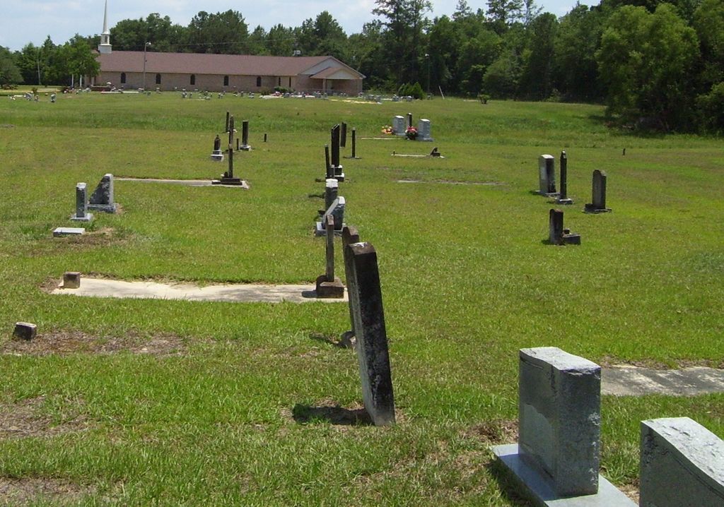
| Description | : | African American Cemetery. Description: A large cemetery separated into a new and old section, in good condition. The new section is closer to the church. Location: NW1/4 S18 T1N R17W, south of Spring Cottage. Directions: From US 98, go south on Hwy 13 for 7.4 miles to the Hwy 43 connector. Turn right (west) on connector for 1.0 mile then turn left (south) on Hwy 43 and go 7.2 miles. Church and double cemetery are on the right. First known interment: 1894 Last known interment: current |
frequently asked questions (FAQ):
-
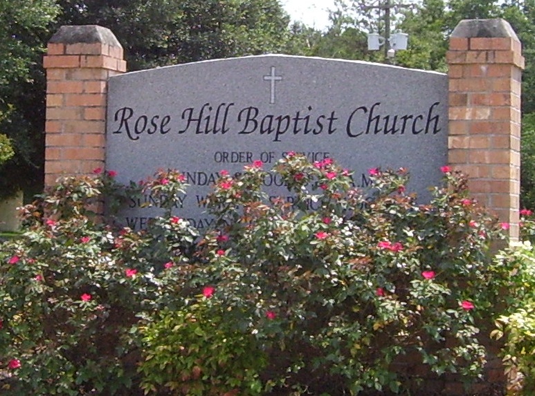
Where is Rose Hill Baptist Church Cemetery?
Rose Hill Baptist Church Cemetery is located at Marion County ,Mississippi ,USA.
-
Rose Hill Baptist Church Cemetery cemetery's updated grave count on graveviews.com?
0 memorials
-
Where are the coordinates of the Rose Hill Baptist Church Cemetery?
Latitude: 31.0480100
Longitude: -89.7473300
Nearby Cemetories:
1. Macedonia Baptist Church Cemetery
Marion County, USA
Coordinate: 31.0806900, -89.7617300
2. New Hope Cemetery
Marion County, USA
Coordinate: 31.0114002, -89.7285995
3. Ford Cemetery
Marion County, USA
Coordinate: 31.0105991, -89.7189026
4. Rev. S. John Ford Cemetery
Sandy Hook, Marion County, USA
Coordinate: 31.0131140, -89.7857510
5. Warren Cemetery
Sandy Hook, Marion County, USA
Coordinate: 31.0627995, -89.8016968
6. Sandy Hook Cemetery
Marion County, USA
Coordinate: 31.0324993, -89.8019028
7. Sandy Hook Baptist Church Cemetery
Marion County, USA
Coordinate: 31.0377998, -89.8058014
8. Ford Chapel Cemetery
Marion County, USA
Coordinate: 31.0072002, -89.7988968
9. Pearl River Cemetery
Marion County, USA
Coordinate: 31.0774994, -89.8233032
10. Whites Chapel Church Cemetery
Poplarville, Pearl River County, USA
Coordinate: 30.9832920, -89.7112330
11. Capp Cemetery
Marion County, USA
Coordinate: 31.1196995, -89.7733002
12. Clear Creek Baptist Church Cemetery
Marion County, USA
Coordinate: 31.0624500, -89.6591200
13. Hub Community Cemetery
Columbia, Marion County, USA
Coordinate: 31.1392000, -89.7566500
14. Live Oak Cemetery
Angie, Washington Parish, USA
Coordinate: 30.9624370, -89.7881400
15. Pleasant Valley Cemetery
Angie, Washington Parish, USA
Coordinate: 30.9571991, -89.7722015
16. Pine Burr Baptist Church Cemetery
Pinebur, Marion County, USA
Coordinate: 31.1322400, -89.6969500
17. Howard Cemetery
Lamar County, USA
Coordinate: 31.0541992, -89.6367035
18. Saint Mark M.B. Church Cemetery
Marion County, USA
Coordinate: 31.1349300, -89.6879110
19. Old Live Oak Cemetery
Angie, Washington Parish, USA
Coordinate: 30.9514008, -89.7838974
20. Bonnie Cemetery
Angie, Washington Parish, USA
Coordinate: 30.9647007, -89.8167038
21. John Foxworth Cemetery
Edna, Marion County, USA
Coordinate: 31.1479500, -89.7846100
22. John Foxworth Cemetery
Edna, Marion County, USA
Coordinate: 31.1482100, -89.7852200
23. T E Stogner Cemetery
Walthall County, USA
Coordinate: 31.0722008, -89.8681030
24. Wesley Ray Cemetery
Angie, Washington Parish, USA
Coordinate: 30.9722004, -89.8347015