
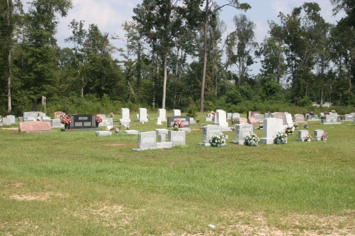
| Memorials | : | 1 |
| Location | : | Marion County, USA |
| Coordinate | : | 31.0377998, -89.8058014 |
frequently asked questions (FAQ):
-
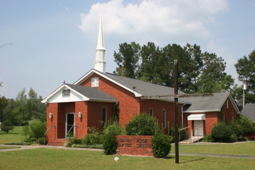
Where is Sandy Hook Baptist Church Cemetery?
Sandy Hook Baptist Church Cemetery is located at Marion County ,Mississippi ,USA.
-
Sandy Hook Baptist Church Cemetery cemetery's updated grave count on graveviews.com?
1 memorials
-
Where are the coordinates of the Sandy Hook Baptist Church Cemetery?
Latitude: 31.0377998
Longitude: -89.8058014
Nearby Cemetories:
1. Sandy Hook Cemetery
Marion County, USA
Coordinate: 31.0324993, -89.8019028
2. Warren Cemetery
Sandy Hook, Marion County, USA
Coordinate: 31.0627995, -89.8016968
3. Rev. S. John Ford Cemetery
Sandy Hook, Marion County, USA
Coordinate: 31.0131140, -89.7857510
4. Ford Chapel Cemetery
Marion County, USA
Coordinate: 31.0072002, -89.7988968
5. Pearl River Cemetery
Marion County, USA
Coordinate: 31.0774994, -89.8233032
6. Rose Hill Baptist Church Cemetery
Marion County, USA
Coordinate: 31.0480100, -89.7473300
7. Macedonia Baptist Church Cemetery
Marion County, USA
Coordinate: 31.0806900, -89.7617300
8. T E Stogner Cemetery
Walthall County, USA
Coordinate: 31.0722008, -89.8681030
9. Wesley Ray Cemetery
Angie, Washington Parish, USA
Coordinate: 30.9722004, -89.8347015
10. New Hope Cemetery
Marion County, USA
Coordinate: 31.0114002, -89.7285995
11. Bonnie Cemetery
Angie, Washington Parish, USA
Coordinate: 30.9647007, -89.8167038
12. Bethel Assembly of God Cemetery
Angie, Washington Parish, USA
Coordinate: 30.9992008, -89.8811035
13. Live Oak Cemetery
Angie, Washington Parish, USA
Coordinate: 30.9624370, -89.7881400
14. First Mount Bethel Church Cemetery
Sandy Hook, Marion County, USA
Coordinate: 31.0760480, -89.8854860
15. Mount Bethel Church Cemetery
Hurricane Creek, Marion County, USA
Coordinate: 31.0763400, -89.8854900
16. Ford Cemetery
Marion County, USA
Coordinate: 31.0105991, -89.7189026
17. Carson Springs Baptist Church Cemetery
Walthall County, USA
Coordinate: 31.0475006, -89.9005966
18. Hurricane Creek Cemetery
Marion County, USA
Coordinate: 31.0972004, -89.8716965
19. Dillon Cemetery
Angie, Washington Parish, USA
Coordinate: 30.9637860, -89.8558050
20. Pleasant Valley Cemetery
Angie, Washington Parish, USA
Coordinate: 30.9571991, -89.7722015
21. Capp Cemetery
Marion County, USA
Coordinate: 31.1196995, -89.7733002
22. Old Live Oak Cemetery
Angie, Washington Parish, USA
Coordinate: 30.9514008, -89.7838974
23. Moses Cemetery
Angie, Washington Parish, USA
Coordinate: 30.9495830, -89.8457630
24. Grimsley Family Cemetery
Hurricane Creek, Marion County, USA
Coordinate: 31.0936500, -89.8959500