
| Memorials | : | 165 |
| Location | : | Oxford, City of Oxford, England |
| Website | : | www.oxford.gov.uk/directory_record/622/rose_hill_cemetery |
| Coordinate | : | 51.7320960, -1.2254070 |
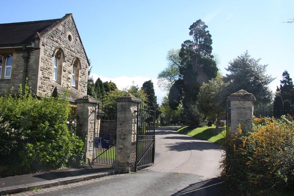
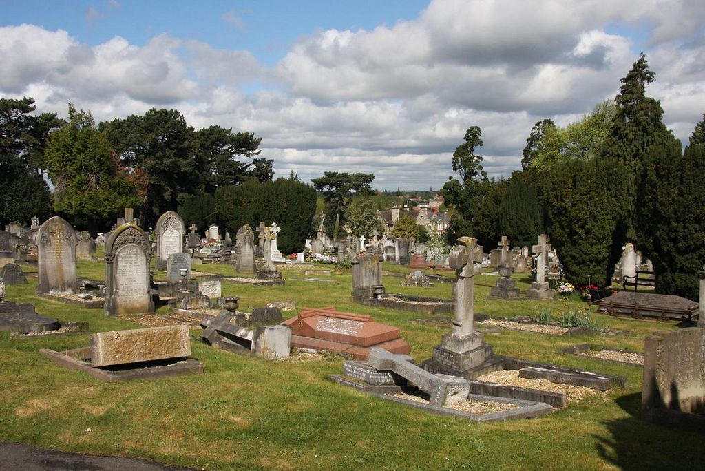
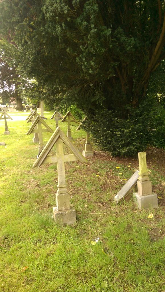
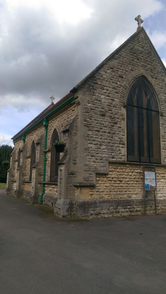
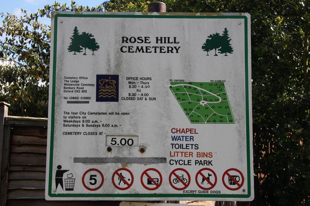
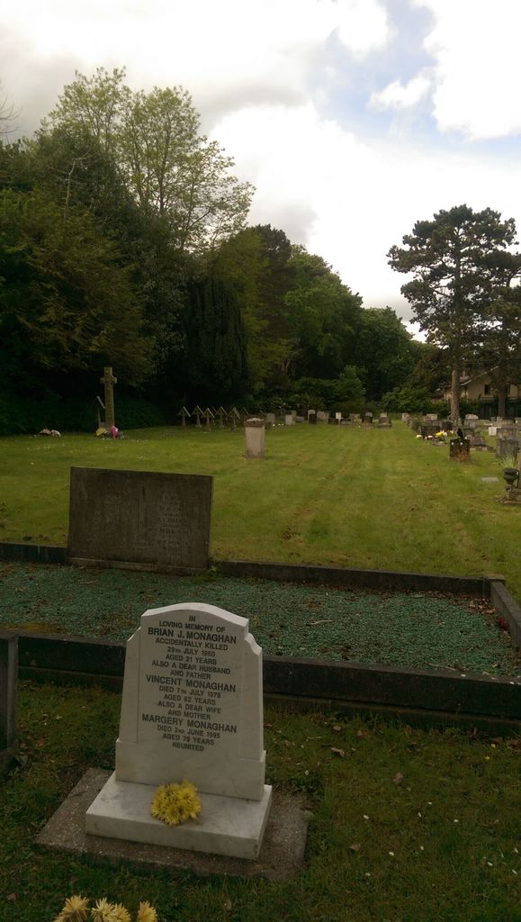
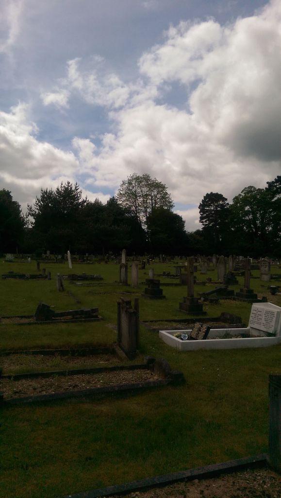
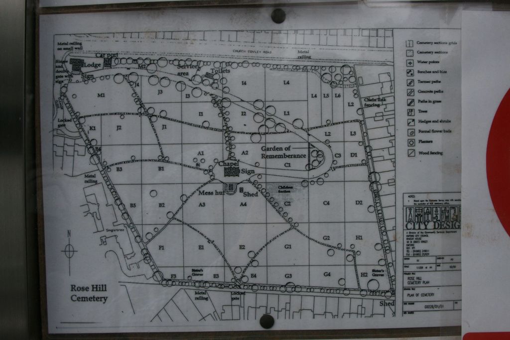
| Description | : | Rose Hill Cemetery is located in Oxford, It was opened in 1889 and has more than 20,000 burials. It covers over 11 acres (45,000 m2) and has a Victorian chapel. The cemetery is closed to new burials. Commonwealth War Graves This cemetery contains 28 Commonwealth burials of the 1914-1918 war and a further 58 of the 1939-1945 war. The war graves are widely distributed throughout the burial ground, half of the 1939-1945 burials being marked by permanent private memorials. |
frequently asked questions (FAQ):
-
Where is Rose Hill Cemetery?
Rose Hill Cemetery is located at Church Cowley Road Oxford, City of Oxford ,Oxfordshire , OX4 3JREngland.
-
Rose Hill Cemetery cemetery's updated grave count on graveviews.com?
147 memorials
-
Where are the coordinates of the Rose Hill Cemetery?
Latitude: 51.7320960
Longitude: -1.2254070
Nearby Cemetories:
1. St. James Churchyard
Cowley, City of Oxford, England
Coordinate: 51.7305878, -1.2202638
2. St Mary the Virgin Churchyard
Iffley, City of Oxford, England
Coordinate: 51.7273590, -1.2381680
3. St Mary and St Nicholas Churchyard
Littlemore, City of Oxford, England
Coordinate: 51.7210753, -1.2232272
4. Littlemore Chapel
Littlemore, City of Oxford, England
Coordinate: 51.7208320, -1.2270330
5. St Mary and St John Church
Oxford, City of Oxford, England
Coordinate: 51.7452501, -1.2314021
6. Greyfriars
Oxford, City of Oxford, England
Coordinate: 51.7437920, -1.2401460
7. St. Aldate's Churchyard
Oxford, City of Oxford, England
Coordinate: 51.7497900, -1.2118500
8. St. Andrew's Churchyard
Sandford-on-Thames, South Oxfordshire District, England
Coordinate: 51.7121430, -1.2289060
9. St Ignatius’ Chapel
Oxford, City of Oxford, England
Coordinate: 51.7503160, -1.2396720
10. St. Clements Churchyard
Oxford, City of Oxford, England
Coordinate: 51.7527790, -1.2369920
11. St Laurence Churchyard
South Hinksey, Vale of White Horse District, England
Coordinate: 51.7319218, -1.2635270
12. St Matthews Church
Oxford, City of Oxford, England
Coordinate: 51.7442200, -1.2585480
13. Magdalen College Chapel
Oxford, City of Oxford, England
Coordinate: 51.7519830, -1.2469820
14. Merton College chapel
Oxford, City of Oxford, England
Coordinate: 51.7510500, -1.2526620
15. Corpus Christi College Chapel
Oxford, City of Oxford, England
Coordinate: 51.7507010, -1.2534236
16. Christ Church Cathedral
Oxford, City of Oxford, England
Coordinate: 51.7500620, -1.2547160
17. Oriel College Ante-Chapel
Oxford, City of Oxford, England
Coordinate: 51.7512420, -1.2531940
18. University College Chapel
Oxford, City of Oxford, England
Coordinate: 51.7522100, -1.2521700
19. Queens College Chapel
Oxford, City of Oxford, England
Coordinate: 51.7532340, -1.2506990
20. St Peter-in-the-East Churchyard
Oxford, City of Oxford, England
Coordinate: 51.7536111, -1.2500000
21. New College
Oxford, City of Oxford, England
Coordinate: 51.7543090, -1.2515310
22. St. Cross Churchyard
Holywell, City of Oxford, England
Coordinate: 51.7558380, -1.2479690
23. University Church of St Mary the Virgin
Oxford, City of Oxford, England
Coordinate: 51.7523990, -1.2556000
24. All Saints Churchyard
Oxford, City of Oxford, England
Coordinate: 51.7525000, -1.2555560